Pendleton County. Formed in 1788 from Hardy, Augusta, Rockingham. Named for Edmund Pendleton, Virginia statesman-jurist. This county has a range of altitude of over 3500 feet. Here are Seneca Rocks, Smoke Hole, and Spruce Knob.
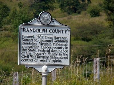
Randolph . . . — — Map (db m9290) HM
On Mount Freedom Drive (West Virginia Route 28) 2.2 miles south of Mountaineer Drive (U.S. 33), on the right when traveling south.
Spruce Knob (9 miles W.), 4,860 feet and the highest point in West Virginia, lies slightly above the crest ridge of Spruce Mountain. The crest lies above 4,500 feet for more than 10 miles and is strewn with fragments of Pottsville Sandstone of the . . . — — Map (db m304589) HM
West Virginia. (Pendleton County). "The Mountain State" - western part of the Commonwealth of Virginia until June 20, 1863. Settled by the Germans and Scotch-Irish. It became a line of defense between the English and French . . . — — Map (db m34536) HM
On Sugar Grove Road (West Virginia Route 21) just north of Propstburg Rd (Local Road 21/9), on the right when traveling south.
61 rods west stood original
round log church upon 3½
acre plot, deeded Dec.18, 1769,
by John Michael Propst and his
wife, Catherine, “for the congregation of the South Fork of the
Potowmack for five shillings
current money of Virginia.” — — Map (db m123901) HM
Although saltpeter (potassium nitrate or nitre), an essential element in the manufacture of gunpowder, had been mined at Organ Cave since the eighteenth century, the need for the mineral increased dramatically during the Civil War. Several . . . — — Map (db m59342) HM
On Mansfield Drive (U.S. 250) at North Main Street (U.S. 250), on the right when traveling east on Mansfield Drive. Reported permanently removed.
Col. Benjamin F. Kelley
Kelley, a railroad agent in Philadelphia and former resident of Wheeling, was called back to command the First Virginia (Union) Infantry--the first Union regiment raised in the South. He planned and led the attack on . . . — — Map (db m308160) HM
The People of Thomas
The history books of Thomas are full of fascinating stories of the people who built these buildings and lived their lives here. Hundreds of people from around the world came to Thomas to seek their fortunes, . . . — — Map (db m153066) HM
On Winchester Pike (U.S. 11) north of Old Mill Road, on the right when traveling north.
Morgan Morgan, a native of Wales, established his home at Bunker Hill before 1732, and was leader in Eastern Panhandle’s early development. His sons gave name to Morgantown, and fought in Indian and Revolutionary Wars. — — Map (db m1176) HM
Near Grant Memorial Hospital Parking Lot south of Route 55.
The Irish Brigade & the McNeill Rangers
General James A. Mulligan, USA
Born June 25, 1830 in Utica, NY, James Adelbert Mulligan was a spirited Irish-American who wore a green scarf in combat. At the outbreak of the Civil War . . . — — Map (db m253588) HM
Thin black lines indicate changes in relevance. Between each pair of lines entries are ordered geographically but all have the same relevance.
* Inflectional forms of words are their plurals, singulars, and possessives as well as gramatical tenses and similar variations.