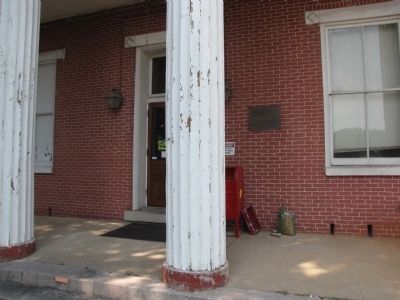
Near Court Street east of North Kentucky Street (Tennessee Highway 58), on the left when traveling east.
To the Glory of God
and in loving memory of
the American soldiers and
sailors of the War of 1812
who enlisted here.
This tablet is erected by
the Tennessee National
Society United States
Daughters of 1812 and the
Court of Roane . . . — — Map (db m42950) WM
On East Cumberland Street at North Kentucky Street (Tennessee Route 58), on the left when traveling west on East Cumberland Street.
On June 7, 1861, future president Andrew Johnson spoke forcefully against secession on the steps of this building, the Roane County Courthouse. Along with many others in East Tennessee, a majority in Roane County opposed separation from the Union, . . . — — Map (db m150757) HM
On Old Springtown Road south of Sandlin Lane, on the right when traveling south.
William (Bill) Woody (1824-1915), one of the first Anglo settlers in Parker County, was born in Roane County, Tennessee. While living in the eastern Tennessee hills bordering North Carolina, he married Elisabeth Lydia Farmer (1822-1879) in 1846. . . . — — Map (db m192530) HM
On East Main Street at Mayland Road, on the right when traveling east on East Main Street.
Less than half a mile west of here, on the Lewis Whitaker farm, the only engagement of the war in Cumberland County between regular Union and Confederate troops took place on December 9, 1863. Several companies of Col. Thomas J. Jordan’s 9th . . . — — Map (db m69228) HM
The Chattanooga Region was rich in mineral resources, including hematite iron ore. The convergence of river transportation and railroads at Chattanooga guaranteed access to markets for iron products such as pig iron bars, and finished castings such . . . — — Map (db m184190) HM
Near South Kentucky Street (Tennessee Route 58) 0.1 miles north of James Ferry Road, on the left when traveling north.
History
The first military post in this area dates to 1792 when a blockhouse was constructed about one-half mile upstream from the present fort sit eon the boundary of U.S. Territory and the Cherokee Nation as defined by a 1791 treaty. The . . . — — Map (db m159797) HM
On Walker Avenue at Winter Gap Road, on the left when traveling west on Walker Avenue.
Although the residents of Oliver Springs did not suffer from the effects of combat during the war, other factors soon took a toll. Like much of East Tennessee, Anderson, Morgan, and Roane Counties voted against secession. The conflicts between Union . . . — — Map (db m159561) HM
After the Removal of the Cherokee Nation in 1838, the southern bank of the Tennessee River was open for legal settlement. Prior to the Removal, 53 families had settled in Ross's Landing to establish occupancy rights. These families formed the . . . — — Map (db m254494) HM
On Valhalla at North Evans Road, on the left when traveling south on Valhalla.
The Selma Stage Stop & Post Office building was constructed around 1850 and became a part of the Harrison and McCulloch stage line in 1851. It was last used by the stage line in 1906. The building went through an extensive restoration from 2004 . . . — — Map (db m195458) HM
On East Main Street (Tennessee Route 151), on the left when traveling east.
Named by early pioneers traversing thru the region, this designated Indian trail led these settlers into this area during Western migration. This mainly Cherokee trail, (although used some by the Shawnee), originated at Rockwood in Roane County, . . . — — Map (db m180021) HM
On Greenwood Street at Roane Street, on the left when traveling south on Greenwood Street.
The Kingston Colored School was the first public elementary school building for African Americans in Kingston, Tennessee. Built in 1934, the two-classroom school served students in grades one through eight until 1965. In 1963 the school's name was . . . — — Map (db m264113) HM
On Oak Ridge Turnpike (State Highway 58) 0.2 miles north of Bear Creek Road, on the right when traveling north.
John Henry and Elizabeth Inman Welcker owned and operated a plantation named Laurel Banks as early as 1810, and possibly 1805. This plantation was located along the banks of the Clinch River, where the East Tennessee Technology Park (formerly the . . . — — Map (db m159564) HM
The core of the original house was one room constructed of locally quarried limestone blocks and built by John S. Harrison and his wife Martha Jane, in 1852. The small room on the north side of the original structure is believed to have been added . . . — — Map (db m195803) HM
On North Kentucky Street (Tennessee Route 58) north of Court Street, on the right when traveling north.
Dedicated to the memory of those
men and women who fought in
the Revolutionary War, with
courage, faith, and sacrifice, who
came to this country and
contributed these same attributes
toward the character of the
people of Roane County, . . . — — Map (db m150759) WM
On Swan Pond Circle Road at Berkshire Lane, on the left when traveling east on Swan Pond Circle Road.
On December 22, 2008, a dike ruptured at the
Tennessee Valley Authority's Kingston Fossil
Plant, releasing more than one billion gallons of
coal ash slurry into the Emory and Clinch Rivers
and the surrounding area. Hundreds of workers
spent . . . — — Map (db m293585) HM
Thin black lines indicate changes in relevance. Between each pair of lines entries are ordered geographically but all have the same relevance.
* Inflectional forms of words are their plurals, singulars, and possessives as well as gramatical tenses and similar variations.