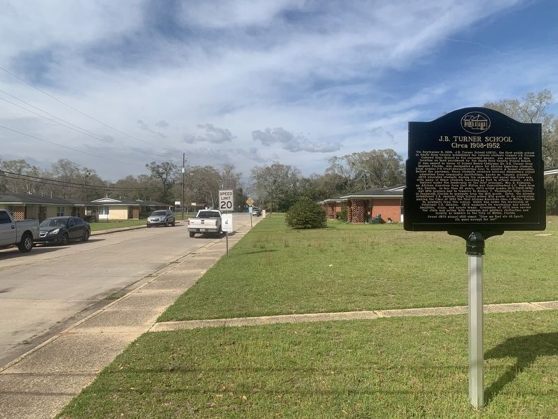
On West Walker Street at Mary Street, on the right when traveling west on West Walker Street.
On September 8, 1908, J.B. Turner School (JBTS), the first public school in Santa Rosa County established for colored students (named J.B. Turner Colored High School in the recorded deeds), was erected at this location on land purchased by the . . . — — Map (db m244290) HM
On Mill Pond Lane north of Juan De Larua Court, on the right when traveling north.
The Arcadia Mill site was the first and largest water-powered industrial complex in antebellum Florida. Arcadia Mill originated in 1817 as part of a Spanish land grant of approximately 680 acres. The site’s ironstone outcropping, a desirable mill . . . — — Map (db m152411) HM
On U.S. 90 0.1 miles west of Bayou Drive, on the right when traveling west.
The Marquis Bayou Bridge, named for George Marquis, the owner of a local saw mill that operated in the mid-1800s, opened in 1937. A Santa Rosa County delegation that included future Florida Governor Millard Caldwell helped to make the bridge a . . . — — Map (db m98374) HM
On Forsyth Street at Thompson Street, on the right when traveling north on Forsyth Street.
The Thompson House
This antebellum home, constructed ca. 1847 by Benjamin Woodson Thompson (1809 - 1876), partner in the Forsyth and Simpson sawmill enterprise in Bagdad, is the best remaining Florida Panhandle example of a symmetrical Greek . . . — — Map (db m63182) HM
On Willing Street 0.1 miles south of U.S. 90, on the left when traveling south.
Blackwater Landing
Blackwater River was first named Rio Del Almirante by Spanish explorers in the late 17th century. During Pensacola’s British Period (1763-1781) it was called Middle River because of its location between the . . . — — Map (db m99703) HM
On 14th Street 0.1 miles east of Madison Street, on the right when traveling east.
The Town of Baker, a stop on the Florida, Alabama and Gulf Railroad, was platted in 1910 and grew up around the timber and turpentine industries. The site of the original Baker High School was owned by J.W. and Mollie McCart who sold the property . . . — — Map (db m73955) HM
Near Main Street 0.1 miles east of Forsyth Street.
Bagdad Lumber Mill
In 1829, Joseph Forsyth saw economic potential in the vast pine forest of North Florida. Old growth yellow pine was one of the world's most prized building materials and the deepwater juncture of Pond Creek . . . — — Map (db m99709) HM
Near Interstate 10 at milepost 29, 1 mile west of Florida Route 87, on the right when traveling west.
Specifications/Performance
Wingspan ……………… 27 ft. 6 ins
Length …………………… 40 ft. 3 ¾ ins.
Height …………………… 15 ft.
Maximum Speed …… 670 mph
Range …………………… 2,000 miles
Gross Weight ………… 24,500 lbs.
Known as . . . — — Map (db m151717) WM
Near Main Street 0.1 miles east of Forsyth Street.
The first years of the Civil War brought prosperity to Bagdad, but a blockade of Pensacola Bay deprived the mill access to former markets. On March 11, 1862, Confederates, burned Bagdad’s industries, shops, and the major buildings in the Pensacola . . . — — Map (db m99851) HM
Near Main Street 0.1 miles east of Forsyth Street.
The village of Bagdad developed as a lumber mill community in the early nineteenth century, and lumber remained the principal industry of the village until 1939. Strategically placed at the confluence of Pond Creek and the Blackwater River, the . . . — — Map (db m100301) HM
Thin black lines indicate changes in relevance. Between each pair of lines entries are ordered geographically but all have the same relevance.
* Inflectional forms of words are their plurals, singulars, and possessives as well as gramatical tenses and similar variations.