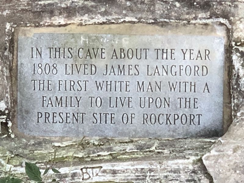
On South 1st Street 0.1 miles south of Main Street, on the right when traveling south.
At the age of 24, James Lankford (Langford) and his family left their home in Stokes County, North Carolina probably traveling through the Cumberland Gap across Daniel Boone's wilderness road, the most direct route from North Carolina to Indiana . . . — — Map (db m207180) HM
Near Shepherd Mill Road, on the right when traveling east.
During the Civil War, the Confederacy relied on small rural ironworks for the metals needed to manufacture cannons, swords, and firearms. The furnace here, owned by the Moratock Mining and Manufacturing Company, was typical of the charcoal blast . . . — — Map (db m34156) HM
The Moravian Church is a Protestant denomination tracing its roots to the followers of Jan Hus. A Czech priest and reformer, Hus was martyred for his faith in 1415. The Moravians founded a church body dedicated to a simple and devout life. For . . . — — Map (db m140201) HM
On Montevallo Road (State Highway 25) at County Road 62, on the left when traveling west on Montevallo Road.
Absalom Pratt built this house 8 miles west of here circa 1835 though a section was constructed earlier. It was moved to this site in 1994 by the Cahaba Trace Commission, restored by the Alabama Historic Ironworks Commission, 1997-98, and dedicated . . . — — Map (db m37078) HM
On Courthouse Circle at Main Street (North Carolina Highway 8/89), on the left when traveling north on Courthouse Circle.
Early in April 1865, Union Gen. George Stoneman’s cavalry moved from Tennessee into Virginia and then south through Danbury to destroy railroad track, warehouses, and supplies that supported Gen. Robert E. Lee’s Army of Northern Virginia. Stoneman . . . — — Map (db m77678) HM
On North Carolina Route 150 0.3 miles north of Somers Loop, on the left when traveling north.
Also called Rockingham Springs. Council of State met here, 1790. Owned by John Lenox, Archibald D. Murphey, & Thomas Ruffin. Famous health resort. — — Map (db m214867) HM
On Bethabara Road 0.1 miles north of Indiana Avenue/Old Town Road, on the left when traveling north.
Pottery played a leading role in establishing Bethabara as a major center of trade. The large-scale pottery operation in Bethabara was not only the first documented in the North Carolina colony, but it was also the most influential, with the . . . — — Map (db m234125) HM
On Caratoke Highway (Route 168) at North Point Road, on the right when traveling south on Caratoke Highway.
In 1728 the Virginia-Carolina boundary was first surveyed from the Atlantic coast to a spot two hundred twenty miles west of here. — — Map (db m2762) HM
Thin black lines indicate changes in relevance. Between each pair of lines entries are ordered geographically but all have the same relevance.
* Inflectional forms of words are their plurals, singulars, and possessives as well as gramatical tenses and similar variations.