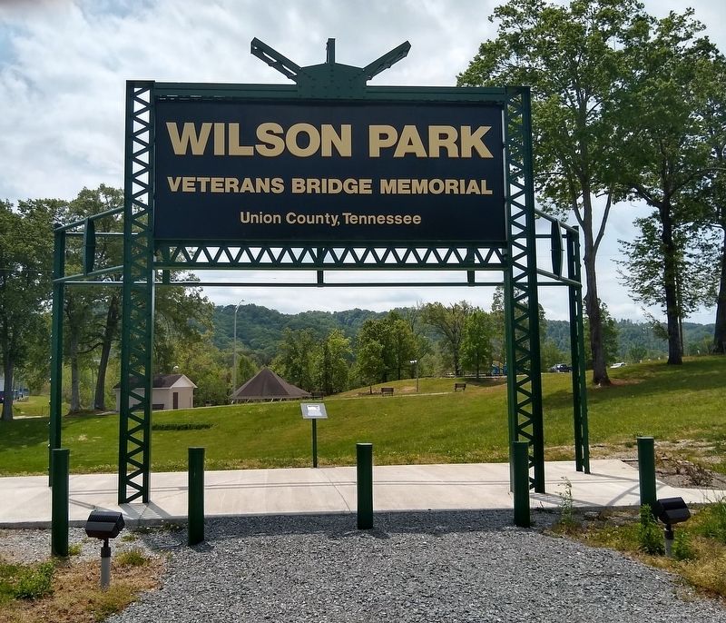
On Wilson Lane just south of Main Street, on the right when traveling north.
Completed in 1936, was a through truss bridge built over Clinch River (Norris Lake) in Union County, Tennessee between Maynardville and Tazewell by the Tennessee Valley Authority. It was one of East Tennessee’s longest continuous Warren through . . . — — Map (db m151540) HM
On Maynardville Highway (Tennessee Route 33/61) at Spring Strret, on the right when traveling east on Maynardville Highway.
The Civil War made civilian life in Union County difficult and dangerous. Most residents opposed secession and were staunch Unionists. men joined such Federal regiments as the 1st Tennessee Infantry and the 2nd and 9th Tennessee Cavalry. Others . . . — — Map (db m100481) HM
On Main Street at Court Street, on the left when traveling east on Main Street.
Horace Maynard was born on August 30, 1814, in Massachusetts. A graduate of Amherst College, he taught at East Tennessee College, later the University of Tennessee. Also a lawyer, he was counsel for the establishment of Union County in 1850, and . . . — — Map (db m130376) HM
On Norris Freeway (U.S. 441) 0.1 miles south of Clear Creek Road, on the left when traveling south.
Divided loyalties in Anderson County, as elsewhere in East Tennessee, often erupted in violence. It was commonplace for guerillas on both sides to raid farms and capture opposing sympathizers. In the county seat of Clinton, Confederates . . . — — Map (db m119021) HM
On South Gay Street at West Church Avenue, on the left when traveling north on South Gay Street.
Born in northern Knox County (now part of Union County), Lloyd Branson is regarded perhaps as Knoxville's finest professional artist. Branson's family moved to Knoxville in 1868, and exhibited extraordinary talent as a youngster. After studying at . . . — — Map (db m134898) HM
Union County is a testament to the strong support for the Union in East Tennessee prior to the Civil War. It’s picturesque expanse was formed from portions of Anderson, Campbell, Claiborne, Grainger, and Knox counties. Attorney Horace Maynard, for . . . — — Map (db m201296) HM
On Lower Clear Creek Road east of U.S. 441, on the right when traveling east.
Originally constructed along Lost Creek, Union County, this mill was built by James Rice. After migrating from North Carolina to Sharp’s Station in 1790, “Uncle Jim” and his sons completed construction of the grist mill in the autumn of 1798. . . . — — Map (db m259108) HM
On Brattonsville Road 0.1 miles north of Percival Road, on the right when traveling south. Reported missing.
The Homestead was built between 1823 and 1826 for Dr. John Simpson Bratton and his wife Harriet Rainey Bratton, the second generation of the Bratton family to live at Brattonsville. Bricks for the chimneys were made on the plantation. The two . . . — — Map (db m272030) HM
On Old Buncombe Road at Jones Ford Road, on the left when traveling east on Old Buncombe Road.
[Front]:
A post office was established in 1809 at Cross Keys, S.C. In 1812-1814, Barrum Bobo erected this house at the intersection of the Piedmont Stage Road and the Old Buncombe Road. During the ante-bellum period, it was the center of . . . — — Map (db m13390) HM
On Gainsville Highway (U.S. 129/19) 0.6 miles north of Blood Mountain Cove Road, on the right when traveling north.
(panel 1) The Appalachian Trail in North Georgia
The 2,190 mile Appalachian Trail (A.T.) is the product of the vision, hard work, and dedication of thousands of people who have conceived, built, maintained and protected this . . . — — Map (db m230145) HM
On Manning Mill Road at West Armuchee Road, on the left when traveling east on Manning Mill Road.
William Little (1801-1884) was born in Union County, South Carolina, and married Elizabeth "Betsy" Young (1815-1884) in 1835. With Betsey's parents, James Marion Young and Sarah Ann Foster Young, the families moved around 1836 to the West Armuchee . . . — — Map (db m307690) HM
On Town Square at Young Harris Street, on the left when traveling west on Town Square.
Old Union County Courthouse
built in 1899
has been placed on the
National Register
of Historic Places
by the United States
Department of the Interior
September 18, 1980 — — Map (db m272497) HM
Thin black lines indicate changes in relevance. Between each pair of lines entries are ordered geographically but all have the same relevance.
* Inflectional forms of words are their plurals, singulars, and possessives as well as gramatical tenses and similar variations.