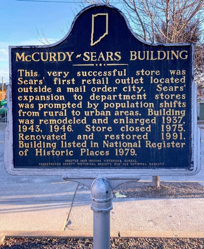
On Sycamore Street east of NW 4th Street, on the left when traveling east.
Built in 1920 for financier and philanthropist William H. McCurdy (1853-1930), president of Old National Bank. Constructed of reinforced concrete with poured concrete floors, employing architectural developments newly pioneered for industrial . . . — — Map (db m47820) HM
Side 1
U.S. Congress passed flood control acts 1936-1938 after disastrous floods, including one on Ohio River when water crested at 53.7 feet in Evansville January 31, 1937. This project authorized August 1937; U.S. Army Corps of . . . — — Map (db m88987) HM
On Ray Becker Parkway south of West Lloyd Expressway/Ohio River Scenic Byway (Indiana Route 62), on the right when traveling south.
Several buildings (1874) remain of
Evansville Cotton Manufacturing Co.,
1867-circa 1900. It was a major
employer on lower Ohio River. Most
workers were women. Accessibility
of raw cotton via river, coal from
local mines, and railroad . . . — — Map (db m226881) HM
Near North Blackford Street north of Indianapolis Cultural Trail, on the right when traveling north.
Historic and modern worlds meet in Vanderburgh County. Located here is a historic Middle Mississippian Native American village from the 14th and 15th centuries. The inhabitants built a commercial and religious regional center that included an . . . — — Map (db m238751) HM
On NW 4th Street at Vine Street, on the right when traveling north on NW 4th Street.
On March 2, 1827, Congress provided a land grant to encourage Indiana to build the Wabash & Erie Canal. The original plan was to link the navigable water of the Maumee with the Wabash through the seven mile portage at Fort Wayne. Work began five . . . — — Map (db m48241) HM
Near North Senate Avenue south of West Ohio Street, on the right when traveling south.
State Senator, 1969-1972
Lieutenant Governor, 1973-1980
45th Governor of Indiana, 1981-1989
United States Ambassador to Singapore, 1989-1992
Appointed by President George H.W. Bush
Robert Dunkerson Orr was born in Ann Arbor, . . . — — Map (db m232659) HM
Near East Boonville-New Harmony Road 0.2 miles west of U.S. 41, on the left when traveling west.
The first Soil and Water Conservation
District in Indiana was organized
here in 1940 – the last in Tipton
County in 1974. The contribution of
these districts to the conservation
and wise use of soil and water
resources has been of great . . . — — Map (db m226493) HM
On Pigeon Creek Greenway Passage 0.1 miles west of Ohio Street, on the right when traveling west.
From the late 1800's to the 1950's, small homemade houseboats dotted Pigeon Creek. In the 1950's, a group of businessmen from the Westside Nut Club worked with the Vanderburgh County Health Department and relocated the residents from Pigeon . . . — — Map (db m226909) HM
On West Brumfield Avenue at North West Street, on the right when traveling west on West Brumfield Avenue.
The Brownlee Addition Historic District is located along West Spruce and
West Walnut Streets between North West Street and Brownlee Avenue. Most
of this district was originally owned by Robert W. Evans. On April 15, 1828
Judge Samuel Hall, who . . . — — Map (db m226445) HM