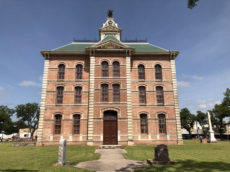
On South Fulton Street south of East Milam Street (State Highway 60), on the right when traveling south.
Wharton County
Created April 3, 1846
From Matagorda, Jackson and Colorado
Counties, Organized same year
Named for
William H. Wharton
1806-1839
Texas minister to the
United States
1836-1837, and his brother
John A. Wharton . . . — — Map (db m120596) HM
On South Gulf Road at Matagorda Cemetery Road, on the left when traveling east on South Gulf Road.
Georgia native Albert Clinton Horton came to Texas in 1834 from Alabama, where he had served in the state legislature. He established a plantation along Caney Creek in present Wharton County. In 1835, he returned to Alabama to recruit volunteers . . . — — Map (db m158655) HM
On Interstate 10 0.3 miles east of Farm to Market Road 1442, on the right when traveling east.
Born in 1815 in Vermilion Parish, Louisiana, Peyton Bland became a vital figure in Orange County. He migrated to Texas as a young man and at Orange in 1835 enrolled to serve in the Texas Revolution. Bland participated in the Grass Fight and the . . . — — Map (db m304221) HM
On South Bay Boulevard west of 4th Street, on the left when traveling east.
Abel Head "Shanghai" Pierce (1834-1900), born in Rhode Island, stowed away on a schooner headed to Indianola in 1854. He amassed 250,000 acres of ranch land in Matagorda and Wharton counties. Pierce discovered that Brahman cattle from India . . . — — Map (db m293826) HM
On University Drive at U.S. 290, on the right when traveling north on University Drive.
In response to the political, social and economic turmoil in Texas and the South after the Civil War, the federal government enacted the Reconstruction Act on March 2, 1867. Many local and state officials were removed from office and a . . . — — Map (db m136910) HM
Dr. John Sutherland (1792-1867), a native of Danville, Virginia, came to Texas in 1835. While helping the Texians prepare to defend the Alamo against the Mexican army in 1836, he suffered an accident with his horse, rendering him unable to fight. . . . — — Map (db m211544) HM
On FM 1093 at County Road 224, on the right when traveling east on FM 1093.
In 1894, a Swedish land promoter from Chicago named John Linderholm purchased 60,000 acres of Gulf Coast prairie in portions of Colorado and Wharton Counties. Linderholm was head of the Southern Texas Colonization Company and sought to bring . . . — — Map (db m300171) HM
On Farm to Market Road 102 south of Farm to Market Road 263, on the right when traveling south.
Joseph (c. 1787-1831) and Rachel Rabb (1790-1872) Newman were married in 1806 in Ohio. Following Joseph's service in the War of 1812 in Illinois, they lived in Arkansas Territory on the Red River before moving into Texas in 1820. In 1823, they left . . . — — Map (db m96300) HM
On Park Drive 0.3 miles east of Croom Drive, on the left when traveling east.
Georgia native Albert Clinton Horton came to Texas in 1834 from Alabama, where he had served in the state legislature. He established a plantation along Caney Creek in present Wharton County. In 1835, he returned to Alabama to recruit volunteers for . . . — — Map (db m191990) HM
On Avenue P 1/2 0 miles 25th Street, on the right when traveling west.
Kentucky native Edwin Hawes (1852-1932) was a prominent attorney, land owner and politician, serving as Wharton County judge and mayor of Kerrville. He and his wife, Lizzie Milburn (Rust) Hawes (1859-1927), married in 1881 and had seven children. . . . — — Map (db m143625) HM
On Farm to Market Road 102 at Farm to Market Road 3013, on the right when traveling south on Road 102.
Near this site once stood the community of Frazarville, founded in 1857 by Dr. Isaac James Frazar and his father, Col. James Watson Frazar. A locust infestation and Comanche raids forced them to move from Cibolo Creek in Bexar County to this site, . . . — — Map (db m96298) HM
On West FM 1161 Road (Farm to Market Road 1161) 0.4 miles east of Farm to Market Road 102, on the right when traveling east.
A crossroads for trade and travel in the earliest years of Anglo settlement in Texas, Egypt is considered the oldest remaining community in Wharton County. In 1826, Eli Mercer established a home and ferry crossing on the east bank of the Colorado . . . — — Map (db m308402) HM
On West Milam Street (State Highway 60), on the right when traveling west.
A native of Dublin, Ireland, George E. Quinan came to Texas in the 1830s. By the mid-1840s he had moved to Wharton and set up a law office near this site. He was elected district attorney in 1845. Quinan and his wife Mary Anne established a home on . . . — — Map (db m120600) HM
On East Bolling Highway (Farm to Market Road 1301) east of Junior College Boulevard, on the left when traveling east.
Included in a land grant awarded in 1824 to Martin Allen, one of Stephen F. Austin's "Old Three Hundred" colonists, this property has had a long and varied history. In the 1840s Allen's heirs sold most of his land to Albert Clinton Horton, Wharton . . . — — Map (db m96304) HM
On West Burleson Street east of South Houston Street, on the left when traveling east.
The Texas legislature created Wharton County in 1846, incorporating part of Stephen F. Austin's original land grant from Mexico. The William Kincheloe family donated land on the east bank of the Colorado River for a courthouse square, and the home . . . — — Map (db m120593) HM
Near Odd Fellows Cemetery Road 0.2 miles south of U.S. 90.
Born in New York. Moved to Texas 1829. Settled in Stephen F. Austin's second colony in 1832. In Texas Revolution, fought at Battle of San Jacinto in 1836. Helped lay out town of Houston same year. At 24 became first Commissioner of Texas General . . . — — Map (db m163183) HM
On Loop State Highway 526 at Pierce Street, on the right when traveling west on State Highway 526.
Here, in the 1890s, the celebrated Texas cattleman A.H. "Shanghai" Pierce (1834-1900) platted the townsite of Pierce, which he hoped would become the Wharton County seat. Its proximity to his ranch headquarters in the central part of the county was . . . — — Map (db m192549) HM
On Walnut Street (U.S. 90) at Travis Street, on the left when traveling west on Walnut Street.
Following the American Civil War and emancipation of slaves in 1865, it
was not until 1871 that African Americans in Texas were able to
uniformly register to vote, following the ratification of the 15th
Amendment to the U.S. Constitution. . . . — — Map (db m314163) HM
On 36th Division Memorial Highway (State Highway 36) at Johnston Road, on the right when traveling south on 36th Division Memorial Highway.
As a young man Martin Allen assisted his father, Benjamin, in surveying roads in their native state of Kentucky. He married Elizabeth Vice in 1804 and by 1810 they and their three children were living in Louisiana.
Martin joined the . . . — — Map (db m61299) HM
On Dontol Road (County Route 101) 2.1 miles north of Farm to Market Road 1301, on the left when traveling north.
The Texas Gulf Sulfur Company began mining operations in Wharton County in 1927. The town which developed around the mine came to be known as New Gulf (or Newgulf), distinguishing it from the company's mine already in operation at Gulf in . . . — — Map (db m259413) HM
On East Milam Street (State Highway 60) at North Fulton Street, on the right when traveling west on East Milam Street.
The Security Bank and Trust Company traces its history to the Wharton National Bank. The second banking institution to open in the city, the Wharton National Bank was organized in 1902, and closed in 1915. Following reorganization, the bank reopened . . . — — Map (db m120599) HM
On Bob-O-Link Lane at North Rusk Street, on the left when traveling east on Bob-O-Link Lane.
At the Diocesan Convention of 1867 St. Thomas’ Episcopal Church was established, the second church group in Wharton County and the first and only Episcopal Church to permanently root in the county, worship in Wharton began with the first official . . . — — Map (db m191926) HM
On East Alabama Street at North East Avenue, on the right when traveling east on East Alabama Street.
Wharton County was established in 1846, and the county seat, Wharton, was laid out on the Mexican Land Grant of "Old 300" colonist William Kincheloe. In 1866, county commissioners appointed James Whitten to find a suitable location for a cemetery. . . . — — Map (db m191935) HM
Thin black lines indicate changes in relevance. Between each pair of lines entries are ordered geographically but all have the same relevance.
* Inflectional forms of words are their plurals, singulars, and possessives as well as gramatical tenses and similar variations.