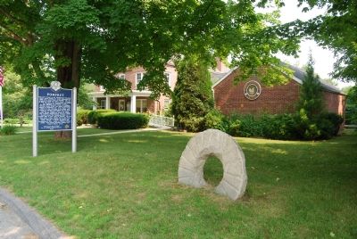
On U.S. 44 1.6 miles west of Connecticut Route 101.
The Town began as the “Mashamoquet Purchase,” 15,100 acres brought by twelve proprietors in 1686 from James Fitch of Norwich, who had acquired it from the Indian sachem, Owaneco. In 1713 the Town was incorporated and named for Pontefract in . . . — — Map (db m1621) HM
On Windham Green Road at Plains Road, on the left when traveling north on Windham Green Road.
The area which became Windham was a part of Joshúa's Tract, bequeathed to Captain John Mason and other Norwich men in a will dated February 29, 1675, by Mohegan Indian chief Joshua, son of Uncas. The gift included land in the present towns of . . . — — Map (db m140008) HM
On Main Street (Connecticut Route 12) at Academy Street, on the right when traveling north on Main Street.
Front Settled in 1700 and incorporated in 1708, Killingly was the forty-second town established in Connecticut.
In 1653, the second John Winthrop obtained a grant of a large tract of land formerly held by the Quinebaug Indian tribe and . . . — — Map (db m93380) HM
On Western Avenue (Vermont Route 9) east of Union Street, on the right when traveling east.
Brattleboro
Rich History, Thriving Culture
Chartered in 1753, Brattleboro is one of Vermont's largest towns. Known as the site of Vermont's first Anglo-Saxon settlement (Fort Drummer, 1724), this town holds a commanding position on the . . . — — Map (db m230515) HM
On Connecticut Route 169, on the right when traveling north.
Near this place, in 1636, Thomas Hooker and his party may have passed by way of the
Connecticut Path, going to settle what is now Hartford. In 1674 John Eliot, Apostle to the Indians, Pastor of the First Church in Roxbury, . . . — — Map (db m123401) HM
On Canterbury Road (Connecticut Route 169) at U.S. 6, on the right when traveling south on Canterbury Road.
Formerly Mortlake, first settled 1703, made a town on 2nd Thursday of May, 1786. Home of General Israel Putnam prior to and after the Revolution.
Town landmarks include:
Meeting House on the Green, built 1771 by First Ecclesiastical . . . — — Map (db m93440) HM
Thin black lines indicate changes in relevance. Between each pair of lines entries are ordered geographically but all have the same relevance.
* Inflectional forms of words are their plurals, singulars, and possessives as well as gramatical tenses and similar variations.