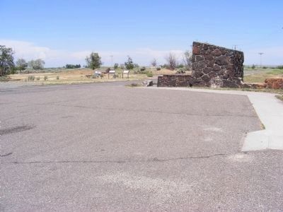
On Hunt Road west of County Road S1400E, on the right when traveling west.
Nearly every relocation center built an Honor Roll sign listing the names of Japanese American internees serving in World War II. Minidoka's sign, which stood near the rock garden, was erected on October 14, 1943. By the war's end nearly 1,000 names . . . — — Map (db m71749) HM
On State Highway 24 at milepost 10 at North 374 Lane East, on the right when traveling east on State Highway 24.
An important pioneer federal reclamation dam and power plant provides water and electricity for farms and cities nearby.
Constructed 5 miles east of here between 1904 and 1906 at a cost of $675,000, Minidoka Dam diverts water into . . . — — Map (db m124027) HM
You are standing at the entrance area of the Minidoka Relocation Center, one of ten American concentration camps established in World War II to incarcerate the 110,000 Americans of Japanese decent in coastal regions off our Pacific states. . . . — — Map (db m62956) HM
Internees created a garden behind the Honor Roll sign. The entrance garden was a cultural expression of inner strength and patriotism in contrast to the entrance gate, a symbol of confinement and injustice. The garden spoke liberty. The gate . . . — — Map (db m62957) HM WM
On Hunt Road near South 1400 East, on the right when traveling east.
The sentry towers are always silhouetted in the distance. It is not enough that they are not being used - to the residents they stand waiting for the day when they will be used. The eight sentry towers are ever present as a symbol of their . . . — — Map (db m138515) HM
Excluded from their west coast homes by military authorities, more than 9000 Japanese Americans occupied Hunt Relocation Camp 4 miles north of here between 1942 & 1945.
Until they could resettle in other places, they live in wartime tarpaper . . . — — Map (db m61972) WM
The North Side Canal brought solace to internees homesick for the Pacific Northwest. Here in the dry Idaho desert, the canal reminded them of familiar scenes in Oregon, Washington, and Alaska, where flowing waters were commonplace. The canal was . . . — — Map (db m62962) HM
The camp’s entrance was a stark and constant reminder that the internees were prisoners in their own country. Even though most internees were U.S. born citizens loyal to the principles and values of the country, they were denied their civil, . . . — — Map (db m62961) HM WM
On an unnamed road at Hunt Road on an unnamed road.
The few letters that we did receive were inked out in black. And some ... had holes, I think they cut it out with razors so you had a holey letter. Marion Tsutakawa Kanemoto
The camp's internee-run post office stood here. Hunt Post . . . — — Map (db m138514) HM
On Hunt Road west of County Road S1400E, on the right when traveling west.
The Honor Roll sign listed the names of Minidoka men and women who served in World War II, attesting to their honor and loyal citizenship. But not all viewed honor and loyalty in the same way. The government issued a questionnaire in early 1943 to . . . — — Map (db m71748) HM
On 1400 East at Hunt Road, on the left when traveling north on 1400 East.
War Relocation Authority (WRA) administration buildings lined the road where you stand. The main complex stood here, four barracks-style buildings tied together with a central passage. Camp Project Director Harry L. Stafford had his office here. . . . — — Map (db m138513) HM
Near Hunt Road 0.2 miles east of County Road S1400E, on the left when traveling east.
Toshio Toyoji and his 44 whse. (warehouse) 20 carpenters make and finish practically all of the office furniture. They remodel and alter barracks for schools and evacuee housing as well as the staff housing. The project sign shop is also . . . — — Map (db m71760) HM
Near Hunt Road near South 1450 East, on the right when traveling east.
The North Side Canal Company has given permission to take water from its canals for the pools. Warnings have been issued to all residents not to bathe or swim in the canal as it has a deep and treacherous current. -- Arthur Kleinhopf, Minidoka . . . — — Map (db m138512) HM
On South Main Street east of 4th Avenue South, on the right when traveling west.
The 1980s saw a growing movement to secure justice for Japanese Americans who had been incarcerated during WWII. Along with the campaign for redress came efforts to overturn the wartime cases of Gordon Hirabayashi, Fred Korematsu, and Minoru . . . — — Map (db m296040) HM
On East Baseline Road near North 200 East, on the right when traveling east.
Near this spot, a ferry was established in 1886 by George Montgomery and Andrew Smith. Charges were fifty cents for man and horse; seventy five cents for team and wagon. Only means of crossing Snake River between Starrh's Ferry and American Falls, a . . . — — Map (db m138487) HM
On North 5th Street south of Jackson Street, on the right when traveling south.
The Nishiura Brothers built this Colonial Revival structure in 1910. Named after its first resident physician from Japan, Dr. Taisuka Kuwabara, the Kumamoto Kenjin-kai (a prefectural association) established the hospital to serve the Japanese . . . — — Map (db m52554) HM
Near Colter Bay Marina Road, on the left when traveling north.
Alterations to a natural lake Jackson Lake is the largest of the park’s many lakes formed by glaciers. The lake expanded when the Bureau of Reclamation built a dam in 1907, creating a reservoir on top of a natural lake. The water behind the dam . . . — — Map (db m89500) HM
On 4th Avenue South, on the right when traveling north.
After the bombing of Pearl Harbor by the Japanese in December 1941, Japanese Americans became the targets of increased hostility and suspicion. The FBI rounded up community leaders; those left behind were subjected to curfews and travel . . . — — Map (db m296028) HM