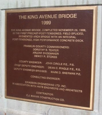
• Around 1863 a steel truss was constructed across the Olentangy River at King Avenue. It was the first roadway to be extended across the Olentangy River.
• Although the great flood of 1913 destroyed or damaged numerous bridges, businesses and . . . — — Map (db m12771) HM
On West Lane Avenue at Oletangy River Road, on the right when traveling west on West Lane Avenue.
The Lane Avenue Bridge over the Olentangy River is the second cable-stayed suspension bridge constructed in Franklin County. The structure is 370 feet long, the twin support towers rise 165 feet above the water and the deck is 112 feet wide. The . . . — — Map (db m200917) HM
On West Lane Avenue at Olentangy River Road, on the right when traveling east on West Lane Avenue.
• In the late 1800's a steel truss was constructed across the Olentangy River at Lane Avenue. Its primary function was to gain access across the Olentangy River from the main campus of The Ohio State University to the agricultural land on the west . . . — — Map (db m200920) HM
On Lane Avenue at Olentangy River Road, on the right when traveling west on Lane Avenue.
• In the late 1800's a steel truss was constructed across the Olentangy River at Lane Avenue. Its primary function was to gain access across the Olentangy River from the main campus of The Ohio State University to the agricultural land on the west . . . — — Map (db m12957) HM
On West Lane Avenue at Olentangy Trail, on the left when traveling west on West Lane Avenue.
The Lane Avenue Bridge over the Olentangy River is the second cable-stayed suspension bridge constructed in Franklin County. The structure is 370 feet long, the tween support towers rise 165 feet above the water and the deck is 112 feet wide. The . . . — — Map (db m200922) HM
On Columbus Street west of Hoover Road, on the right when traveling west.
Leithart family farm until 1956 when converted
by the Thomas family into "Rush 'n' Opal's Restaurant."
Later home and office of Dr. Kenyon Corry and became
offices for GC United Methodist Church in 2010. — — Map (db m195461) HM
On Central College Road (County Road 18) at Cedar Brook Drive, on the left when traveling east on Central College Road.
In 1820, Mark Evans, John Davis, and Jacob Waggoner acquired from Daniel Triplett an 18-rod-square parcel (approximately two acres) at this location on which to build the first school in Plain Township. Education was not publicly funded at the . . . — — Map (db m40646) HM
Honoring the Memory of Franklin County Soldiers of the Mexican War 1846 - 1848 On this day, October 2, 1954, this tablet is placed in memory of those soldiers from Franklin County, Ohio who served their country with great courage and . . . — — Map (db m13106) HM
On Graham Road, on the right when traveling north.
Alexander W. Livingston, plant breeder, horticulturist and seed merchant, who became internationally known through his development of the tomato, was born October 14, 1821, the son of John and Mary Graham Livingston. The first known variety of the . . . — — Map (db m17420) HM
On West Travis Street at South Grove Street, on the right when traveling west on West Travis Street.
Four Generations of a Founding Texas Family Called This Place Home
Family patriarch Dr. James Harper Starr was nearing the end of a long and storied career when the Starr family relocated their businesses to Marshall. His son, James . . . — — Map (db m191327) HM
Near North Center Street just south of East Mulberry Street, on the right when traveling north.
In July of 1866, Collierville, like much of the South, was beginning to recover from the ravages of war. Three years earlier, "Mister Collier's Village" consisting of several homes and a general store a few hundred yards east of the square on Mt. . . . — — Map (db m149075) HM
On North High (U.S. 23) at East North Broasway, on the right when traveling north on North High.
Clintonville
This community located in Section 2 of Clinton Township, was
settled in 1813 by Thomas Bull. The land was formerly owned
by John Rathbone for whom Rathbone Road is named. Its early
growth was due largely to a number of . . . — — Map (db m92853) HM
Dedicated November 11, 2006 to the men and women of Franklin County Ohio that served our country bravely and honorably so our freedoms endure.
The sacrifices of few ensured the freedom of many. A grateful community remembers those who served in . . . — — Map (db m13487) WM
Thin black lines indicate changes in relevance. Between each pair of lines entries are ordered geographically but all have the same relevance.
* Inflectional forms of words are their plurals, singulars, and possessives as well as gramatical tenses and similar variations.