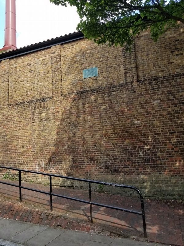
On Lambeth Road at St. George’s Road, on the left when traveling west on Lambeth Road.
In 1914, the 15-inch gun was the newest, largest and most powerful of the big guns used in Royal Navy battleships. The gun was developed in 1912 for the new Queen Elizabeth class battleships and became the main armament in 22 ships. Each example . . . — — Map (db m118019) HM WM
On Railway Avenue at Rotherhithe Street, on the left when traveling north on Railway Avenue.
Brunel’s Engine House
The tunnel shaft and pumping house for
Marc Brunel’s tunnel was constructed
between 1825 and 1843. This was the
first thoroughfare under a navigable
river in the world. — — Map (db m128417) HM
On Surrey Quays Road close to Lower Road, on the right when traveling east.
Dockmanager’s Office
Former Surrey Commercial Docks
Superintendents’ Office built in 1887
and restored to its original condition
by LDDC in 1985. — — Map (db m128355) HM
On Parl Street just west of Porter Street, on the right when traveling east.
Here stood the Globe Playhouse of Shakespeare, 1598 - 1613.
Commemorated by the Shakespeare Reading Society of London and by subscribers in the United Kingdom and India. — — Map (db m135421) HM
On Hay's Lane at Tooley Street (Route A200), on the right when traveling south on Hay's Lane.
The land between Tooley Street and the Thames has been occupied by wharves and warehouses since the middle ages. Founded by Alexander Hay in 1651, the Hay's Wharf Company grew to own most of the quayside between London and Tower Bridges. Hay's Wharf . . . — — Map (db m132009) HM
On Surrey Quays Road close to Lower Road, on the left when traveling east.
King George's Field
King George's Field is a memorial to King George V (1865-1936) in the heart of the Docklands, and one of only two such sites in Southwark.
The park grew in three stages. In 1938, Bermondsey Borough Council used a grant of . . . — — Map (db m128358) HM
On Borough High Street at Talbot Yard, on the left when traveling north on Borough High Street.
To the Memory of the Men of
The London Hop Trade Who
Died for Us in the Great War
1914 — 1918
Pte. Adams A.A. 15th Cty. of London Reg. · Pte. Arnold E. 9th Bn. Suffolk Reg. · Cpl. Attree G.W. Q.R.W.Sy. Reg. · Capt. Baird F.M. . . . — — Map (db m130043) WM
Near Stoney Street at Clink Street, on the right when traveling north.
Old Thameside Inn
Old Thameside Inn at Picktord's Wharf was formerly a tea warehouse, converted into a pub in the 1980’s. Next to it stands a fulf-size model of Sir Francis Drake's Golden Hind (in which he captured great treasures on the high seas . . . — — Map (db m118650) HM
Near Stoney Street at Clink Street, on the right when traveling north.
Old Thameside Inn
The Old Thameside Inn was once an old spice warehouse in the very busy Pickfords Wharf in the Pool of London on docks that date back to the 16th Century. Behind the pub is “The Clink" Street Prison, the private prison of . . . — — Map (db m118651) HM
On Waterloo Road at London Road, on the right when traveling south on Waterloo Road.
One Mile
XXXX Feet
from
London Bridge
Erected in
XI Year
Of the Reign
Of King George
The Third
MDCCXXI
One Mile
from
Palace Yard
Westminster
Hall
One Mile
CCCIL Feet
from
Fleet Street
The Right . . . — — Map (db m118015) HM
Near Cathedral Street at Montague Close, on the right when traveling north.
Elizabeth acceded to the throne in 1558; when England was in a period of great turbulence, fraught with religious tensions, internal political struggles and later threats from the Spanish and Ottoman Empires. She would eventually oversee major . . . — — Map (db m118648) HM
On St Mary Church Street close to Tunnel Road, on the left when traveling east.
London Borough of Southwark
The
Rotherhithe
Picture Research
Library &
Sands Film Studio
in Grice’s Granary since 1976,
a working building
since the 1780’s
Voted by the People — — Map (db m128380) HM
On Lambeth Road at St. George’s Road, on the left when traveling west on Lambeth Road.
Change Your Life by the graffiti artist, Indiano
The Berlin Wall was erected by the East German security forces in August 1961 to seal off the East German sector of Berlin from the West. On 9 November 1989 the East Germans began taking down . . . — — Map (db m118016) HM
Near Cathedral Street at Montague Close, on the right when traveling north.
Sir Francis Drake was a 16th century explorer, privateer and English National Hero who has inspired countless generations around the world. He was the first English captain to circumnavigate the globe and played a vital role in the defence of . . . — — Map (db m118646) HM
On Montague Close at Cathedral Street, on the left when traveling south on Montague Close.
Southwark Cathedral
For over 1,000 years Christians have worshipped here:
AD 606 – a convent
AD 1106 – a priory
AD 1540 – a parish church
AD 1905 – a cathedral
The oldest gothic church building in . . . — — Map (db m118612) HM
Near Lambeth Road at St. George’s Road, on the left when traveling west.
This Memorial Commemorates
The 27 Million Soviet Citizens &
Service Men & Women Who Died
For the Allied Victory in World War II
We Shall Remember Them — — Map (db m118020) WM
On St Mary Church Street at Tunnel Road, on the right when traveling east on St Mary Church Street.
St Mary Rotherhithe
Free School Founded by Peter Hill and Robert Bell Esqs. 1613
Charity School instituted 1742
Removed here 1797
Supported by Voluntary Contributions — — Map (db m128377) HM
On Cathedral Street at Montague Close, on the right when traveling north on Cathedral Street.
St. Mary Overie’s Dock
From the 16th century
Notice
This Dock is a free landing place at which
the Parishoners of St. Saviour’s Parish are
entitled to land goods free of toll.
Wardens Office
8, Southwark St. SE1
By order of the . . . — — Map (db m118644) HM
On Montague Close at Cathedral Street, on the right when traveling east on Montague Close.
These Gates Were Given By the
St. Olaves & St. Saviour’s
Grammar School Foundation
On the Centenary of
St. Saviour’s & St. Olaves
Girls’ School
AD 2003 — — Map (db m118641) HM
On Cathedral Street at Montague Close, on the right when traveling north on Cathedral Street.
The ground between the west side of this warehouse and the footpath opposite extending 93 feet 7 inches from the north end of Church Street to Saint Mary Overy's Dock is the private property of the parish of Saint Saviour's Southwark, the greatest . . . — — Map (db m118642) HM
On Borough High Street at Talbot Yard, on the right when traveling south on Borough High Street.
( east side )
Give Honour to the Men of St. Saviour’s Southwark
Who Gave Their Lives for the Empire 1914 – 1918
Their Names are Inscribed Within
The Parish Church
May Their Memory Live For Ever In the Minds of Men
( . . . — — Map (db m118653) WM
On Surrey Quays Road at Lower Road, on the right when traveling east on Surrey Quays Road.
London Borough of Southwark
Surrey docks fire
On September 7th 1940
the docks were set on
fire in the first raid
of the Blitz
Voted by the People — — Map (db m128354) HM
On Tooley Street (England Route A200) at Bridge Yard, on the right when traveling west on Tooley Street.
On the ground occupied by this building stood formerly, the Church of St. Olave. This church was founded in the eleventh century in memory of St. Olaf or Olave, King of Norway who in the year 1014, helped King Ethelred defend the city of London . . . — — Map (db m132010) HM
On Newington Butts at St. George’s Road, on the right when traveling north on Newington Butts.
The Faraday Memorial
Michael Faraday (22 September 1791 to 25 August 1867)
Near this spot in Newington Butts, Michael Faraday, one of Britain's greatest scientific figures, was born on 22 September 1791 and his birth is recorded in the . . . — — Map (db m121927) HM
Near Borough High Street at Talbot Yard, on the left when traveling south.
The National Trust
The George Inn
It is known that the George Inn existed in the late 16th Century although the present building dates from 1677. Both Shakespeare and Dickens knew the hospitality of the inn which has continued right up to the . . . — — Map (db m118652) HM
On Montague Close at London Bridge, on the left when traveling east on Montague Close.
The Glaziers Hall
Pool of London
The land in this area formed part of the site of the cloisters of the Church of St Mary Ouverie, now Southwark Cathedral. After the dissolution of the monasteries in 1540 it was sold and eventually bought by the . . . — — Map (db m118614) HM
On Battle Bridge Lane at Tooley Street (England Route A200), on the right when traveling south on Battle Bridge Lane.
Hay's Wharf was one of the earliest quaysides to incorporate fireproofing, using incombustible floors of brick arches on cast iron beams. Despite this Hay's Wharf was destroyed in the fire of Tooley Street of 1861.
This was London's biggest fire . . . — — Map (db m132007) HM
Near Stoney Street at Clink Street, on the right when traveling north.
The Jubilee Walkway – Southwark
This panel is dedicated to the memory of Sir James Swaffield, Director General of the GLC between 1973 and 1984 and a Trustee of the Jubilee Walkway Trust from 1977 until 2012.
The Jubilee Walkway is a . . . — — Map (db m119079) HM
Near Stoney Street at Clink Street, on the right when traveling north.
Legend suggests that before the construction of London Bridge in the tenth century a ferry existed here. Ferrying passengers across the River Thames was a lucrative trade. John Overs who, with his watermen and apprentices, kept the “traverse . . . — — Map (db m118649) HM
On Rotherhithe Street at St Mary Church Street, on the left when traveling east on Rotherhithe Street.
Built in the 17th century Mayflower has been the favoured Inn for many illustrious adventurers none more so than Captain Christopher Jones who set sail in the Mayflower in 1620 to discover the new world.
Today the view across the Thames from . . . — — Map (db m128381) HM
On St Mary Church Street close to Tunnel Road, on the left when traveling east.
This Tower
Being in Imminent Danger of Ruin
Owing to the Weakness of the Foundation
Was Underpinned and Made Secure
In Memory of
Emily Blanche Carr-Gomm
Lady of the Manor of Rotherhithe
By Her Son
Hubert William Culling Carr-Gomm . . . — — Map (db m128379) HM
On Tower Bridge Road just south of St Katharine's Way, on the right when traveling south.
When it was first built, Tower Bridge was controlled from two cabins, situated on the east side of each pier. These were originally built of wood, but were replaced with stone structures after World War II. Since 1962, due to the decline in river . . . — — Map (db m117761) HM
On Montague Close at London Bridge (England Route A3), on the left when traveling west on Montague Close.
William Nicholson
1824-1909
Distiller, Politician, Cricket Player, Benefactor
This alehouse is part of the Nicholson's heritage collection. They're all different, yet they all owe something to the man who founded them. William Nicholson was a . . . — — Map (db m121933) HM
On Stoney Street at Clink Street, on the right when traveling north on Stoney Street.
Winchester Palace
These ruins are all that remain of the palace of the powerful Bishops of Winchester, one of the largest and most important buildings in medieval London. Founded in the 12th century by Bishop Henry de Blois, brother of King . . . — — Map (db m118656) HM