Near Old Highway 80 East at Stafford Drive, on the left when traveling south.
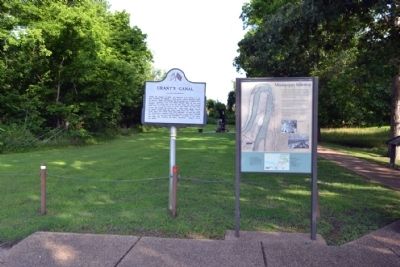
During the summer of 1862, the Federals’ first attempt to bypass Vicksburg by digging a canal across DeSoto Peninsula failed. By January, 1863, the Federals had reoccupied the Louisiana shore opposite Vicksburg. Gen. U.S. Grant ordered work on the . . . — — Map (db m84467) HM
On Thomastown Road at Ashley Plantation Road, on the left when traveling north on Thomastown Road. Reported missing.
At daybreak on June 7, 1863, Gen. H. E. McCulloch led his Texas Brigade against the Union force which guarded the Union supply depot at Milliken’s Bend. In the savage fighting which ensued, the Confederates drove the Federals from their camp. While . . . — — Map (db m34798) HM
On Old U.S. Highway 65 (State Highway 603) 1.2 miles south of Lee Street, on the left when traveling south.
During the second week of May 1863, the Federals abandoned their supply line connecting Milliken's Bend with Hard Times. On June 4, the Confederates reoccupied Richmond. From Richmond, Gen. Dick Taylor launched an offensive to destroy the Union . . . — — Map (db m89049) HM
On State Highway 602 at Crescent Plantation Drive, on the right when traveling east on State Highway 602.
During the Civil War, Crescent was the home of Dr. D.M. and Elizabeth DeMoss Dancy. The house was built in 1832.
When Gen. U.S. Grant's Federal forces occupied Madison Parish, an officer and several soldiers came to Crescent with orders to burn . . . — — Map (db m89054) HM
On Thomastown Road at Ashley Plantation Road, on the left when traveling north on Thomastown Road.
The succeeding markers identify the route of march by General U.S. Grant through Louisiana. Erected 1962 by Jimmy H. Davis, Governor of Louisiana.
Louisiana Civil War Centennial Commission. R. J. Breaux • Mrs. Frank J. Pava • Rep. Jesse M. . . . — — Map (db m214569) HM
On Old U.S. Highway 65 (State Highway 603) 1.2 miles south of Lee Street, on the left when traveling south.
Col. T.W. Bennett's task force, which had been sent to reconnoiter the route from Milliken's Bend to New Carthage, reached this point at 2:00 P.M. on March 31, 1863. If the Federals were to occupy Richmond, they would first have to cross Roundaway . . . — — Map (db m89050) HM
On North Cedar Street (U.S. 65) at Depot Street, on the right when traveling south on North Cedar Street.
Tallulah was founded in 1857. In 1862 it was an important telegraph and railroad station on the Vicksburg, Shreveport, and Texas Railroad. On August 18, 1862, the depot, telegraph office, and several cars were destroyed by a small detachment of . . . — — Map (db m89792) HM
On Highway 605 at Highway 608, on the left when traveling south on Highway 605.
To facilitate the concentration of the Union Army at Hard Times, Gen. J.A. McClernand ordered his troops to reconnoiter a road from Somerset along the western shore of Lake St. Joseph. Col. J. Keigwin was placed in charge of this project. . . . — — Map (db m137382) HM
Four miles east of this marker in Warren County, Mississippi is Davis Island on which was located Briarfield Plantation, owned by Jefferson Davis, President of the Confederacy. Hurricane Plantation, owned by Joseph Davis, older brother of Jefferson . . . — — Map (db m137180) HM
On State Highway 605, 0.5 miles south of State Highway 888, on the right when traveling south.
At the time of the Civil War, Franklin Plantation was owned by Dr. Allen T. Bowie. Other planters of this prosperous section of Louisiana owned more property and grew more bales of cotton, but Dr. Bowle's mansion was the grandest. A Confederate from . . . — — Map (db m137160) HM
On State Highway 605, 0.6 miles south of State Highway 608.
During the second week of May 1863, the Federals abandoned their supply line connecting Milliken's Bend with Hard Times. ON June 4, the Confederates reoccupied Richmond. From Richmond, Gen. Dick Taylor launched an offensive to destroy the Union . . . — — Map (db m137040) HM
On U.S. 65 at State Highway 898, on the right when traveling south on U.S. 65.
The flooded countryside between Pointe Clear and New Carthage forced the Federals to look for another way to reach Somerset. Gen. A.P. Hovey's division was given the task of opening the road known to bound Bayou Vidal on the West.
Leaving . . . — — Map (db m51632) HM
On State Highway 608, 3 miles east of State Highway 605, on the right when traveling east.
Winter Quarters Plantation was owned by Haller Nutt during the Civil War. The plantation was used as an overnight stopping point by thousands of Federal troops on their march to Hard Times. The first to arrive was Col. J. Keigwin's force, which . . . — — Map (db m239893) HM
On State Highway 605 north of Arceneaux Road, on the left when traveling north.
After completing the bridges across Phelps and Clark Bayous Col. J. Keigwin started for Hard Times on the Mississippi River on April 28, 1863. A cavalry patrol was sent to see if it could locate Maj. I.F. Harrison's Louisianians. The Union . . . — — Map (db m136955) HM