On New Salem Road at Salient Road NW, on the right when traveling north on New Salem Road.
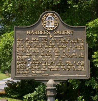
June 16, 1864. From this point as a pivot, the Confederate line W. to Gilgal Church & Lost Mtn. was swung back to a N. & S. line E. of Mud Creek, thereby making a salient angle -- Hardee's A. C. on the left or S; Polk's & Hood's Corps on the right, . . . — — Map (db m11481) HM
Near Kennesaw Mountain Drive, 1.7 miles south of Stilesboro Road.
May 7 - 100,000 Federal Troops under Sherman start south from Chattanooga. Joseph E. Johnston with 50,000 Confederates oppose them. Sherman uses flanking movements more than battles to push Confederates back.
June 19 - Confederates . . . — — Map (db m208802) HM
In May, 1864 Sherman with 100,000 men
drove into north Georgia hoping to
destroy Johnston's army of 50,000 and
lay waste vital railroads and factories.
Sherman attacked at Dalton, Resaca,
Cassville and New Hope Church. These
attacks were . . . — — Map (db m15465) HM
On Powder Springs Road Southwest near Powder Springs Road SW (Georgia Route 360), on the right when traveling south.
A costly Confederate attack here stopped the Union army's attempt to bypass Kennesaw Mountain. On June 22, 1864, Confederate Gen. Joseph E. Johnston sent Lt. Gen. John Bell Hood's 13,000 troops down Powder Springs Road to stop the Federal . . . — — Map (db m17280) HM
On Callaway Road SW, 0 miles south of Powder Springs Road SW (Georgia Route 360), on the right when traveling south.
The extension of the right wing of Federal forces S. of the Dallas Rd. threatening to outflank him, Johnston sent Hood’s Corps [CS] from the right (E. of Kennesaw) to this, the extreme left, with directions to stop further Federal advances. Hood . . . — — Map (db m17158) HM
On Powder Springs Road SW at Bankstone Drive SW, on the right when traveling south on Powder Springs Road SW.
Hdqrs., Maj. Gen. John M. Schofield, Commanding Army of the Ohio [US] -- rt. wing of Sherman’s forces on the Kennesaw front, June 22-30, 1864, while directing flanking march of 23d A.C. [US] S. on the Sandtown Road. Cox’s 3d Div. camped here & . . . — — Map (db m19699) HM
As Sherman approached the Kennesaw
line, Hood's Corps struck his right on
June 22 at Kolb Farm. The Federals,
warned, repulsed Hood with a loss of
1,000 men. Sherman decided to assault
and cut the Southern center at Cheatham
Hill and Little . . . — — Map (db m15475) HM
On Cheatham Mill Road SW, 0.2 miles north of Cavan Drive SW, on the right when traveling south.
In field west of rd., where right of 14th joined left of 20th Corps [US]. From this point, June 27, Gen. Thomas [US] directed the assault of 5 brigades of 4th and 14th Corps, against Hardee’s Corps [CS] posted on Cheatham's Hill, E., across valley . . . — — Map (db m17179) HM
On Burnt Hickory Road NW at Old Mountain Road NW, on the left when traveling east on Burnt Hickory Road NW.
One of the two abortive attempts to break Johnson’s line, [CS] June 27, 1864, was made in this area by 3 Federal brigades. Deployed on the ridge W. of the stream & astride Burnt Hickory Rd., they moved E. toward the Spur of the mountain, which was . . . — — Map (db m867) HM
On Noonday Creek Trail (Old Highway 41) at Ridenour Road, on the left when traveling west on Noonday Creek Trail.
June 19, 1864. Maj. Gen. John A. Logan’s 15th A. C. [US] was deployed astride this, the old Marietta road; Smith’s 2d div., N. E. of it; Osterhaus’ 1st, S. W.; Harrow's 4th, in reserve. This was the 2d & final sector held by Sherman’s left wing on . . . — — Map (db m80729) HM
On Cheatham Hill Dr. (Georgia Route 120) near Whitlock Ave NW, on the left when traveling west.
The intrenched line of the Confederate Army of Tenn., as of June 19-July 3, 1864, crossed the road here. This sector was held by Lt. Gen. Wm. J. Hardee's A.C. -- the right of his line at Kennesaw Mtn., the left, from 1 to 2 miles southward of this . . . — — Map (db m5239) HM
On Burnt Hickory Road NW at Carnes Road NW on Burnt Hickory Road NW.
Cyrus York house-site; June 10-19, 1864. Johnston’s forces [CS] moved from Paulding Co. to Kennesaw area, June 5, & occupied lines from Lost to Brushy Mtns. June 16: the left was withdrawn E. of Mud Creek. June 19: all forces shifted to mountain . . . — — Map (db m17650) HM