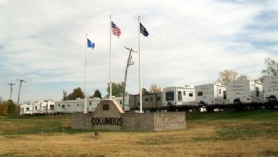
On U.S. 69/160 at North East Avenue (U.S. 69), on the right when traveling east on U.S. 69/160.
The Cherokee Indians were given this land in an 1835 treaty becoming the Cherokee Neutral Lands. Kansas was established as a state in 1861. The territory became Cherokee County named for the Cherokee Indian Nation.
During the Civil War the . . . — — Map (db m60770) HM
On South East Beasley Road, on the right when traveling west.
Rainbow Curve Bridge constructed in 1923 over Brush Creek. Only remaining Marsh Arch Bridge on Route 66. Listed on the National Registry March 10, 1983. — — Map (db m52060) HM
On 2nd Street near Pine Street, on the right when traveling west.
The 1st Deep Mine, Scammonville, KS
In 1874 four brothers from Illinois, the Scammon brothers, pioneered new methods of mining coal in southeastern Kansas, digging the first mine shaft in Cherokee County. Although many doubted that their . . . — — Map (db m35605) HM
The City of Treece, located ½ mile west of Hwy. 69 was founded on February 26, 1918 as a result of mining operations in the early 20th century. During prime mining industry production; Treece, neighboring Picher, Oklahoma and several other small . . . — — Map (db m82092) HM
On West 2nd Street at Willow Avenue (Old U.S. 66), on the right when traveling east on West 2nd Street.
Baxter Springs was named for John Baxter, the area's first European settler in 1849, and the springs on his homestead. A military surveying party who camped in the area in 1857 recounted springs rich in iron salts as rising in a "cone of red mud," . . . — — Map (db m174251) HM
On U.S. 400 at State Highway 66, on the right when traveling south on U.S. 400.
When Route 66 first gained federal status in 1926, it traveled over Kansas roads already paved.
At a time when hard-surfaced roads were a rarity in Kansas, Cherokee County was an exception. Prior to the turn of the century, engineers had . . . — — Map (db m81117) HM
On U.S. 400 at State Highway 66, on the right when traveling south on U.S. 400.
The waters of the Spring River and its tributaries have shaped this land and its settlement.
The Spring River and the waters that feed it, such as Brush, Shoal and Short Creek, carve their way through this corner of Cherokee County. For . . . — — Map (db m81100) HM
On 2nd Street near Pine Street, on the right when traveling west.
• William Wilkinson was born in Pelton Fell, England in 1862. He worked in the mines from the age of 10 and came to Weir City, Kansas, in 1883 at the age of 20 to continue mining.
• In 1917, he started his own deep mine a mile south of . . . — — Map (db m35606) HM
On Main Street at 5th Street, on the right when traveling south on Main Street.
Named for the ore it produced, Galena lead mining was the largest industry in our history, starting in 1873 and continuing until 1973. The mining and smelting required 3 railroads, 65 crushers, 2 smelters and 3 sludge mills to handle the ore . . . — — Map (db m43035) HM
On West 2nd Street at Walnut Street, on the right when traveling west on West 2nd Street.
Phase One: Pioneer Mining
The coal fields of Cherokee and Crawford Counties covered over 300 square miles of land, making it a prime area for coal mining. When early settlers first moved into the area in the 1800's, they were amazed to see . . . — — Map (db m35571) HM
On South Main Street just south of West 5th Street, on the right when traveling south.
As an important mining town, Galena had
numerous mines and smelters, but none
was more important than the Eagle-Picher
smelter plant north of the pre-1940s Route 66
alignment. The facility operated from around
the late 19th century until 2004 . . . — — Map (db m161632) HM
Thin black lines indicate changes in relevance. Between each pair of lines entries are ordered geographically but all have the same relevance.
* Inflectional forms of words are their plurals, singulars, and possessives as well as gramatical tenses and similar variations.