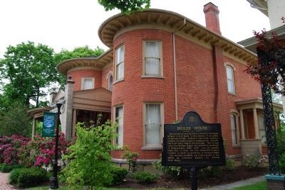
On North Front Street at North Front Street (Pennsylvania Route 153), on the right when traveling west on North Front Street.
This property was deeded in 1825 by Abraham Witmer to A.B. Reed, a descendent of an early Clearfield settler, making it one of the county's earliest recorded property transactions. According to an early map of the borough, the lot was owned by . . . — — Map (db m65558) HM
A journey down the West Branch tells the tale of lumbering in Pennsylvania, from the early lumber mills to today's sustainable forests. As you float downstream you will see the legacy of lumber; the "rafting points" used by river pilots to navigate . . . — — Map (db m87639) HM
On Front Street (Pennsylvania Route 153) just north of Locust Street, on the right when traveling south.
A journey down the West Branch tells the tale of lumbering in Pennsylvania, from the early lumber mills to today's sustainable forests. As you float downstream you will see the legacy of lumber; the "rafting points" used by river pilots to . . . — — Map (db m251275) HM
On Curwensville Tyrone Highway (Pennsylvania Route 453) 0.2 miles south of Peoples Road, on the right when traveling south.
Begun in 1962 as one of four dams built to protect the West Branch Basin from flooding, it was completed November 1965. Unlike the devastating floods in 1889 & 1936, Pennsylvania's worst flood in 1972 was less severe in Clearfield County. The . . . — — Map (db m106597) HM
A journey down the West Branch tells the tale of lumbering in Pennsylvania, from the early lumber mills to today's sustainable forests. As you float downstream you will see the legacy of lumber; the "rafting points" used by river pilots to . . . — — Map (db m263023) HM
On Covered Bridge Road 0.1 miles south of Burnside McGee Highway (U.S. 219), on the right when traveling south.
Only remaining covered bridge over any branch of the Susquehanna River. Thomas McGee built this single span Burr arch truss bridge in 1873 for $175 using hand hewed white pine timbers from the area. It was the last covered bridge built in . . . — — Map (db m106713) HM
Near Market Street (U.S. 15) just south of Susquehanna Beltway (U.S. 220), on the right when traveling south.
Daring, brawn, and skill — that's what Pennsylvania rivermen needed to deliver timber to market in the early 1800s. Men felled immense Eastern white pines, fastened them together into log rafts, and rode them down river to be used for shipbuilding . . . — — Map (db m191997) HM
On Main Street south of Cemetery Avenue, on the right when traveling south.
[GAR Emblem]
Erected Anno Domini 1927
by a grateful people, to the
memory of the brave soldiers
of Easton Post No. 229 Grand
Army of the Republic, and of
Clearfield County, Pennsylvania.
Who by their valorous deeds
from 1861 to . . . — — Map (db m265568) WM
On Front Street (Pennsylvania Route 153) north of Pine Street, on the left when traveling south.
When the first pioneers came to Clearfield County early in
the 19th century they found an endless forest of white
pine trees. After homesteads were established much of the
timber left standing was made into log rafts. Rafts
would be floated . . . — — Map (db m251242) HM
Thin black lines indicate changes in relevance. Between each pair of lines entries are ordered geographically but all have the same relevance.
* Inflectional forms of words are their plurals, singulars, and possessives as well as gramatical tenses and similar variations.