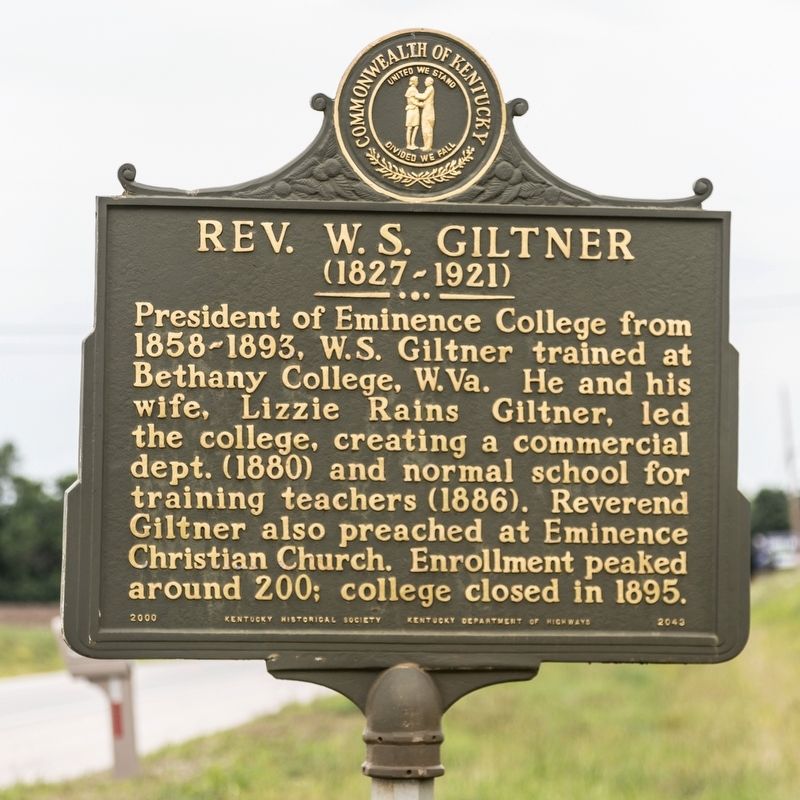
On Eminence Pike (Kentucky Route 55) south of Mulberry Road ( Route 1899), on the right when traveling south.
Chartered as a high school by
Kentucky Legislature in 1856. The
school had trustees Dr. D.
Porter, S.T. Drane, Morris Thomas,
Preston Thomas, James Drane, W. B.
Wilson, and W. J. Mason. In 1861,
the name Eminence College conferred
on it. Men . . . — — Map (db m136246) HM
On Harlin Street, on the right when traveling east.
Highway 22/Gratz Bridge
The Department of Highways built the Highway 22/Gratz Bridge
during a time of major road improvements in Kentucky. Automobiles
unit trucks were becoming increasingly common and the public
demanded better roads. By . . . — — Map (db m205602) HM
On Jefferson Street (Kentucky Route 146) west of 1st Avenue ( Route 53), on the right when traveling west.
Taken from parts of Jefferson, Shelby, and Henry counties, it was the 74th formed.
Named for Col. William Oldham, native Virginian, officer in War of Revolution. Commanded regiment of Kentucky militia in ill-fated Indian campaign on Wabash . . . — — Map (db m61868) HM
On Walnut Street, on the right when traveling east.
Built by Barton Lasater in 1920. Purchased 1923 by Sidney Mandle, owner of Kentucky/Tennessee Clay Company. Bricks made in Puryear from Henry County clay. Remodeled and expanded in 1933 to a Colonial design with Georgian Revival influence . . . — — Map (db m155866) HM
South Carolina native Edward H. Tarrant enlisted in the Kentucky Militia in 1814 and served under Gen. Andrew Jackson in the Battle of New Orleans. Moving to Tennessee after 1816, he was elected Colonel of the Henry County Militia and served as . . . — — Map (db m188852) HM
Near Letcher Lane (Virginia Route 749) 0.5 miles west of Ararat Highway ( Route 773), on the left when traveling west.
William Letcher, the maternal great-grandfather of James Ewell Brown Stuart, was born about 1750 near Petersburg, Virginia. He was the second son of Giles Letcher of Goochland County, who was born in Ireland, and his wife, Hannah Hughes, who was of . . . — — Map (db m162905) HM
Near 6th Avenue North north of Harrison Street, on the left when traveling north.
Bounded on the east by Kentucky Lake, Henry County honors the
Revolutionary War patriot and statesman – Patrick Henry.
Tennessee's “Volunteer County”, is the home of the “World’s
Biggest Fish Fry” and governors Isham G. Harris, James D.
Porter, . . . — — Map (db m199701) HM
On Georgia Route 81 at Griffin Street (U.S. 23), on the left when traveling east on Georgia Route 81.
By Wednesday evening, November 16, 1864, after marching that day from the vicinity of Stockbridge, two Federal infantry corps camped at locations around McDonough, the seat of Henry County. The 17th Corps, more than 11,000 strong and commanded by . . . — — Map (db m186572) HM
On North Main Street at East Poplar Avenue (Tennessee Route 57), on the right when traveling north on North Main Street.
The Original Town Site of Collierville/Colliersville
In this area and to the east, lies the original town site of Collierville. The lands that were destined to become Collierville traveled through many periods of history before a village . . . — — Map (db m149071) HM
Thin black lines indicate changes in relevance. Between each pair of lines entries are ordered geographically but all have the same relevance.
* Inflectional forms of words are their plurals, singulars, and possessives as well as gramatical tenses and similar variations.