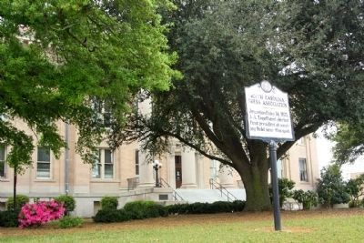
On U.S. 45 at Jimmy Ramey Road, on the right when traveling south on U.S. 45.
This family was estab. in Wayne County by Clinch Gray, a native of North Carolina. He immigrated to this region in 1808, one yr. before the Co. was organ. within the Mississippi Terr. Gray signed Miss.'s first const. in 1817. He was buried here, . . . — — Map (db m80359) HM
On Market Street (Business U.S. 17) west of South 19th Street, on the left when traveling west.
Shingle style house built for Joseph Daniel Edwards (1873-1936), native of Wayne County, NC, city-county tax appraiser; and wife, Norma Foster (1880-1963), music teacher and chair of music of the North Carolina Federation of Women's Clubs. The house . . . — — Map (db m266019) HM
On West Franklin Street at South Main Street, on the right when traveling west on West Franklin Street.
The Indiana General Assembly authorized the formation of Randolph County from Wayne County in January 1818 to take effect in August 1818. Early historians contend that the county's name came from settlers who relocated from Randolph County, North . . . — — Map (db m225004) HM
On this spot stood
Dobbs County Court House
1758-1791
The following counties
were formed from Dobbs.
Greene (formerly Glascow) 1779
Wayne 1779
Lenoir 1791
Erected by the Wayne County
Committee North Carolina Society
Colonial . . . — — Map (db m64803) HM
On West Water Street at Monroe Street, on the right when traveling west on West Water Street.
In its edition of August 27, 1851, the Plymouth Villager made a backhanded confirmation of the presence of abolitionists in Washington County, North Carolina. "A coat of tar and feathers is in waiting for the gentleman who will come about . . . — — Map (db m276306) HM
On North William Street near East Walnut Street, on the right when traveling south.
Seymour Johnson Field, established on June 12, 1942, six months after the United States entered
World War II, is named in honor of Lieutenant Seymour A. Johnson. A Goldsboro native and U.S.Navy test
pilot, he was killed in an aircraft crash . . . — — Map (db m66699) HM
On East Walnut Street at North William Street when traveling west on East Walnut Street.
No North Carolina city, no town, no rural section, escaped.
These boys, the dead and living wounded, are the real heroes of this war. These are the men to whom our state and every part thereof should never fail to pay tribute.
Brigadier . . . — — Map (db m266943) HM
On North Carolina Highway 58 (State Highway 58) at Fort Run Road (State Highway 1058), on the right when traveling south on North Carolina Highway 58.
Tuscarora stronghold. Site of decisive battle of the Tuscarora War, March 20-23, 1713, when 950 Indians were killed or captured. Site 1 mi. N. — — Map (db m222352) HM
On Highland Boulevard (State Highway 118) at Queen Street, on the right when traveling north on Highland Boulevard.
Fortified Indian town & site of the Tuscarora conspiracy of Sept., 1711. Capitulated, 1712, after a 10-day siege by Col. John Barnwell. Site is 4 mi. N. — — Map (db m65288) HM
Thin black lines indicate changes in relevance. Between each pair of lines entries are ordered geographically but all have the same relevance.
* Inflectional forms of words are their plurals, singulars, and possessives as well as gramatical tenses and similar variations.