THE HISTORICAL
MARKER DATABASE
“Bite-Size Bits of Local, National, and Global History”


8 entries match your criteria.  


Related Historical Markers

Markers for Fort Stevens and related sites.
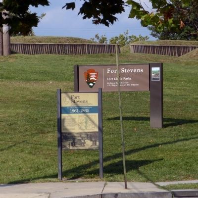
 
By Allen C. Browne, April 13, 2013
Fort Stevens Marker
SHOWN IN SOURCE-SPECIFIED ORDER
1 ► District of Columbia, Washington, Northwest Washington, Brightwood — Fort Stevens —
On 13th Street Northwest at Quakenbos Street Northwest, on the right when traveling north on 13th Street Northwest.
2 ► District of Columbia, Washington, Northwest Washington, Brightwood — Lincoln Under Fire at Fort Stevens —
Near 13th Street Northwest north of Fort Stevens Drive Northwest, on the right when traveling north.
3 ► District of Columbia, Washington, Northwest Washington, Brightwood — 16 — “Get Down You Fool” — Battleground to Community — Brightwood Heritage Trail —
On Quackenbos Street Northwest east of 13th Street Northwest, on the left when traveling west.
4 ► District of Columbia, Washington, Northwest Washington, Brightwood — 17 — Aunt Betty's Story — Battleground to Community — Brightwood Heritage Trail —
On 13th Street Northwest at Quakenbos Street Northwest, on the right when traveling north on 13th Street Northwest.
5 ► District of Columbia, Washington, Northwest Washington, Manor Park — Fort Slocum — Civil War Defenses of Washington — 1861-1865 —
On Kansas Avenue Northwest at Nicholson Street Northwest, on the right when traveling south on Kansas Avenue Northwest.
6 ► District of Columbia, Washington, Northeast Washington, Fort Totten — Fort Totten — Civil War Defenses of Washington — 1861-1865 —
On Fort Totten Drive Northeast north of Crittenden Street Northeast, on the right when traveling north.
7 ► District of Columbia, Washington, Northeast Washington, Fort Totten — Fort Totten —
On Fort Totten Drive Northeast north of Allison Street Northeast, on the right when traveling north.
8 ► District of Columbia, Washington, Northwest Washington, Former Walter Reed Army Medical Center — Site of a Tulip Tree —
On Butternut Street Northwest west of Georgia Avenue Northwest (Route 29), on the right when traveling west.
 
 
CeraNet Cloud Computing sponsors the Historical Marker Database.
This website earns income from purchases you make after using our links to Amazon.com. We appreciate your support.
Paid Advertisement
Nov. 11, 2026
