21 entries match your criteria.
Entries Containing All of the Phrases «randolph county» AND «indiana»
This list will also include matches for inflectional* forms of the words.
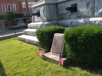
By Courtesy:: Marilyn Wolf, May 30, 2010
Looking East - - Randolph County (Indiana) Marker
RANKED BY RELEVANCE
| On West Washington Street (a.k.a. St. Rd. 32) at South Main Street, on the right when traveling east on West Washington Street (a.k.a. St. Rd. 32). |
| On West Washington Street (a.k.a. St. Rd. 32) at South Main Street, on the right when traveling east on West Washington Street (a.k.a. St. Rd. 32). |
| On West Washington Street (State Road 32) at South Meridian Street, on the right when traveling east on West Washington Street. |
| Near West Franklin Street at South Main Street, on the right when traveling west. |
| On West Franklin Street west of South Main Street, on the right when traveling west. |
| On State Road 32 at County Road N 100 E, on the right when traveling east on State Road 32. |
| On West Franklin Street at South Main Street, on the right when traveling west on West Franklin Street. |
| On West Franklin Street west of South Main Street, on the right when traveling west. |
| On West Franklin Street at South Main Street, on the right when traveling west on West Franklin Street. |
| On North Columbia Street at W. Pearl Street, on the left when traveling north on North Columbia Street. |
| On West Franklin Street at South Main Street, on the right when traveling west on West Franklin Street. |
| On West Franklin Street west of South Main Street, on the right when traveling west. |
| On Stingley Road (County Route 57) 0.2 miles west of Smith Road (County Route 386), on the left when traveling west. |
| On Union City Gateway Trail east of South Market Street, on the left when traveling east. |
| On St. Leo's Road (County Route 23) north of Bluff Road. |
| On Main Street (Illinois Route 3) at Route 155, on the right when traveling south on Main Street. |
| Near College Avenue 0.5 miles east of East Main Street, on the right when traveling west. |
| On West Franklin Street at South Main Street, on the right when traveling west on West Franklin Street. |
| On West Franklin Street at South Main Street, on the right when traveling west on West Franklin Street. |
| On West Franklin Street at South Main Street, on the right when traveling west on West Franklin Street. |
| Near Valley Boulevard east of Loma Avenue. |
Thin black lines indicate changes in relevance. Between each pair of lines entries are ordered geographically but all have the same relevance.* Inflectional forms of words are their plurals, singulars, and possessives as well as gramatical tenses and similar variations.
This website earns income from purchases you make after using our links to Amazon.com. We appreciate your support.
Nov. 12, 2026
