30 entries match your criteria.
Entries Containing the Phrase «fort apache»
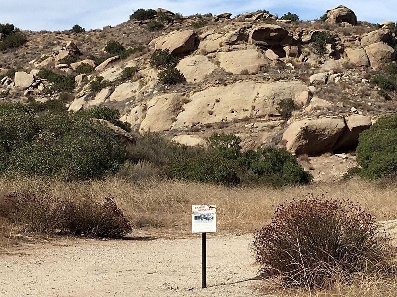
By Craig Baker, November 11, 2022
Fort Apache Marker
RANKED BY RELEVANCE
1 ► California, Ventura County, Simi Valley — 5 — Fort Apache — Corriganville —  |
| Near Smith Road 0.5 miles east of Kuehner Drive. | |||
| 2 ► California, Ventura County, Simi Valley — 4 — Fort Apache — Corriganville — |
| Near Smith Road 0.5 miles east of Kuehner Drive, on the left when traveling east. | |||
| 3 ► Arizona, Navajo County, Fort Apache — Non-Commissioned Officers' Quarters (110 & 111) — |
| On General Crook Street, on the left when traveling east. | |||
| 4 ► Arizona, Navajo County, Fort Apache — First Commanding Officer's Quarters (101) — |
| On General Crook Street at Scout Street, on the left when traveling east on General Crook Street. | |||
| 5 ► Arizona, Navajo County, Fort Apache — Adjutant's Office (117) — |
| On General Crook Street, on the right when traveling east. | |||
| 6 ► Arizona, Navajo County, Fort Apache — Barracks Row — |
| On Scout Street, on the left when traveling north. | |||
| 7 ► Arizona, Navajo County, Fort Apache — Boys' Dormitory (116) — |
| On Barracks Row, on the right when traveling west. | |||
| 8 ► Arizona, Navajo County, Fort Apache — Captain's Quarters (102 and 103) — |
| On General Crook Street, on the left when traveling east. | |||
| 9 ► Arizona, Navajo County, Fort Apache — Parade Ground — |
| On General Crook Street, on the right when traveling east. | |||
| 10 ► Arizona, Navajo County, Fort Apache — Theodore Roosevelt School (118) — |
| On Barracks Row, on the left when traveling west. | |||
| 11 ► Arizona, Navajo County, Fort Apache — Old Guard House (115A) — |
| Near Fort Apache Road, on the right when traveling west. | |||
| 12 ► Arizona, Navajo County, Fort Apache — T.R. School Cafeteria (119) — |
| On Barracks Row, on the left when traveling west. | |||
| 13 ► Arizona, Navajo County, Fort Apache — B.I.A. Club House (105) — |
| On General Crook Street, on the left when traveling east. | |||
| 14 ► Arizona, Navajo County, Fort Apache — Barracks (115) — |
| Near Barracks Row, on the left when traveling west. | |||
| 15 ► Arizona, Navajo County, Fort Apache — Commanding Officers' Quarters (104) — |
| On General Crook Street, on the left when traveling east. | |||
| 16 ► Arizona, Navajo County, Fort Apache — Commissary Storehouse (113) — |
| On Kinney Road, on the left when traveling south. | |||
| 17 ► Arizona, Navajo County, Fort Apache — Girls' Dormitory (120) — |
| On Barracks Row, on the right when traveling west. | |||
| 18 ► Arizona, Navajo County, Fort Apache — Guard House (114) — |
| On Kinney Road, on the left when traveling south. | |||
| 19 ► Arizona, Navajo County, Fort Apache — Officer's Quarters (106) — |
| On General Crook Street, on the left when traveling east. | |||
| 20 ► Arizona, Navajo County, Fort Apache — Officers' Quarters (107, 108, 109) — |
| On General Crook Street, on the left when traveling east. | |||
| 21 ► Arizona, Navajo County, Fort Apache — T.R. School Teachers' Quarters (112) — |
| On General Crook Street, on the left when traveling east. | |||
| 22 ► Arizona, Maricopa County, Apache Junction — Alchesay — |
| On Arizona Route 88 at milepost 241, on the left when traveling east. | |||
| 23 ► Arizona, Navajo County, Whiteriver — Kinishba Ruins — |
| Near Kanishba Road. | |||
| 24 ► Arizona, Coconino County, Happy Jack — General Crook Trail — |
| On Rim Road (Forest Road 300) 1.2 miles east of Route 87, on the left when traveling east. | |||
| 25 ► Arizona, Coconino County, Happy Jack — General Crook Trail — |
| On Rim Road (Forest Road 300) 8.4 miles east of Route 87, on the left when traveling east. | |||
| 26 ► New Mexico, Mora County, Watrous — Enough to Feed an Army — Quartermaster Depot Storehouses Fort Union National Monument — National Park Service, U.S. Department of the Interior — |
| Near New Mexico Route 161 7.5 miles north of CanAm Highway (Interstate 25). | |||
| 27 ► Arizona, Navajo County, Lakeside — 436 — Lakeside — |
| On Larson Road at Heritage Lane, on the right when traveling south on Larson Road. | |||
| 28 ► California, Ventura County, Simi Valley — 3 — Vendetta Village — Corriganville — |
| Near Smith Road 0.5 miles east of Kuehner Drive. | |||
| 29 ► Kansas, Ford County, Dodge City — Henry Fonda — Dodge City Trail of Fame — |
| On Gunsmoke Street just east of 1st Avenue, on the right when traveling east. | |||
| 30 ► Arizona, Yavapai County, Camp Verde — "0" Mile Post General Crook Trail — |
| Near East Hollamon Street 0.3 miles North Montezuma Well Road (Arizona Route 260). | |||
Thin black lines indicate changes in relevance. Between each pair of lines entries are ordered geographically but all have the same relevance.
* Inflectional forms of words are their plurals, singulars, and possessives as well as gramatical tenses and similar variations.
Nov. 12, 2026