14 entries match your criteria.
California - Sutter Creek Gold Mine Trail Historical Markers A 15 mile tour highlighting the Gold Rush era mines in and near Sutter Creek. Markers are placed from ¼ to ½ mile apart. Please do not trespass on private property.
By Barry Swackhamer, April 27, 2011
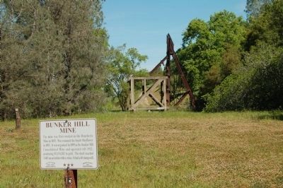
Bunker Hill Mine Marker and Headframe
GEOGRAPHIC SORT Title Sort Marker Number Sort Marker Number Sort for Trails Publication Order Sort Publication Order Sort A Erected Year Sort Most Viewed Sort Most Recent-Interest Sort Most Recently Changed Sort SEE FAQ #33 FOR DESCRIPTIONS
On Bunker Hill Road at Fremont Mine Road on Bunker Hill Road.
On East School Street at Amador Creek Street, on the right when traveling south on East School Street.
On String Bean Alley east of Old Route 49.
On Bunker Hill Road south of Fremont Mine Road.
On Bunker Hill Road at New Chicago Road, on the left when traveling south on Bunker Hill Road.
On New Chicago Road at Old Drytown Plymouth Road on New Chicago Road.
On North Main Street, on the left when traveling north.
Near North Main Street/Jackson Gate Road.
On Fuller Lane at California Highway 49, on the left when traveling west on Fuller Lane.
On Broadway Street at French Bar Road, on the left when traveling south on Broadway Street.
On Pacific Street south of California Highway 49, on the left when traveling south.
On Old Sutter Creek-Amador City Highway north of Hanford Street (Old Highway 49).
On Main Street (Old California 49) at Sutter Hill Road, on the right when traveling south on Main Street (Old California 49).
︽
Nov. 13, 2026