17 entries match your criteria.
Entries Containing All of the Phrases «tazewell county» AND «virginia»
This list will also include matches for inflectional* forms of the words.
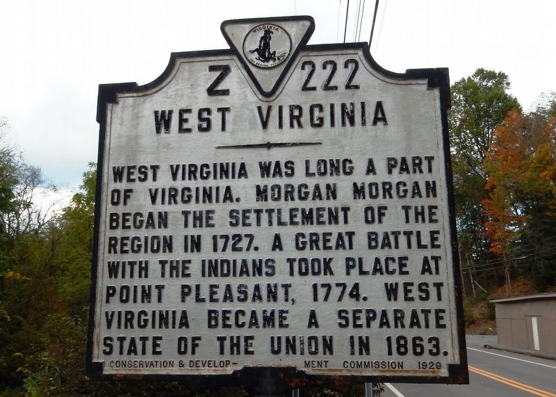
By Cosmos Mariner, September 21, 2017
West Virginia (side facing south into Virginia, seen approaching West Virginia from south)
RANKED BY RELEVANCE
| On Trail of the Lonesome Pine (Virginia Avenue) (U.S. 19) 0.2 miles north of Meadoes Street, on the right when traveling south. |
| On Falls Mills Road (West Virginia Route 102). |
| On Bramwell-Pocahontas Road (County Route 120), on the right when traveling west. |
| Near Seneca Trail (U.S. 219) near George Hill Road (County Route 24/1). |
| On Crab Orchard Road (Business U.S. 19/460) at Trail of the Lonesome Pine (U.S. 19/460), on the right when traveling south on Crab Orchard Road. |
| On Virginia Avenue (U.S. 460) 2.2 miles west of Thomas Drive, on the right when traveling west. |
| On Princeton Avenue (U.S. 19) east of Bland Street (U.S. 52), on the right when traveling east. |
| On U.S. 460 south of Shortt Gap Road, on the right when traveling north. |
| On West Virginia Route 16 just south of Jess Reedy Road, on the left when traveling south. |
| On Wyoming Street (West Virginia Route 16) at Bank Street, on the right when traveling north on Wyoming Street. |
| On Shop Hollow Road (County Route 659) at Boissevain Road (County Route 644) on Shop Hollow Road. |
| On Main Street (County Route 120) at Simmons Avenue (Route 120), on the left when traveling west on Main Street. |
| On Governor George C. Peery Highway (U.S. 469) at Patterson Street, on the right when traveling west on Governor George C. Peery Highway. |
| On Trail of the Lonesome Pine (Alternate U.S. 58) east of Upper Copper Creek Road (County Route 671), on the left when traveling east. |
| On Lindell Road (County Road 50) at Hiawatha Lane (County Road 800), on the right when traveling south on Lindell Road. |
Thin black lines indicate changes in relevance. Between each pair of lines entries are ordered geographically but all have the same relevance.* Inflectional forms of words are their plurals, singulars, and possessives as well as gramatical tenses and similar variations.
This website earns income from purchases you make after using our links to Amazon.com. We appreciate your support.
Nov. 13, 2026
