261 entries match your criteria. Entries 201 through 261 are listed.⊲ Previous 100
Historical Markers and War Memorials
in the Flint Hills Region
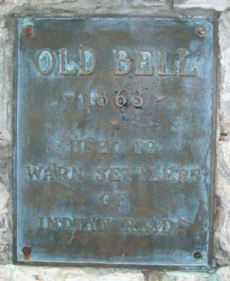
By William Fischer, Jr., February 19, 2011
Old Bell Marker
201 ► Kansas, Morris County, Council Grove — Old Bell — 1863 —  |
| On North Belfry Street near Columbia Street, on the right when traveling north. | |||
| 202 ► Kansas, Morris County, Council Grove — Pioneer Cowboy Jail — City Calaboose Since 1849 — |
| On Main Street (U.S. 56) at 5th Street, on the left when traveling east on Main Street. | |||
| 203 ► Kansas, Morris County, Council Grove — Post Office Oak — |
| On Main Street (U.S. 56) near Union Street, on the left when traveling east. | |||
| 204 ► Kansas, Morris County, Council Grove — Post Office Oak — |
| On Main Street (U.S. 56) near Union Street, on the left when traveling east. | |||
| 205 ► Kansas, Morris County, Council Grove — Rendezvous on the Trail — |
| On Union Street (State Highway 177) at Main Street (U.S. 56), on the right when traveling north on Union Street. | |||
| 206 ► Kansas, Morris County, Council Grove — Santa Fe Trail — 1822 - 1872 — |
| On U.S. 56 0.3 miles east of 1300th Road, on the right when traveling west. | |||
| 207 ► Kansas, Morris County, Council Grove — Santa Fe Trail / Council Grove — 1822 - 1872 — |
| On Main Street (U.S. 56) near 2nd Street, on the left when traveling east. | |||
| 208 ► Kansas, Morris County, Council Grove — Seth Hays Home — |
| Near Wood Street. | |||
| 209 ► Kansas, Morris County, Council Grove — Seth Hays Home — 1867 — |
| Near Wood Street. | |||
| 210 ► Kansas, Morris County, Council Grove — Sylvan Park Depot — 1900 — |
| On Main Street (U.S. 56) at 5th Street, on the left when traveling east on Main Street. | |||
| 211 ► Kansas, Morris County, Council Grove — Terwilliger Home / Trail Days House — 1861 — On the way to Santa Fe — |
| On Main Street (U.S. 56) at Adams Street, on the left when traveling west on Main Street. | |||
| 212 ► Kansas, Morris County, Council Grove — The Cottage House Hotel and Motel — 1867 - 1872 — Philomathian Heritage Plaque — |
| On Neosho Street at Columbia Street, on the left when traveling north on Neosho Street. | |||
| 213 ► Kansas, Morris County, Council Grove — The Limestone Bank Barn — |
| Near U.S. 56. | |||
| 214 ► Kansas, Morris County, Council Grove — The Mormon Battalion at Council Grove, Kansas — |
| Near North Mission. | |||
| 215 ► Kansas, Morris County, Council Grove — Trail Ruts — |
| On 1400 Road south of U.S. 56, on the right when traveling south. | |||
| 216 ► Kansas, Riley County, Manhattan — Amanda Arnold Arch — |
| Near Humboldt Street west of North 4th Street, on the left when traveling west. | |||
| 217 ► Kansas, Riley County, Manhattan — Carnegie Library — |
| On Poyntz Avenue at 5th Street, on the right when traveling west on Poyntz Avenue. | |||
| 218 ► Kansas, Riley County, Manhattan — Change & Growth — The Beginnings of Business — |
| On 3rd Street at Colorado Street, on the right when traveling south on 3rd Street. | |||
| 219 ► Kansas, Riley County, Manhattan — Civil War Memorial — |
| Near North 11th Street. | |||
| 220 ► Kansas, Riley County, Manhattan — Civil War Memorial — |
| On Sunset Avenue 0.1 miles north of Poyntz Avenue, on the left when traveling north. | |||
| 221 ► Kansas, Riley County, Manhattan — Civil War Memorial — |
| Near Poyntz Avenue. | |||
| 222 ► Kansas, Riley County, Manhattan — Colorado Street — |
| On 4th Street at Colorado Street, on the right when traveling south on 4th Street. | |||
| 223 ► Kansas, Riley County, Manhattan — Damon Runyon — The First Neighborhoods — |
| On 4th Street at Osage Street, on the left when traveling north on 4th Street. | |||
| 224 ► Kansas, Riley County, Manhattan — Dobřichovice, Czech Republic • Manhattan, Kansas — Partner City Flag Plaza — Creating Lasting Relationships — |
| On 14th Street at Poyntz Avenue, on the right when traveling north on 14th Street. | |||
| 225 ► Kansas, Riley County, Manhattan — Ft. Leavenworth - Ft. Riley Military Road — |
| On Poyntz Avenue at 12th Street, on the right when traveling west on Poyntz Avenue. | |||
| 226 ► Kansas, Riley County, Manhattan — Geology at Konza — |
| On Pillsbury Drive (State Highway 177) 5 miles north of Interstate 70, on the left when traveling north. | |||
| 227 ► Kansas, Riley County, Manhattan — Harahey — |
| Near Central Park Road. | |||
| 228 ► Kansas, Riley County, Manhattan — Konza Prairie — Konza Prairie Research Natural Area — |
| On Pillsbury Drive (State Highway 177) 5 miles north of Interstate 70, on the left when traveling north. | |||
| 229 ► Kansas, Riley County, Manhattan — Manhattan's Union Pacific Depot - Revived — The Beginnings of Business — |
| On 3rd Street at Blue Earth Place, on the left when traveling south on 3rd Street. | |||
| 230 ► Kansas, Riley County, Manhattan — Millstones — |
| On Mid-Campus Drive north of Petticoat Lane, on the left when traveling north. | |||
| 231 ► Kansas, Riley County, Manhattan — Osage Street — The First Neighborhoods — |
| On Osage Street at 4th Street, on the right when traveling west on Osage Street. | |||
| 232 ► Kansas, Riley County, Manhattan — Riley County Courthouse — |
| On East Poyntz Avenue at South 5th Street, on the right when traveling west on East Poyntz Avenue. | |||
| 233 ► Kansas, Riley County, Manhattan — Spanish American War Veterans Memorial — |
| Near North 11th Street. | |||
| 234 ► Kansas, Riley County, Manhattan — The American Veteran — |
| On East Poyntz Avenue west of South 4th Street, on the right when traveling west. | |||
| 235 ► Kansas, Riley County, Manhattan — The Hartford House — |
| On Claflin Road. | |||
| 236 ► Kansas, Riley County, Manhattan — The Tallgrass Prairie — |
| On Pillsbury Drive 5 miles north of Interstate 70, on the left when traveling north. | |||
| 237 ► Kansas, Riley County, Manhattan — World War II Memorial — |
| On Vattier Street west of Oak Street, on the left when traveling west. | |||
| 238 ► Kansas, Riley County, Manhattan — Yuma Street — The First Neighborhoods — Dr. John Walters — |
| On 4th Street at Yuma Street, on the right when traveling south on 4th Street. | |||
| 239 ► Kansas, Riley County, Ogden — Ogden — Settled in 1854 — |
| On Riley Boulevard at North Park Street, on the right when traveling east on Riley Boulevard. | |||
| 240 ► Kansas, Riley County, Ogden — Veteran's Memorial — |
| On Riley Boulevard at North Park Street, on the left when traveling west on Riley Boulevard. | |||
| 241 ► Kansas, Riley County, Riley — Riley Centennial — 1870 - 1970 — |
| On Broadway at Elm Street, on the right when traveling south on Broadway. | |||
| 242 ► Kansas, Riley County, Riley — War Memorial — Freedom Is Never Free ! — All Gave Some • Some Gave All — |
| On Broadway north of Cedar Street, on the left when traveling north. | |||
| 243 ► Kansas, Riley County, Zeandale — Chris Barr's Cabin — Built in 1863 — |
| On Pillsbury Crossing Road 0.6 miles east of Deep Creek Road (Kansas Highway 911), on the left when traveling east. | |||
| 244 ► Kansas, Wabaunsee County, Alma — 8 — Brandt Hotel — Built in 1887 — |
| On Missouri Avenue (State Highway 99) at 4th Street, on the left when traveling south on Missouri Avenue. | |||
| 245 ► Kansas, Wabaunsee County, Alma — 3 — Commercial National Bank Block — Built in the late 1800's — |
| On Missouri Avenue (State Highway 99) at 3rd Street, on the left when traveling south on Missouri Avenue. | |||
| 246 ► Kansas, Wabaunsee County, Alma — Harahey — |
| On Kansas Avenue north of 2nd Street, on the left when traveling north. | |||
| 247 ► Kansas, Wabaunsee County, Alma — 7 — Limerick Building — Built in the early 1880's — |
| On Missouri Avenue (State Highway 99) at 4th Street, on the left when traveling south on Missouri Avenue. | |||
| 248 ► Kansas, Wabaunsee County, Alma — 1 — Meyer Block — Built in the early 1890's — |
| On Missouri Avenue (State Highway 99) at 3rd Street, on the right when traveling south on Missouri Avenue. | |||
| 249 ► Kansas, Wabaunsee County, Alma — 4 — Mueller Block — Built in mid 1870's — |
| On Missouri Avenue (State Highway 99) at 3rd Street, on the left when traveling south on Missouri Avenue. | |||
| 250 ► Kansas, Wabaunsee County, Alma — 2 — Palenske Building — Built in 1890 — |
| On Missouri Avenue south of 3rd Street, on the left when traveling south. | |||
| 251 ► Kansas, Wabaunsee County, Alma — 9 — Soldiers and Sailors Memorial (American Legion Post) — Built in 1936 — |
| On Missouri Avenue (State Highway 99) at 5th Street, on the left when traveling south on Missouri Avenue. | |||
| 252 ► Kansas, Wabaunsee County, Alma — Stone Fences — |
| On State Highway 99 north of Soloscheid Road, on the right when traveling south. | |||
| 253 ► Kansas, Wabaunsee County, Alma — Strasen Farm Stone — |
| On 3rd Street west of Missouri Avenue (Kansas Highway 99), on the left when traveling west. | |||
| 254 ► Kansas, Wabaunsee County, Alma — 6 — Wabaunsee County Bank and Kinne & Kerans General Merchandise — Built in 1886 — |
| On Missouri Avenue (State Highway 99) south of 4th Street, on the right when traveling south. | |||
| 255 ► Kansas, Wabaunsee County, Alma — Wabaunsee County World War I Memorial — |
| On Kansas Avenue north of 2nd Street, on the left when traveling north. | |||
| 256 ► Kansas, Wabaunsee County, Alma — War Memorial — |
| On Kansas Avenue north of 2nd Street, on the left when traveling north. | |||
| 257 ► Kansas, Wabaunsee County, Eskridge — All Veterans Memorial — |
| On Pine Street south of 4th Avenue, on the right when traveling south. | |||
| 258 ► Kansas, Wabaunsee County, Eskridge — Waugh Bank Building — 1906 — |
| On Main Street (State Highway 4) at 2nd Avenue, on the left when traveling north on Main Street. | |||
| 259 ► Kansas, Wabaunsee County, Mission Creek — Veterans Memorial — |
| On State Highway 4, on the left when traveling east. | |||
| 260 ► Kansas, Wabaunsee County, Paxico — 97 — Bluestem in the Flint Hills / Beecher Bibles — |
| Near Dwight D. Eisenhower Highway. | |||
| 261 ► Kansas, Wabaunsee County, Paxico — 106 — Historical Kansas — |
| Near Interstate 70 at milepost 337. | |||
261 entries matched your criteria. Entries 201 through 261 are listed above. ⊲ Previous 100