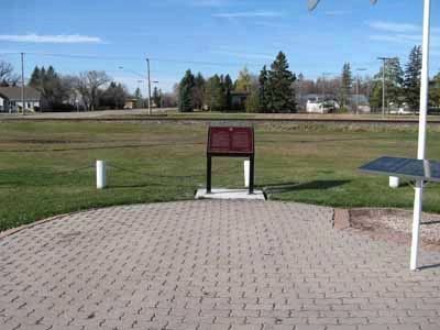
First Railway in Western Canada
On December 3, 1878, the last spike was driven here to complete the first railway line built in the Canadian West. Known
as the Pembina Branch, it ran some 100 kilometres from St. Boniface to . . . — — Map (db m301874) HM
This is an original size reproduction of Manitoba's biggest sturgeon. Weight 406 lbs. Length 15 1/2 feet. Age 150 years. A female, full of caviar. This record sturgeon was taken out of the Roseau River east of Dominion City by Sandy Waddell, October . . . — — Map (db m301875) HM
This splendid example of a small Neo-Classical style
municipal building was designed by the Winnipeg architect
John D. Atchison. Erected during 1917-18 by general contractors
Grey and Davidson, it remains one of the outstanding buildings . . . — — Map (db m288747) HM
Established in 1872, Fort Dufferin was essential to events asserting Canada's
sovereignty over Manitoba and the North-West Territories. The complex
was initially the headquarters for the British-Canadian contingent of the
North . . . — — Map (db m306577) HM
After 1790 the junction of the Red and Pembina
Rivers was the site of fur-trading posts of the Hudson's
Bay Co., North-West Co., and XY Co. Here at Fort Daer
the early Selkirk Settlers hunted buffalo when food was
scarce at the Red River . . . — — Map (db m288748) HM
The March West
In June 1874 the newly-formed North-West Mounted
Police assembled here at Fort Dufferin, the Canadian
headquarters of the International Boundary Commission.
On 8 July the force set out on its famous "March . . . — — Map (db m306575) HM
Postage Stamp Province
Here ran the original east boundary of the Province of Manitoba. On July 15, 1870 Manitoba officially became a Canadian province. It then measured about
130 miles east to west and 110 miles north to south, . . . — — Map (db m288820) HM
St Michael's Ukrainian Orthodox Church
St. Michael's Orthodox Church, consecrated October 14, 1899,
was the first permanent Ukrainian church erected in Canada. Until the
parish joined the Greek-Orthodox Church of Canada in . . . — — Map (db m296627) HM
Constructed in 1899, this church is a fine early example of Ukrainian ecclesiastical architecture in Canada. Its distinctive massing, plan and bulbous cupolas reflect the Byzantine-influenced architectural heritage of the homeland of the . . . — — Map (db m8421) HM