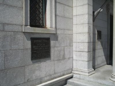
--------------- Site of the Battle of Bunker Hill fought June 17, 1775 --------------- Although orders were issued by the Committee of Safety to seize and fortify Bunker Hill the colonial officers after consultation fortified this hill on June 16, . . . — — Map (db m17974) HM
“Don’t fire ‘til you see the whites of their eyes.”
The Battle of Bunker Hill, fought here on Breed’s Hill, June 17, 1775, was the first major military confrontation of the Revolutionary War. Although the . . . — — Map (db m282107) HM
The rail fence and grass line of protection formed after the British troops landed was six hundred feet in the rear at the base of Bunker Hill — — Map (db m18659) HM
Colonel William Prescott of Massachusetts led the colonial forces on Breed’s Hill. His commanding figure and strong will inspired the farmer soldiers to the greatness of the day. Dr. Joseph Warren, commissioned a Major General, elected to serve . . . — — Map (db m18651) HM
June 17, 1775 He who brought us over still sustains us. Connecticut American Revolution Bicentennial Commission South Marker:
General Israel Putnam of Connecticut helped decide to fortify the Charlestown peninsula and with Captain Thomas . . . — — Map (db m191806) HM
June 17, 1775 Strength United is Stronger New Hampshire American Revolution Bicentennial Commission East Marker: Colonel John Stark commanded 900 New Hampshire men at the rail fence and at the stone wall on the Mystic River shore against the . . . — — Map (db m115949) HM
On this hill the Continental militia fought heroically on June 17, 1775. Protected by an earth and timber redoubt laid out by Colonel Richard Gridley, the Army’s first chief engineer, the Americans killed or wounded nearly half of the attacking . . . — — Map (db m18653) HM
Here assembled on the night of June 16th, 1775, 1200 Continental troops under command of General Prescott. After prayer by President Langdon they marched to Bunker Hill. — — Map (db m277938) HM WM
Established in 1810, this is Charlestown's second oldest burying ground, and the site of the left wing of Colonial forces at the Battle of Bunker Hill in 1775. A monument marks the location of the Rail Fence and Stone Wall fortified by the . . . — — Map (db m282110) HM
The line of Rail Fence and Grass Protection formed after the British Troops landed on the seventeenth of June extended in this direction to Mystic River — — Map (db m55530) HM