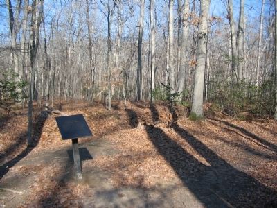
Near Bullock Road north of Plank Road (Virginia Route 3), on the left when traveling north.
Federal soldiers of the 12th Corps built these earthworks on May 1, 1863. "Stonewall" Jackson's flank attack the following day placed them in Confederate hands. At about 6:00 a.m. on May 3, North Carolinians under William Dorsey Pender and . . . — — Map (db m295203) HM
Near Bullock Road north of Plank Road (Virginia Route 3), on the left when traveling north.
The armies fought the Battle of Chancellorsville in the heart of a 70-square-mile region of tangled undergrowth known locally as the Wilderness. This inhospitable terrain added a new dimension of horror to the fighting on May 3. Fires erupted . . . — — Map (db m295204) HM
Near Plank Road (State Highway 3) east of Bullock Road, on the right when traveling west.
Maj. Gen. Hiram G. Berry's division formed the front of the Union defense north of the Orange Turnpike on the morning of May 3. Although virtually all of Berry's entrenchments have disappeared, this small segment of works on the right marks the . . . — — Map (db m295285) HM
Near Plank Road (State Highway 3) east of Bullock Road, on the right when traveling west.
At about 7:00 a.m. on May 3, a dangerous gap in the Union line opened near the Orange Turnpike, ¼ mile to your right. Federal troops on your right, led by Hiram Berry, retreated about ½ mile and established a new position. The blue-clad soldiers . . . — — Map (db m295283) HM
Near Plank Road (State Highway 3) east of Bullock Road, on the right when traveling west.
On this ridge, the Union brigade of Brig. Gen. William Hays, supported by artillery, temporarily stopped the Confederate advance across the ground below you. A member of the 12th New Jersey described what happened next: "We were in open sight, . . . — — Map (db m295282) HM
Near Plank Road (State Highway 3) north of Elys Ford Road (County Road 610), on the right when traveling west.
On the morning of May 3, Col. Emlen Franklin's Union brigade shifted from south of the Orange Turnpike to this vicinity. Here, they met Pender and Thomas head on. Lt. Col. Jonathan H. Lockwood of the 7th Virginia (Union) remembered what happened . . . — — Map (db m295287) HM
On Plank Road (State Highway 3) at Elys Ford Road (County Road 610), on the right when traveling west on Plank Road.
Vicious fighting surged back and forth across this large clearing on the morning of May 3. From here, you can clearly see the two key Union positions; Fairview, to your right front near the brick wall of the Chancellor Cemetery; and the . . . — — Map (db m295195) HM
On Plank Road / Germania Highway (State Highway 3) at Wiles Drive, on the right when traveling west on Plank Road / Germania Highway.
April 10 - May 3, 1863. These trenches were part of Hooker's original line. On May 2, Couch's II Corps skirmishers, under command of Col. Nelson A. Miles, beat off repeated Confederate attacks launched to draw attention from Jackson's flanking . . . — — Map (db m159157) HM
On Hooker Drive, on the right when traveling north.
Men of Maj. Gen. Winfield Scott Hancock's division manned the earthworks which are located just inside this woodline. Hancock's troops confronted two Confederate divisions advancing from the south (from your right front) and east as well as the . . . — — Map (db m3867) HM
On Elys Ford Road (County Route 610) at Bullock Road, on the right when traveling north on Elys Ford Road.
Earthworks to your right rear mark the apex of Hooker's last line of defense. The Federals retreated to this position late in the morning of May 3, guarding the roads to Ely's and United States Fords. The defensive minded Union commander sat . . . — — Map (db m3695) HM
Near Bullock Road west of Elys Ford Road, on the left when traveling east.
Union soldiers on the front line probably utilized these rifle pits on May 3-5. Trenches on the other side of the creek possibly served Confederate skirmishers. While the fighting raged near Salem Church, Union Maj. Gen. John F. Reynolds believed . . . — — Map (db m295289) HM
Near Bullock Road south of Elys Ford Road, on the left when traveling north.
After being driven from the Chancellorsville crossroads by Lee on May 3, 1863, Hooker retreated to a new line of defenses covering U.S. Ford, 3.5 miles to your rear. For two days, Hooker strengthened his defenses and awaited attack. Lee took . . . — — Map (db m295288) HM
Near Bullock Road north of Plank Road (Virginia Route 3), on the right when traveling north.
After dark, May 5, 1863, Union soldiers left their trenches and began making their way toward U.S. Ford. A cold rain drenched the soldiers to the skin and turned the woodland roads to mud. At the ford, the Rappahannock River rose five feet in . . . — — Map (db m295286) HM