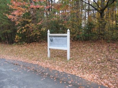
Just ahead is the crossing of the Orange Plank Road, a mid-nineteenth century trade route from the mountains to the navigable Rappahannock at Fredericksburg. Loaded wagons had the right-of-way on the planking, which covered half the roadbed. . . . — — Map (db m3552) HM
May 2, 1863. Jackson's two leading lines, battling the tangled undergrowth and the retreating Federal XI Corps, became disorganized. In this vicinity, Jackson halted his successful advance and ordered A.P. Hill's Division to the front. While the . . . — — Map (db m295217) HM
April 27-May 6, 1863. Leaving a large detachment under Sedgwick in front of Fredericksburg, Hooker marched a flanking column around and behind the Confederates. Lee then left a small unit to face Sedgwick and advanced westward to meet Hooker. . . . — — Map (db m3517) HM
May 1-3, 1863. "Our enemy must either ingloriously fly or come out from behind his entrenchments and give us battle on our own ground, where certain destruction awaits him." With these words, "Fighting Joe" Hooker, on May 1, started toward the . . . — — Map (db m295196) HM
May 2, 1863. Shortly after noon, Sickles’ Corps advanced from the Union right-center to attack the "retreating" Confederates. Posey's and Wright's brigades, part of Lee's holding line, met the advance. A rear guard from Jackson's marching column . . . — — Map (db m295224) HM
May 3, 1863 - Battle cries break the stillness of the dawn as 25,000 Confederate soldiers move up through the dark woods on both sides of the Plank Road to attack the Union position guarding Fairview heights, 800 yards to the east. Leading them . . . — — Map (db m295261) HM
May 2-3, 1863. In this vicinity, holding Hooker's original center, Slocum's Corps curved northwestward (reader's right rear) to form an interior line behind Howard's Corps. When Jackson smashed Howard, Slocum's western line fell also. The rest of . . . — — Map (db m295263) HM
May 2-3, 1863. Units of Slocum's Federal XII Corps held this line. Its left extended a little beyond the Orange Plank Road (reader's left) where it connected with the right of Couch's II Corps. A mile to the southeast the Orange Plank Road . . . — — Map (db m296480) HM
April 10 - May 3, 1863. These trenches were part of Hooker's original line. On May 2, Couch's II Corps skirmishers, under command of Col. Nelson A. Miles, beat off repeated Confederate attacks launched to draw attention from Jackson's flanking . . . — — Map (db m159157) HM
May 2, 1863. Having lost the Furnace, the 23rd Georgia Regiment established a new line here in the bed of the Unfinished Railroad. Other troops reinforced the position. During late afternoon, while Jackson's front lines were hitting the Federal . . . — — Map (db m295223) HM
Jackson's marching soldiers filled this narrow road from shoulder to shoulder making it slow and tedious work for any mounted officer to pass along the column. One of Stonewall's aides, Captain James Power Smith, attempted to catch up to the . . . — — Map (db m295221) HM
Jackson's most direct route toward the enemy's flank lay in the right turn onto the Brock Road here. Instead of following that route he turned left, or southward, proceeded a quarter of a mile, and then turned right into a parallel woods road. . . . — — Map (db m295222) HM
May 2, 1863. Deluding the enemy was the secret of Jackson's success. Since his troops had been observed from Federal signal stations as they marched across the front of Hooker's army, he turned them south on the Brock Road to create the . . . — — Map (db m295277) HM
If a balloonist had been high overhead, Jackson's column might have resembled a huge serpent as it wound through the forest. Closer up, it became thousands of marchers in worn battle dress. From this point, they stretched back about six miles to . . . — — Map (db m295278) HM
May 2, 1863. Hour by hour, the long gray columns of Jackson's Corps splashed through the shallow ford here, which was not stone-paved then, stirring the crossing into a mud hole. Before the water of this branch of Poplar Run ran clear again in its . . . — — Map (db m295280) HM
"Stonewall" Jackson's way here was a woodland road west of and parallel to the Brock Road. This park trail approximates the old appearance. No tar, asphalt, or cement highway existed in the 1860's. Even the best of that time, the stone turnpikes . . . — — Map (db m295281) HM
May 2, 1863. The head of Jackson's column reached this point about 12:30 p.m. Eight miles away, the rear , under fire of Federal guns, was closing up near the Catharine Furnace. Jackson planned to turn the column right onto the Plank Road (1 mile . . . — — Map (db m3934) HM
About a mile in the distance, beyond the vista cut through the trees, you can see modern buildings on high ground which at the time of the battle of Chancellorsville was called Hazel Grove. When "Stonewall" Jackson began his famous flank march . . . — — Map (db m3583) HM
April 10 - May 3, 1863. These trenches were part of Hooker's original line. On May 2, Couch's II Corps skirmishers, under command of Col. Nelson A. Miles, beat off repeated Confederate attacks launched to draw attention from Jackson's flanking . . . — — Map (db m159157) HM