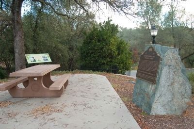
Near Glenn Drive south of Meadowview Drive, on the right when traveling south.
Judge Joseph Lewis planted this Mediterranean Sweet Orange seedling near the toll bridge at Bidwell’s Bar, Butte County, California in 1856. It has survived hard times and is the oldest living orange tree in California. “From its example and . . . — — Map (db m143395) HM
A vast expanse covering 26,000 acres, Rancho Chico was purchased in 1849-50 by John Bidwell. In 1865 he began construction of the mansion nearby, which in time became the social and cultural center of the upper Sacramento Valley. It was through . . . — — Map (db m230785) HM
On Oregon Gulch Road at Oregon City Trail, on the left when traveling south on Oregon Gulch Road.
Entering California over the Applegate and Lassen trails, a party of Oregonians, captained by Peter H. Burnett, arrived here in autumn of 1848 to establish the town of Oregon City. Burnett, little more than a year later, became the first civil . . . — — Map (db m100600) HM
Near Browns Valley Highway (State Highway 20) 0.8 miles east of Marysville Road, on the right when traveling east.
Donated to Yuba County, and opened in July 1928, this park is but a tiny remnant of the 10,000+ acres controlled by Wendell P. Hammon’s Dredging companies. He arrived in California in 1875 and by 1902 had developed the incredible machinery needed to . . . — — Map (db m40191) HM
To commemorate The Mother Orange Tree of Butte County planted at this spot by Judge Joseph Lewis in 1856.
The Bidwell Bar Bridge, first suspension bridge of California, transported from New York via Cape Horn 1853. Completed 1856. . . . — — Map (db m100596) HM
Born in Bucks County Pennsylvania, Neal a blacksmith by trade came to California with John Fremont’s second expedition in 1844. After working for John Sutter briefly at New Helvetia, obtained a land grant and established Rancho Esquon. After . . . — — Map (db m61826) HM
This peaceful community, gateway to the remote regions of the High Lakes of Butte and Plumas Counties, owes its origin and subsequent development to the entrance of the Diamond Match Company to California. With the purchase of about 40,000 acres of . . . — — Map (db m61764) HM
Named for George Lovelock, born in Wales in 1824, emigrated to California in 1850. George Lovelock settled in Butte County in 1851 and began a successful business in Butte Creek Canyon before moving not far from this present site to establish a . . . — — Map (db m61685) HM
Near Bryant Ravine Road (Forest Road 21N35Y) 1.6 miles north of Lumpkin Road when traveling north.
Bald Rock Dome was formed from a large body of melted rocks (called the Bald Rock Pluton) deep in the earth's crust. The Bald Rock Pluton is two miles wide, and was formed approximately 140 million years ago. As the pluton cooled, parts of its . . . — — Map (db m146208) HM
On Cherokee Road 1.5 miles east of North General Sherman Way, on the left when traveling north.
Led from Indian Territory by their New England schoolmaster, a band of young Cherokee Argonauts discovered gold here 1850. Town established 1853 when first stores erected by Welsh miners. During heyday of 1875, Cherokee boasted its own theatre, race . . . — — Map (db m234) HM
On Forest Service Road 27N08 (Lassen Trail) near California Route 32, on the left when traveling south.
“There is an immense abyss on either side, we could look down thousands of feet. The side of the ridge seeming almost perpendicular” —Charles Glass Gray, Sep 29, 1849
Guidebook available
Trails West Inc., P.O. Box 12045, Reno, NV 89510 . . . — — Map (db m87734) HM
On Black Olive Drive north of Pearson Road, on the right when traveling north.
Constructed in 1903, this depot is one of three maintained along the Butte County Railroad, a 31 mile line from Chico to Stirling City, completed by Diamond Match Co. in 1904. The railroad was later acquired by Southern Pacific and operated as a . . . — — Map (db m29671) HM
Near 5th Avenue (CanAm Highway) (U.S. 85) just north of Faulk Street, on the right when traveling north.
[marker on south side of cabin] This cabin, built in 1876 of logs split & transported by Spaulding from the Black Hills, was the first home on the Redwater & what became Butte County. An experienced scout, familiar with the . . . — — Map (db m234772) HM
On Interstate 25 at milepost 59, 0.3 miles north of County Road 103, on the right when traveling north.
Here, in the shadow of the Spanish Peaks and the Wet Mountains, stands El Huerfano - "the orphan." This stark and lonely volcanic outcrop, named in the late 1700s by an unknown Spanish trader, had for centuries guided earlier Hispanos and . . . — — Map (db m97717) HM