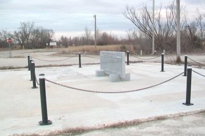
The City of Treece, located ½ mile west of Hwy. 69 was founded on February 26, 1918 as a result of mining operations in the early 20th century. During prime mining industry production; Treece, neighboring Picher, Oklahoma and several other small . . . — — Map (db m82092) HM
(preface)
In 1838, the United States government deported more than 16,000 Cherokee Indian people from their homelands in Tennessee, Alabama, North Carolina, and Georgia, and sent them to Indian Territory (now Oklahoma). Thousands of . . . — — Map (db m156081) HM
Baxter Springs was named for John Baxter, the area's first European settler in 1849, and the springs on his homestead. A military surveying party who camped in the area in 1857 recounted springs rich in iron salts as rising in a "cone of red mud," . . . — — Map (db m174251) HM
(preface)
In 1838, the United States government deported more than 16,000 Cherokee Indian people from their homelands in Tennessee, Alabama, North Carolina, and Georgia, and sent them to Indian Territory (now Oklahoma). Thousands of . . . — — Map (db m156080) HM
As an important mining town, Galena had
numerous mines and smelters, but none
was more important than the Eagle-Picher
smelter plant north of the pre-1940s Route 66
alignment. The facility operated from around
the late 19th century until 2004 . . . — — Map (db m161632) HM
has been designated a Registered National Historic Landmark under the provisions of the Historic Sites Act of August 21, 1935 This site possesses exceptional value in commemorating and illustrating the history of the United States . . . — — Map (db m259277) HM
Thin black lines indicate changes in relevance. Between each pair of lines entries are ordered geographically but all have the same relevance.
* Inflectional forms of words are their plurals, singulars, and possessives as well as gramatical tenses and similar variations.