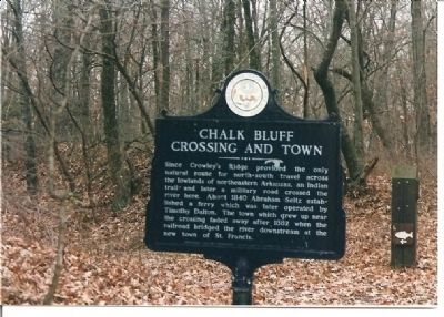
Since Crowley's Ridge provided the only natural route for north-south travel across the lowlands of northeastern Arkansas, an Indian trail and later a military road crossed the river here. About 1840 Abraham Seitz established a ferry which was later . . . — — Map (db m4912) HM
On March 10, 1863 Union cavalry captured the ferry after a three-hour fight. They burned buildings and stores of corn in Chalk Bluff and destroyed a large uncompleted ferry boat. Two weeks later on March 24 Union cavalry returned to Chalk Bluff . . . — — Map (db m4906) HM
In April 1863 a Confederate army of 5000 men commanded by General John S. Marmaduke advanced into Missouri. Forced to retreat before superior Union forces, the Confederates on May 1-2 fought a successful delaying action here while their army crossed . . . — — Map (db m4911) HM
When established in 1789, New Madrid was one of a handful of settlements in the Spanish territory west of the Mississippi River. First as a district and later as a county, the New Madrid jurisdiction extended as far south to the northern border of . . . — — Map (db m179976) HM
Here in the Southeast Lowland Region of Missouri on a Delaware and Shawnee Indian village site, Kennett was laid out as the seat of Dunklin County, 1846. The town was first called Chilletecaux for a Delaware Indian living here at the time. Later . . . — — Map (db m17477) HM
During the Civil War, Bloomfield was a geographically commanding point in southeastern Missouri due to its location atop Crowley's Ridge, the only high ground separating two nearly impenetrable swamps. Whoever held Bloomfield controlled movements on . . . — — Map (db m207550) HM
Thin black lines indicate changes in relevance. Between each pair of lines entries are ordered geographically but all have the same relevance.
* Inflectional forms of words are their plurals, singulars, and possessives as well as gramatical tenses and similar variations.