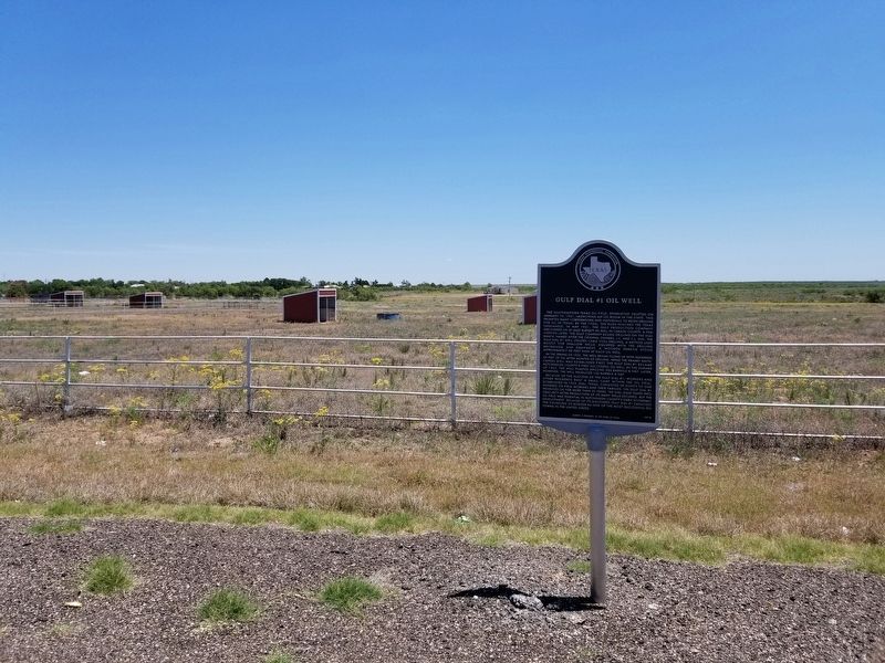
On Highway 207 at Lantelme Lane, on the right when traveling north on Highway 207.
The southeastern Texas oil field, Spindletop, erupted on January 10, 1901, launching an oil boom in the state. This prompted many corporations and individuals to begin drilling for oil in Texas. By the 1920s, the rush reached the Texas Panhandle. . . . — — Map (db m150741) HM
On County Highway 22 0.1 miles Farm to Market Road 281, on the left when traveling north.
In the late 1890s Texas enacted colonization and homestead laws that significantly quickened the settlement of the then sparsely populated Panhandle region of North Texas. Hutchinson County soon recorded the required 150 applications for land . . . — — Map (db m155146) HM
On State Highway 207 at County Road H, on the right when traveling south on State Highway 207.
Famed cattleman Charles Goodnight established one of
the first ranches in the Texas Panhandle, the JA ranch, in 1876. Later that year Thomas S. Bugbee established the first cattle ranch in Hutchinson County.
As a result of soaring beef . . . — — Map (db m201793) HM
Geologist Charles Gould founded the University of Oklahoma Geology Department in 1900, which was the first accredited school dedicated to petroleum geology. He was recruited by the Roosevelt administration as part an ongoing assessment of the . . . — — Map (db m200536) HM
On State Highway 152 0.5 miles north of County Route 13, on the right when traveling north.
Fritz Thompson was Hutchinson County Commissioner from 1937 through 1952, during which time much of the highway system in Hutchinson County was conceived. He was Borger City Manager from October 1, 1953 to September 30, 1956, during which time he . . . — — Map (db m93257) HM
On North Main Street, on the right when traveling north.
Hutchinson County, named for prominent judge and writer Anderson Hutchinson, was one of 54 counties created out of the District of Bexar in 1876 by the Texas Legislature. It was not until 1901, however, that the county was officially organized. That . . . — — Map (db m93250) HM
On County Road 22 0.1 miles north of Farm to Market Road 281, on the left when traveling north.
Famed cattleman Charles Goodnight established one
of the first ranches in the Texas Panhandle, the JA
Ranch, in 1876. Later that year Thomas S. Bugbee established the first cattle ranch in Hutchinson County.
As a result of soaring beef . . . — — Map (db m155144) HM
On Euclid Avenue, on the right when traveling north.
Among first landowners in area. In 1898 started ranch 25 miles to the north. Ran country store, post office, phone exchange. Moved 1915 to Panhandle. The 1924 discovery of oil on their ranch led to the founding of Borger. They gave land to every . . . — — Map (db m150734) HM
On South Cuyler Street south of West Foster Avenue, on the right when traveling south.
Houses property records of the White Deer Land Company (1886-1957), one of the strongest commercial influences in settlement of the Texas Panhandle.
Organized from wreckage of the bankrupt Francklyn Land and Cattle Company—whose chief . . . — — Map (db m55843) HM
On County Highway 22 0.1 miles north of Farm to Market Road 281, on the left when traveling north.
A county-wide public school district was established soon after Hutchinson County was created in 1901. As more people began to settle in the area, regional school districts were formed. Common School District No. 8 was established in the . . . — — Map (db m155145) HM
On 1st Street (State Highway 15), on the right when traveling east.
Here, between 1874 and 1890, supply wagons, a daily stage coach and the U.S. Mail moved over this earliest known trail from Dodge City, Kansas, to Fort Elliott, Texas. The Fort, first known as "Cantonment on Sweet water" was established after the . . . — — Map (db m190717) HM
On Marcy Trail, on the right when traveling south.
Edward Fitzgerald “Ned” Beale was a significant figure in 19th century America. In his long career, he was a naval officer, military general, explorer, diplomat, rancher and frontiersman. He fought in the U.S. - Mexico War, emerging as a . . . — — Map (db m93344) HM
On 5th Street east of North Main Street, on the left when traveling east.
Built 1899 with materials hauled at great peril across the Canadian - then without a bridge. Mr. McCormick, his wife, Capitola, and eight children lived in a covered wagon and a tent while they put up their house.
Home became cradle of county . . . — — Map (db m93249) HM
On East 9th Street west of North Harvey Street, on the right when traveling west.
In 1926, even though the city of Borger had not yet been formally organized, some of the citizens petitioned the Hutchinson County Commissioners Court to incorporate an independent school system. Borger I.S.D. was officially organized on Jul. 28, . . . — — Map (db m93317) HM
Benton was born in Neosho, Missouri into an influential family of politicians. His father, Maecenas, was a lawyer and 4 times elected U.S. congressman from Missouri. Known as the "little giant of the Ozarks," he named his son after his . . . — — Map (db m200527) HM
On South McGee Street at Franklin Street, on the left when traveling north on South McGee Street.
In 1876 the Texas legislature created Hutchinson County, naming it
for attorney and judge Anderson Hutchinson. The county remained
sparsely populated for several years and was not organized until
1901. Pioneers and ranchers John F. and Maggie . . . — — Map (db m248417) HM
Thin black lines indicate changes in relevance. Between each pair of lines entries are ordered geographically but all have the same relevance.
* Inflectional forms of words are their plurals, singulars, and possessives as well as gramatical tenses and similar variations.