Marker Logo
THE HISTORICAL
MARKER DATABASE
“Bite-Size Bits of Local, National, and Global History”


6 entries match your criteria.  


Entries Containing All of the Phrases «pemiscot county» AND «missouri»

This list will also include matches for inflectional* forms of the words.
 
By Craig Swain, August 31, 2010
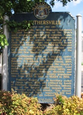
Reverse of Marker
RANKED BY RELEVANCE
1 ► Missouri, Pemiscot County, Caruthersville — Caruthersville —
(Front): The capital of historic Pemiscot County and center for a cotton, grain, timber, and industrial area, Caruthersville was laid out, 1857, by George W. Bushey and J. Hardeman Walker (1794-1860), on the Walker plantation. "Bootheel" . . . — — Map (db m36219) HM

2 ► Missouri, Stoddard County, Bloomfield — The Civil War in Bloomfield — A State Divided: — The Civil War in Missouri —
During the Civil War, Bloomfield was a geographically commanding point in southeastern Missouri due to its location atop Crowley's Ridge, the only high ground separating two nearly impenetrable swamps. Whoever held Bloomfield controlled movements on . . . — — Map (db m207550) HM

3 ► Missouri, New Madrid County, New Madrid — A Growing State...A Shrinking County —
When established in 1789, New Madrid was one of a handful of settlements in the Spanish territory west of the Mississippi River. First as a district and later as a county, the New Madrid jurisdiction extended as far south to the northern border of . . . — — Map (db m179976) HM

4 ► Missouri, Dunklin County, Kennett — Kennett — Reported missing
Here in the Southeast Lowland Region of Missouri on a Delaware and Shawnee Indian village site, Kennett was laid out as the seat of Dunklin County, 1846. The town was first called Chilletecaux for a Delaware Indian living here at the time. Later . . . — — Map (db m17477) HM

5 ► Tennessee, Shelby County, Memphis — 58 — Caruthersville, Missouri/Gayoso, Missouri/Little Cypress Bend — Mississippi River Walk —
A) Caruthersville, Missouri Mile 846.0 AHP A fur trading post called Le Petite Prairie was established on this site in 1794 by Francois Le Sieur. The small community which grew here was totally destroyed by the New Madrid earthquakes . . . — — Map (db m256822) HM

6 ► Missouri, Pemiscot County, Caruthersville — Pemiscot County — Past. Present. Future — Missouri 20221 Bicentennal —
Pemiscot County commemorates the Bicentennial of the 24th state of the union, The Great State Of Missouri August 10, 2021 A.D. — — Map (db m231761) HM
 
    Thin black lines indicate changes in relevance. Between each pair of lines entries are ordered geographically but all have the same relevance.
* Inflectional forms of words are their plurals, singulars, and possessives as well as gramatical tenses and similar variations.
 
CeraNet Cloud Computing sponsors the Historical Marker Database.
This website earns income from purchases you make after using our links to Amazon.com. We appreciate your support.
Paid Advertisement
Nov. 14, 2026