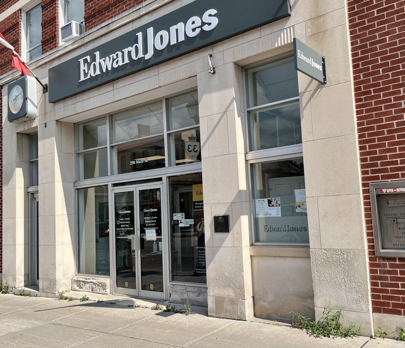
On Picton Main Street at Bridge Street, on the right when traveling east on Picton Main Street.
In June, 1846, the first bank in
Picton
was opened by the
Bank of Montreal.
This plaque commemorates that event and was
installed by the bank to observe its 150th anniversary,
in the centennial year of Canadian confederation.
This building . . . — — Map (db m307957) HM
On Chapel Street 0.1 kilometers south of Picton Main Street, on the right when traveling south.
In 1824, the first Methodist "Canada Conference," which resulted in the separation of the Canadian and U.S. churches, was held in a recently completed frame chapel that originally stood on this site. Built by a congregation that had been established . . . — — Map (db m307806) HM
On Picton Main Street at Paul Street, on the right when traveling north on Picton Main Street.
County Registry Office Built 1871
Shire Hall Built 1874
Prior to the construction of the Shire Hall in 1874 the Prince Edward County Council met in the Court House on Union Street and the administration offices were in rented space . . . — — Map (db m307966) HM
On Main Street West at Ross Street, on the right when traveling east on Main Street West.
On 2nd September 1939
The Hastings and Prince Edward Regiment
was mobilized for service overseas in the Second World War leaving from the Picton Armoury near this location.
The Regiment arrived in the United Kingdom on New Years Day 1940 as . . . — — Map (db m307973) HM WM
On Main Street West 0.1 kilometers west of Ross Street, on the right when traveling west.
John A. Macdonald (1815-1891), who became Canada's first prime minister at Confederation, began the study of law in 1830 under George Mackenzie, a prominent Kingston lawyer. Three years later he came to Hallowell (now Picton) to manage the law . . . — — Map (db m307970) HM
On Ferguson Street at Prospect Avenue, on the right when traveling north on Ferguson Street.
Born near Cobourg of Methodist parents, Letitia Youmans, née Creighton, was educated at local schools and at Burlington Ladies Academy. In 1849 she moved to Picton and taught briefly at a girls school. Deeply religious and believing that a . . . — — Map (db m307802) HM
On County Road 22 at York Street, on the right when traveling north on County Road 22.
The Church of St. Mary Magdalene
Built C. 1825
Macauley House
Built C. 1830
The old Church of St. Mary Magdalene and its rectory were built by the Reverend William Macaulay on land he received as a crown grant.
When the . . . — — Map (db m308166) HM
On County Road 8 0.1 kilometers west of Roses Crossroad, on the right when traveling west.
Following the American Revolution, Marysburgh Township was established for the settlement of Loyalists and discharged soldiers of regular regiments. Surveyed in 1784 by the Honourable John Collins, Deputy Surveyor-General, the township was named in . . . — — Map (db m308161) HM
On Main Street West at Bridge Street, on the right when traveling east on Main Street West.
The hotel occupies the most prominent spot in town, and was the site of very many early meetings and events in Picton's history. Built of brick in straight-forward American Loyalist house style, it is three stories high, with a shallow two storey . . . — — Map (db m307961) HM
On Church Street at Union Street, on the right when traveling north on Church Street.
In 1803 William Macauley, son of a United Empire Loyalist, received a crown grant of some 400 acres of land in this vicinity. Born in Kingston, Macauley was educated under the Rev. John Strachan and at Oxford University. Ordained in 1818, he used . . . — — Map (db m308169) HM
On County Road 8 0.1 kilometers west of Roses Crossroad, on the right when traveling west.
Rose House is one of the oldest remaining residences in North Marysburgh Township, originally known as "Fifth Town"- the fifth town to be settled west of Kingston.
The first Marysburgh settlers were United Empire Loyalists and Hessian . . . — — Map (db m308162) HM
On Hatchery Lane 0.1 kilometers east of The Loyalist Parkway (Highway 33), on the left when traveling east.
Originally designed in 1606, this flag was officially adopted in 1707 by England and Scotland as their royal standard at the time of the union of the thrones and parliaments of both countries. It consists of the blue background and white diagonal . . . — — Map (db m308128) HM
On Main Street West at Ross Street, on the right when traveling east on Main Street West.
The Picton Armoury has a rich Canadian history. It is one of eleven drill halls built in rural Ontario between 1876 and 1918 as part of a campaign to expand the volunteer reservists who had been trained to defend our Country.
The Armoury was . . . — — Map (db m308018) HM
On White Chapel Road at Highway 49, on the left when traveling east on White Chapel Road.
This church, formerly known as the "Old Chapel, was built on land donated by Stephen Conger, a Loyalist from New Jersey, who had settled with his family in Hallowell Township in 1787. Commenced in 1809, it was the first Methodist church in Prince . . . — — Map (db m308019) HM