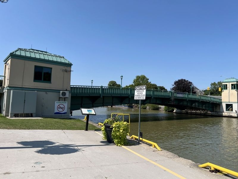
Originally, Port Stanley residents had to use small boats to cross Kettle Creek. In 1843, the Province of Canada built a swing bridge across the Harbour. This bridge would allow vessels to travel north of the bridge if the creek was deepened . . . — — Map (db m253079) HM
Port Stanley was not yet settled when the War of 1812 broke out, however, the land on which it sits had been granted to John Bostwick, a native of Massachusetts, then living in the Long Point region. He had come to Upper Canada with his brother in . . . — — Map (db m252879) HM
This tablet erected in 1939 commemorates more than one hundred years of development of Port Stanley harbour
beginning with the launching of schooner “Sterling” in 1827 of 90 tons burthen and commencement of first harbour pier.
The steamer “Thames" . . . — — Map (db m253080) HM
Born in Massachusetts, Bostwick came as a child to Norfolk County. He was appointed high constable of the London District in 1800 and sheriff in 1805. A deputy surveyor, he laid out some of the earliest roads in the Talbot Settlement and in 1804 was . . . — — Map (db m284031) HM
The London and Port Stanley Railroad
After the Great Western Railway reached London in 1853, local businessmen and politicians began promoting a competitive line south to Lake Erie. The London and Port Stanley Railway began . . . — — Map (db m253034) HM
Kettle Creek was called by the Iroquois the "Kanagio", by the Ojibwas the "Akiksibi", by the French the "Rivière Tonti". Among early visitors were: Louis Jolliet, September, 1669; Dollier and Galinée, April, 1670; the Celoron expedition, . . . — — Map (db m252912) HM
H E L L O
.... . ._.. ._.. _ _ _
In the early years of the last century, if you wanted your cousin in the Northwest Territories to know that his Aunt Millie had taken a turn for the worse you would probably have headed for the . . . — — Map (db m253428) HM