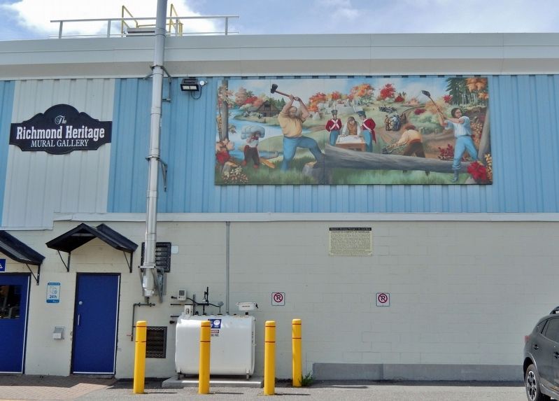
On Huntley Road just north of Perth Street, on the left when traveling north.
The village of Richmond was established in 1818. This scene illustrates the clearing of the original Richmond Road through dense forest and undergrowth from Richmond Landing on the Ottawa River, to the Jock River (called at that time the “Goodwood”) . . . — — Map (db m255093) HM
On Old Richmond Road just south of Steeple Hill Crescent, on the left when traveling south.
Charles Lennox was appointed Commander-in-Chief of all the British North American colonies and Governor-in-Chief of Lower Canada in May 1818. He received a mandate to improve the colonies' defences and inland navigation system. Lennox recommended . . . — — Map (db m109977) HM
On Perth Street just west of Huntley Road, on the right when traveling west.
County of Carleton
Agricultural Society
1844 - 1944
Presented by
Ontario Department of Agriculture
in recognition of
One Hundred Years Service
September 8th 1944
———————————————
Richmond Agricultural Society . . . — — Map (db m109968) HM
On McBean Street at Strachan Street, on the right when traveling south on McBean Street.
Built before 1863 in Classical Revival Style, this building began its life as a store operated by George Brown in 1863 and then by James and Robert Brown around 1900. The first floor was used as a bank from 1905 to 1970 but the Loyal Orange Lodge . . . — — Map (db m109972) HM
On Perth Street just west of Huntley Road, on the right when traveling west.
In August, 1818, some thirty disbanded veterans of the 99th Regiment, led by Captain G.T. Burke, arrived in newly surveyed Goulbourn Township. These formed the advance party of a military settlement planned and supported by the . . . — — Map (db m109965) HM
On Huntley Road just north of Perth Street, on the left when traveling north.
This mural depicts the artist's conception of the Richmond Settlement of 1825. Centered around the intersection of Strachan and Cockburn Streets, the original settlement used the Jock River as “Main Street”, with boats, rafts, canoes and barges of . . . — — Map (db m255097) HM
On McBean Street just south of Martin Street, on the left when traveling south.
St. Andrew's was the first Presbyterian congregation in Carleton County and was served primarily by itinerant preachers until the 1840's. A wooden church was constructed on this site in 1847 and replaced by the present brick church and spire in . . . — — Map (db m109970) HM