126 entries match your criteria. Entries 101 through 126 are listed.⊲ Previous 100
Historical Markers and War Memorials in Brockville, Ontario
By William Fischer, Jr., March 14, 2020
Sylvester Skinner House and Marker
| 101 ► Ontario, Leeds and Grenville United Counties, Brockville — Sylvester Skinner House — c. 1830 — |
| On Church Street just east of Perth Street, on the right when traveling east. | |||
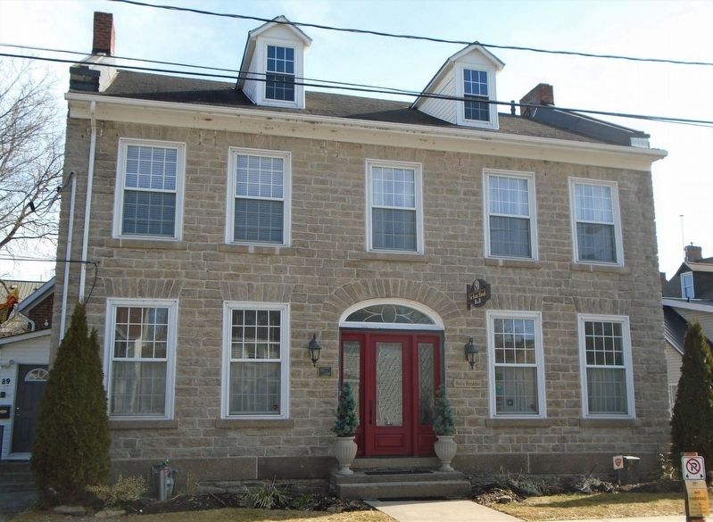
| 102 ► Ontario, Leeds and Grenville United Counties, Brockville — T. Gilmore & Co. Building — c. 1870 — |
| On King Street West (County Highway 2) just west of John Street, on the right when traveling west. | |||
| 103 ► Ontario, Leeds and Grenville United Counties, Brockville — Tall Ships 1812 Tour — |
| On Broad Street just south of Flint Street, on the left when traveling south. | |||
| 104 ► Ontario, Leeds and Grenville United Counties, Brockville — The "Baby Bottle" House — part of the Brace Terrace — built 1895 — |
| On King Street East (County Highway 2) at Ford Street, on the right when traveling east on King Street East. | |||
| 105 ► Ontario, Leeds and Grenville United Counties, Brockville — The Bluenose Visit, 1933 / La visite du Bluenose, 1933 — Brockville Historic Area: The Brock Trail — |
| On Block House Island Road, on the right. | |||
| 106 ► Ontario, Leeds and Grenville United Counties, Brockville — The Brockville "Van" or Caboose — Built 1954 - Donated, restored and placed here, 1987 — |
| Near Water Street East at Ferry Street. | |||
| 107 ► Ontario, Leeds and Grenville United Counties, Brockville — The Brockville Public Library — Brockville Historic Area: Our Past — |
| On Buell Street just north of King Street West (Provincial Highway 2), on the right when traveling north. | |||
| 108 ► Ontario, Leeds and Grenville United Counties, Brockville — The Brockville Tunnel 1860 — |
| On Block House Island Road, 0.1 kilometers south of Water Street East, on the left when traveling south. | |||
| 109 ► Ontario, Leeds and Grenville United Counties, Brockville — The Brockville Waterworks and Pump House — was located here from 1884 to 1960 — Brockville Historic Area: The Brock Trail — |
| On Water Street East east of Park Street, on the right when traveling east. | |||
| 110 ► Ontario, Leeds and Grenville United Counties, Brockville — The Great War Memorial — 1914 - 1918 — |
| On Water Street at Ferry Street, on the right when traveling east on Water Street. | |||
| 111 ► Ontario, Leeds and Grenville United Counties, Brockville — The Strathcona Hotel / The Brock Theatre — Brockville Historic Area: Our Past — |
| On King Street West (County Highway 2) at Chase Street, on the right when traveling west on King Street West. | |||
| 112 ► Ontario, Leeds and Grenville United Counties, Brockville — The Wreck of the Robert Gaskin — GPS location co-ordinates: latitude N44 35.358 longitude W75 40.625 — Brockville Historic Area: The Brock Trail — |
| On Block House Island Road, on the right when traveling south. | |||
| 113 ► Ontario, Leeds and Grenville United Counties, Brockville — Thomas & Anna Webster House — built c. 1861 — |
| On Park Street just north of Pine Street, on the right when traveling north. | |||
| 114 ► Ontario, Leeds and Grenville United Counties, Brockville — Thomas Hume House — c. 1847 — |
| On Orchard Street just north of Pine Street, on the right when traveling north. | |||
| 115 ► Ontario, Leeds and Grenville United Counties, Brockville — Thomas R. Sheffield House — c.1863 — |
| On King Street East (County Highway 2) at Ormond Street, on the left when traveling east on King Street East. | |||
| 116 ► Ontario, Leeds and Grenville United Counties, Brockville — Timber Rafts on the River — |
| On Henry Street just south of Water Street West, on the left when traveling south. | |||
| 117 ► Ontario, Leeds and Grenville United Counties, Brockville — Tompkins Building and Grand Central Hotel — ca. 1899 — Brockville Historic Area: Our Past — |
| On King Street West (County Highway 2) at Buell Street, on the left when traveling west on King Street West. | |||
| 118 ► Ontario, Leeds and Grenville United Counties, Brockville — Victoria Hall and East Ward Market Building — 1863 — |
| On King Street (County Highway 2) at Victoria Avenue, on the left when traveling west on King Street. | |||
| 119 ► Ontario, Leeds and Grenville United Counties, Brockville — War Memorial — • Their Name Liveth Forever More • — |
| On King Street West (County Highway 2) at Court House Avenue (County Highway 29), on the right when traveling west on King Street West. | |||
| 120 ► Ontario, Leeds and Grenville United Counties, Brockville — Wesleyan Methodist Church — 1830 — |
| On Wall Street (Provincial Highway 29) at John Ross Matheson Way, on the right when traveling north on Wall Street. | |||
| 121 ► Ontario, Leeds and Grenville United Counties, Brockville — William and Augusta Swift House — c.1871 — |
| On King Street East (County Highway 2) at Orchard Street, on the left when traveling east on King Street East. | |||
| 122 ► Ontario, Leeds and Grenville United Counties, Brockville — William Buell House — Brockville Historic Area: The Brock Trail — |
| On Water Street West at Home Street, on the left when traveling west on Water Street West. | |||
| 123 ► Ontario, Leeds and Grenville United Counties, Brockville — William Buell, Sr. 1751 - 1832 — |
| On Home Street at Water Street West, on the right when traveling south on Home Street. | |||
| 124 ► Ontario, Leeds and Grenville United Counties, Brockville — William Buell’s 1816 Map of Brockville — |
| On Home Street close to Ernie Fox Quay. | |||
| 125 ► Ontario, Leeds and Grenville United Counties, Brockville — William Parkin House — built c.1843 — |
| On Water Street East at Orchard Street, on the left when traveling east on Water Street East. | |||
| 126 ► Ontario, Leeds and Grenville United Counties, Brockville — Women's Memorial — |
126 entries matched your criteria. Entries 101 through 126 are listed above. ⊲ Previous 100