5 entries match your criteria.
Related Historical Markers
Mount Morris Dam
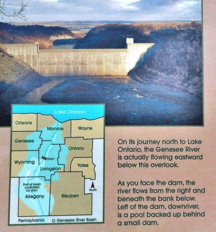
Marker detail: Genesee River flows to Lake Ontario
SHOWN IN SOURCE-SPECIFIED ORDER
| Near Park Road, 1.4 miles west of Mt. Morris Road (State Route 36), on the left when traveling west. |
| | In reaction to the severe flooding that occurred almost every seven years in the Genesee Valley since the 1800s, Congress authorized the Mount Morris Dam project under the Flood Control Act of 1944. Completed in 1952 by the United States Army Corps . . . — — Map (db m143296) HM |
| Near Visitor Center Road, 1.8 miles north of Mount Morris Nunda Road (State Route 408). |
| | Working Before Its Time On November 25, 1950 storm clouds covered the sky and heavy rains fell causing the water to rise in the upper Genesee River. Severe flooding inundated upstream towns and villages. Many families were rescued from their . . . — — Map (db m143300) HM |
| Near Visitor Center Road, 1.8 miles north of Mount Morris Nunda Road (State Route 408). |
| | Dedicated to the men and women employed by the Mount Morris Dam Builders and U.S. Army Corps of Engineers, Buffalo District 1948-1952
Under the Flood Control Act of 1944, the United States Congress authorized the construction of a dam . . . — — Map (db m143298) HM |
| Near Visitor Center Road, 1.8 miles north of Mount Morris Nunda Road (State Route 408). |
| | (left panel) Looking Left – Upstream A Dry Dam… A Protected River Why is there no reservoir upstream of the dam? The Genesee River Basin provides beautiful scenic, natural, recreational, cultural, geological and ecological . . . — — Map (db m143299) HM |
| Near Visitor Center Road, 1.8 miles north of Mount Morris Nunda Road (State Route 408). |
| | Mount Morris Dam was built to provide flood protection to the farm lands, residential areas, and commercial and industrial development in the Genesee River Valley from the dam site north through Metropolitan Rochester to Lake Ontario. Prior to its . . . — — Map (db m143297) HM |
May. 4, 2024