First settled in the 1780's by British veterans and Loyalist refugees from the American Revolution, Sheet Harbour is an important centre on Nova Scotia's eastern shore. West and East Rivers meet near here, and where their waters tumble and froth . . . — — Map (db m146113) HM
Following the expulsion of the Acadians in 1755, the Government of Nova Scotia distributed grants of land, in an effort to populate the province with British subjects.
Prior to white settlement, Sheet Harbour served as a summer hunting . . . — — Map (db m146114) HM
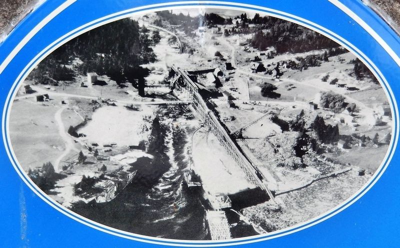
For almost 150 years, the East and West Rivers provided Sheet Harbour with waterpower for its sawmills. In the 1920s, the East River played an important role in delivering hydroelectric power to Sheet Harbour, as well as other communities in Nova . . . — — Map (db m146158) HM
With few existing roads along the Eastern Shore in the eighteenth century, the only reliable route to Halifax was by sea. During this period, Sheet Harbour’s isolated inhabitants relied on boats and ships for fishing, trade, and travel along the . . . — — Map (db m146116) HM
As Sheet Harbour's lumber industry prospered in the nineteenth century, there was a growing demand for ground wood pulp, which was used in the manufacture of paper products such as newsprint.
Local lumber baron William Chisholm . . . — — Map (db m146117) HM
Following the expulsion of the Acadians in 1755, the Government of Nova Scotia distributed grants of land in an effort to populate the province with British subjects.
Located 75 miles (115 km) east of Halifax, on Highway 7, the . . . — — Map (db m146118) HM
Situated on the Eastern Shore of Nova Scotia, Sheet Harbour lies at the junction of the East and West Rivers. This forested area, with its excellent river systems and natural port, proved ideal for the establishment of a prosperous lumber . . . — — Map (db m146119) HM
For centuries, salmon fishing on Sheet Harbour’s East and West Rivers was both a livelihood and leisure activity.
The Mi’kmaq were the first to utilize this rich resource, while Loyalist settlers and their descendents fished salmon for . . . — — Map (db m146120) HM