Andrew Lewis was born on 9 Oct. 1720 in Ireland, and his family immigrated to Virginia by 1732. He attained prominence as a frontier soldier during Dunmore's War when on 10 Oct. 1774 his troops defeated Indians led by Shawnee Chief Cornstalk, at . . . — — Map (db m3907) HM
Hero of the battle of Point Pleasant which was the most closely contested of any battle ever fought with the Northwest Indians: was the opening act in the drama whereof the closing scene was played at Yorktown. — — Map (db m3904) HM
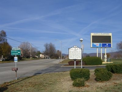
This famous pioneer, patriot, statesman, and soldier, is buried here on part of his 625 acre estate. Member of House of Burgesses, 1772-1775; defeated Indians at battle of Point Pleasant 1774; drove Lord Dunmore from Virginia 1776. Died 1781. — — Map (db m3903) HM
Here Major (later General) Andrew Lewis camped, February 26, 1756, with Virginia troops on way to attack Indians who had been raiding the settlements. Bitter cold and food shortage brought disaster to the expedition. — — Map (db m200621) HM
Side A Site of Fort Savannah, built in 1755. Here at Camp Union Gen. Andrew Lewis mustered troops which participated in the Battle of Point Pleasant 1774. Lewisburg was incorporated in October, 1782, by the Virginia Assembly. Side B . . . — — Map (db m21747) HM
The nearby highway is part of route
traversing W.Va. from Lewisburg to
Point Pleasant memorialized by the
state to commemorate the march of
the American Colonial army of 1,200
men led by Andrew & Charles Lewis.
After a month's march this . . . — — Map (db m11454) HM
[Front Plaque, Facing East]
This monument was erected in the year 1909 in commemoration of the Battle of Point Pleasant, fought at the mouth of the Great Kanawha River, now in West Virginia, October 10, 1774. Between twelve hundred and . . . — — Map (db m20799) HM
Born October 9, 1720, in County Donegal, Ireland. The second son of John and Margaret Lynn Lewis. He served in the early campaigns on the American frontier. Wounded at Fort Necessity in 1754. Commanded the Big Sandy Expedition in 1756. With Forbes . . . — — Map (db m20791) HM
[Top Inscription on Marker]
Dedicated to those militiamen who were
buried in the magazine and the surrounding battlefield
on OCTOBER 11, 1774
Col. Charles Lewis, Col. John Field, Capt. Thomas Buford,
Cpt. Robert McClenachan, . . . — — Map (db m20797) HM
In this monument rests the remains of Keigh-tugh-qua, better known as Cornstalk to the early settlers and frontiersman. Chief Cornstalk was well known and respected by the white settlers and Indian tribes of the Ohio Valley. As chief of the Shawnees . . . — — Map (db m20790) HM
[Front Side]
The Shawnee and Delaware Indians grew restless as numbers of Virginians encroached on their lands by settling along the Ohio River. On October 10, 1774, Lord Dunmore, of the Virginia Colony, ordered Colonel Andrew Lewis and . . . — — Map (db m20825) HM
Side A:
In an effort to maintain peace with Native Americans, the British imposed the Proclamation Line of 1763, which prohibited colonial settlement west of the Appalachian Mountains. Some settlers did not recognize British authority and . . . — — Map (db m13499) HM
Near this spot the famous treaty was made between Lord Dunmore, Governor of Virginia and Chief Cornstalk of the Shawnees and Allied Tribes in October 1774.
This camp was named “Charlotte” after the Queen of England. — — Map (db m13500) HM
Two miles northwest of this site, on Scippo Creek, was the town of the Shawnee chief, Cornstalk, celebrated for his leadership of an Indian army against Virginia volunteers under Colonel Andrew Lewis, in the Battle of Point Pleasant, Virginia, . . . — — Map (db m13669) HM
Grenadier Squaw was chief of the largest Shawnee Indian village, located on the south bank of Scippo Creek, upon the Pickaway Plains in 1774. Born about 1720, Non-hel-e-ma, sister of Chief Cornstalk, was named “Grenadier Squaw” by white . . . — — Map (db m13670) HM
Side A: Chief Logan
Tah-gah-jute, the Mingo chief named Logan, was a native of Pennsylvania. Logan moved to Ohio in 1770, and settled at the Pickaway Plains. Logan and his father, Shikellimus, had long supported friendships between Native . . . — — Map (db m13658) HM
This plaque marks the site of the Logan Elm, under which in 1774, according to legend, Logan, Chief of the Mingoes, gave his impassioned speech of vengeance to an interpreter sent from Lord Dunmore, colonial governor of Virginia. Logan had refused . . . — — Map (db m13659) HM
A Colonial and Revolutionary Hero of Ohio, Virginia, and Maryland, whose military services assisted in gaining the “Dunmore Treaty,” after the Battle of Point Pleasant, in which he fought in the Hampshire County, Virginia, regiment. Captain . . . — — Map (db m13660) HM
Side A: Grenadier Squaw Village
The Grenadier Squaw Village was located between this area and Scippo Creek, upon the Pickaway Plains, the primary Shawnee settlement in Ohio. Non-hel-e-ma, born circa 1722, was the sister of the Shawnee . . . — — Map (db m13652) HM