7 entries match your criteria.
Related Historical Markers
By Mark Hilton, December 27, 2021
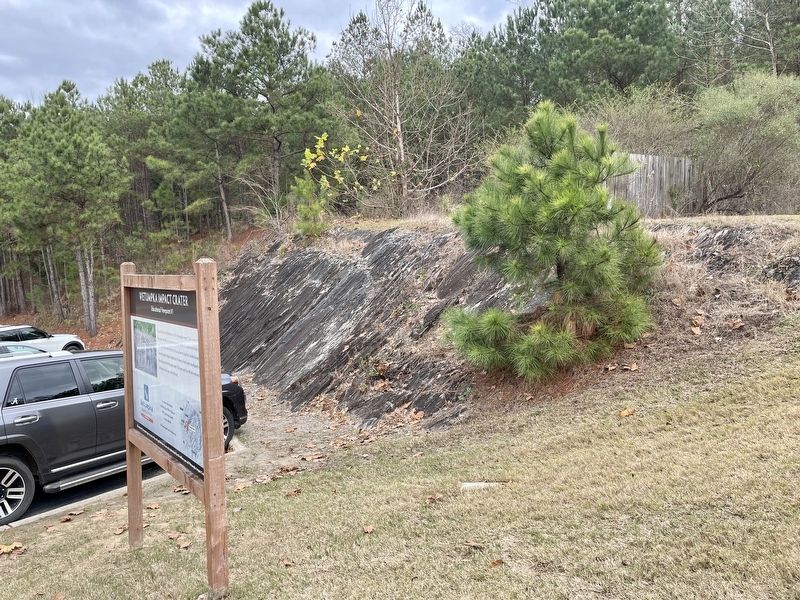
Wetumpka Impact Crater metamorphic bedrock.
SHOWN IN SOURCE-SPECIFIED ORDER
| | You are on the northwestern rim of the Wetumpka Impact Crater. In this area of
the crater rim, there are several man-made cuts into the metamorphic bedrock.
Mica schist forms the bedrock in this area down to depths of several thousand feet. After . . . — — Map (db m189013) HM |
| | The beautiful vista across the Wetumpka Impact Crater is best seen
from the highest point on the northwestern rim here at Bald Knob.
A favored area for communication towers, Bald Knob is almost 600
feet above sea level. Looking down the power . . . — — Map (db m189019) HM |
| | You are on the crater floor inside the western rim of the Wetumpka Impact Crater, in an area called the "cliffs." After the meteor's impact, there was a massive landslide from the southern rim that brought vast quantities of clay and sandy sediment . . . — — Map (db m189021) HM |
| | This section of Buck Ridge Road is unusual because you can easily see hills created on both sides of the road that are related to the impact of a large meteor 85 million years ago. These hills contain large boulders that came to rest near the . . . — — Map (db m189024) HM |
| | Because of the cleared natural gas pipeline, this area provides an excellent view
of the eastern rim of the Wetumpka Impact Crater. The notch on the far rim is
over a mile away. On the west side of Trotters Trail (behind you) the high point
is . . . — — Map (db m189029) HM |
| | From a distance, one of the best vistas of the Wetumpka Impact Crater is from the Wetumpka Sports Complex. Your view here is of the highest remains of the northwestern rim of the crater. In the center, several communication towers are located on . . . — — Map (db m189035) HM |
| | The rock layers here in the Coosa River are part of
the deeply eroded western rim of the Wetumpka
Impact Crater. The Coosa River curves around the
rim in the downtown area and these rock layers tilt
away from the crater center, typical of . . . — — Map (db m189038) HM |
Apr. 30, 2024