14 entries match your criteria.
Related Historical Markers
Additional markers detailing the Desert Maneuver Center where mapping the markers shows the scope and scale of the training area.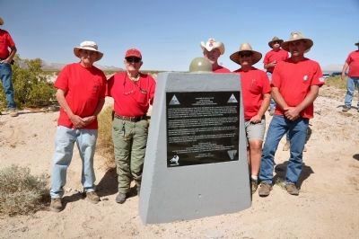
By Michael Kindig, March 15, 2014
Coxcomb Divisional Camp Marker with Plaque Re-Erection Crew
SHOWN IN SOURCE-SPECIFIED ORDER
| 1 ► California, Riverside County, Chuckwalla — 148 — Coxcomb Divisional Camp — Camp Coxcomb — Desert Training Center, California-Arizona Maneuver Area — |
| On California Route 177 at milepost 17 at Coxcomb Monument Road, on the left when traveling north on State Route 177. Reported missing. | |||
| 2 ► California, Riverside County, Chiriaco Summit — The Desert Training Center — |
| Near Chiriaco Road north of Interstate 10, on the left when traveling east. | |||
| 3 ► California, San Bernardino County, Vidal — 153 — Granite Divisional Camp — Camp Granite — Desert Training Center, California-Arizona Maneuver Area — |
| On California Route 62 at milepost 90.5, on the right when traveling east. | |||
| 4 ► California, San Bernardino County, Vidal — 151 — Iron Mountain Divisional Camp — Desert Training Center — California-Arizona Maneuver Area — |
| On Desert Center - Rice Road (California Route 62 at milepost 90.7), on the left when traveling east. | |||
| 5 ► California, San Bernardino County, Needles — 44 — Ibis Divisional Camp - Desert Training Center — California – Arizona Maneuver Area — 440th Anti – Aircraft Artillery - (Automatic Weapons) Battalion — |
| On U.S. 95 at milepost 66,, 10 miles north of Interstate 40, on the right when traveling north. | |||
| 6 ► California, San Bernardino County, Fenner — 985 — Clipper Divisional Camp — Camp Clipper - Desert Training Center — California-Arizona Maneuver Area — |
| On Interstate 40, 6 miles east of the Essex Road Interchange, on the right when traveling east. | |||
| 7 ► Arizona, Yuma County, Yuma — Camp Laguna — Desert Training Center — California – Arizona Maneuver Area — |
| On East Imperial Dam Road, 0.5 miles west of U.S. 95, on the right when traveling east. | |||
| 8 ► Arizona, Yuma County, Dateland — 110 — Hyder Divisional Camp-Horn Divisional Camp Desert Training Center — California-Arizona Maneuver Area — United States Army — |
| On Ave 64E near Interstate 8, on the left when traveling south. | |||
| 9 ► Arizona, La Paz County, Bouse — Camp Bouse — |
| On Broadway Avenue (Arizona Route 72 at milepost 27) south of Main Street, on the right when traveling west. | |||
| 10 ► California, San Bernardino County, Vidal — 63 — Rice Divisional Camp — Camp Rice — Desert Training Center, California-Arizona Maneuver Area — |
| On Aqueduct Road (Route 62 at milepost 112.4), on the right when traveling east. | |||
| 11 ► California, Riverside County, Chiriaco Summit — 985 — Desert Training Center — California Arizona Maneuver Area — |
| Near Chiriaco Road (Business Interstate 10) just north of Summit Road, on the left when traveling east. | |||
| 12 ► Arizona, La Paz County, Bouse — 86 — Camp Bouse — The 526th A. I. B. - Canal Defense Light Project — Desert Training Center - California – Arizona Maneuver Area — |
| On Broadway Avenue (Arizona Route 72 at milepost 27) south of Main Street, on the right when traveling west. | |||
| 13 ► California, San Bernardino County, Goffs — 136 — Army Camp at Goffs — Desert Training Center — California-Arizona Maneuver Area — |
| On Lanfair Road, 0.1 miles north of Goffs Road, on the left when traveling north. | |||
| 14 ► Nevada, Clark County, Cal-Nev-Ari — 138 — Cal-Nev-Ari — |
| Near Veterans Memorial Highway (U.S. 95 at milepost 9) near Piute Valley Drive, on the right when traveling south. | |||