Antonio de Espejo Entrada of 1582-1583 Historical Markers
Antonio de Espejo was a Spanish explorer who led an expedition into New Mexico, Arizona and Texas in 1582-1583. The expedition created interest in establishing a Spanish colony among the Pueblo Indians of the Rio Grande valley. The journals from this trip, especially those of Diego Pérez de Luxan, provide early first hand accounts of the region and Native Americans living there.
On U.S. 93, on the right when traveling north. Reported missing.
First exploration probably by early Spanish explorers, Espejo in 1582 and Farfan in 1589. Explored later by Lt. Amiel W. Whipple in 1854. Important agriculture, mining, milling, and smelting area in our early days. The McCrackin Mine discovered by . . . — — Map (db m68947) HM
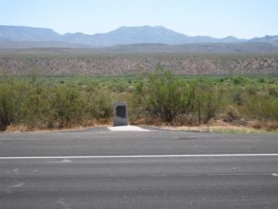
Stagecoaches of the Butterfield Overland Mail Co. began carrying passengers and mail from St. Louis to San Francisco, across southern New Mexico, in 1858. The 2,795-mile journey took 21-22 days. In 1861 the service was re-routed through Salt Lake . . . — — Map (db m6553) HM
On U.S. 285 at County Road 719, on the right when traveling north on U.S. 285.
Don Antonio de Espejo, leader of the third expedition to explore New Mexico, passed near here on his return to Mexico City in 1583. After learning of the martyrdom of two Franciscan friars from an earlier expedition, he explored the Pueblo country . . . — — Map (db m61472) HM
On Coronado Avenue (U.S. 84) 0.1 miles east of Interstate 40, on the right when traveling east.
The Spanish explorer Antonio de Espejo passed through this area in 1583, as did Gaspar Castano de Sosa in 1590. Santa Rosa, the Guadalupe County seat, was laid out on the ranch of Celso Baca y Baca, a politician and rancher in the late 1800s. It was . . . — — Map (db m45894) HM
On Coronado Avenue at River Road, on the right when traveling east on Coronado Avenue.
The Spanish explorer Antonio de Espejo passed through this area in 1583, as did Gaspar Castaño de Sosa in 1590. Santa Rosa, the Guadalupe County seat, was laid out on the ranch of Celso Baca y Baca, a politician and rancher in the late 1800s. It was . . . — — Map (db m45895) HM
On New Mexico Route 44 / (U.S. 55) 0.3 miles east of Zia Boulevard (Business Road 785), on the left when traveling west.
In 1583 Antonio de Espejo recorded this pueblo as one of five in the Province of Punamé. Following the sacking of Zia by Spanish troops in 1689, the pueblo was reestablished, but never attained its former size. The Zia ancient sun symbol is . . . — — Map (db m32858) HM
Near CanAm Highway (Interstate 25 at milepost 113), 1.2 miles south of State Road 107, on the right when traveling south.
In 1582 and 1583, Antonio de Espejo and his party followed the Rio Grande north to the Bernalillo area. Espejo was trying to learn the fate of two Franciscan friars who stayed with the Pueblo Indians after the Rodriquez – Sanchez/Chamuscado . . . — — Map (db m68057) HM
Following the Rodriguez-Chamuscado expedition of 1581 there was increased interest in the area now known as New Mexico and Texas. There was also concern for the safety of Fray Rodriguez and Fray Lopez, who had stayed in the area. In 1582 a . . . — — Map (db m118277) HM
Established by Lieut. Col. Washington Seawell with six companies of the Eighth U.S. Infantry in October 1854 for protecting travelers on the San Antonio-El Paso Road.
Named in honor of the then Secretary of War, Jefferson Davis, it was . . . — — Map (db m26357) HM
On Wild Rose Pass (State Highway 17) 1.3 miles south of Powell Ranch Road, on the left when traveling south.
In early days the Indian trail through these mountains followed the gorge below known as Limpia Canyon. To avoid the floods travelers over the San Antonio - El Paso Road, emigrants, U.S. troops and supply trains, and the mail chose this higher pass . . . — — Map (db m239563) HM
On U.S. 67, 0.8 miles east of Highland Street, on the right when traveling west.
At confluence of Concho and
Rio Grande Rivers.
A settlement for over 10,000 years
Site of
first recorded wagon train
crossing into Texas
December 10, 1582
Headed by Antonio de Espejo — — Map (db m215858) HM
On East 1st Street at South Cedar Street (U.S. 285), on the left when traveling west on East 1st Street.
Antonio de Espejo in 1583, after exploring among pueblos in New Mexico, reached the Pecos River southeast of Santa Fe. He named it Rio de Las Vacas (River of Cows), for the abundance of buffalo. On his return route to Mexico he went down the river . . . — — Map (db m73303) HM
On Texas Park Road 30 near Texas Highway 17, on the right when traveling south.
Called "Mescalero Spring" in 1849, when watering corn and peaches of the Mescalero Apaches. To Ft. Davis soldiers, 1856, was "Head Spring". Present name given by first permanent settlers, Mexican farmers.
Miller, Lyles and Murphy in 1871 began . . . — — Map (db m59706) HM
Near State Highway Park Road 41, 0.2 miles north of Interstate 20, on the left when traveling north.
In these shifting seas of sand, rich in stone evidences of primitive men, today's visitors find flint points, sandstone metates and manos of peoples who were here as early as 10,000 years ago and late as the 1870s. Bones of great mammoths and . . . — — Map (db m73307) HM