130 entries match your criteria. Entries 101 through 130 are listed.⊲ Previous 100
DC, Art on Call Historical Markers
Historical markers that were installed in approximately 145 decommissioned call boxes in the District of Columbia by Cultural Tourism DC. Note that not all the markers issued by Cultural Tourism DC qualify for inclusion in the database, so we would not have all 145.
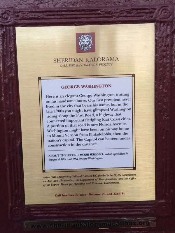
Here is an elegant George Washington trotting on his handsome horse. Our first president never lived in the city that bears his name, but in the late 1700s you might have glimpsed Washington riding along the Post Road, a highway that connected . . . — — Map (db m112624) HM
The area known as Sheridan-Kalorama was patented to John Langsworth by King Charles II in 1668. It was later sold to Anthony Holmead who in turn willed it to his nephew. in 1791, as L'Enfant laid out his plans for the boundaries of the new . . . — — Map (db m112621) HM
Joel Barlow (1754-1812) served in the American Revolution and was a businessman, diplomat and published poet. In 1796-97 he negotiated the release of Americans held for years by the Turkish regent of Algiers. Thomas Jefferson urged Barlow to settle . . . — — Map (db m129820) HM
Charles Codman's painting depicts Kalorama, the 19th century estate of Joel Barlow. Kalorama (Greek for beautiful view) was extolled by Thomas Jefferson as "a most lovely seat adjoining the city, on a high hill commanding the Potomac River." . . . — — Map (db m112615) HM
Paz, paix, shalom, esaalam, are words from several foreign languages spoken in Sheridan-Kalorama, each meaning peace. This representation of a benevolent friar welcomes you in peace. We share, too, works of "America's poet" Walt Whitman, who spent . . . — — Map (db m112601) HM
Writers, sculptors, painters, and collectors made Sheridan-Kalorama their home: best-selling mystery writer Mary Roberts Rinehart at 2419 Massachusetts; classicist Edith Hamilton at 2448 Massachusetts; poet/novelist Elinor Wylie at 2153 Florida; . . . — — Map (db m99362) HM
At 2401 Kalorama Road stands an elegant Georgian frame house, The Lindens. This is Washington's oldest house, yet it is not "of" the District. Built in 1754, in Danvers, Massachusetts, by Robert "King" Hooper a wealthy merchant, The Lindens once . . . — — Map (db m112603) HM
Five presidents lived in Sheridan-Kalorama between 1916 and 1930. Warren G. Harding lived at 2314 Wyoming Avenue while a senator from Ohio. William Howard Taft lived across the street at 2215 Wyoming Avenue while Chief Justice of the Supreme Court . . . — — Map (db m112606) HM
Sheridan-Kalorama has been home to many influential women. While she lobbied our political leaders to support Nationalist China, Madame Chiang Kai-Shek lived nearby at 2443 Kalorama Rd. Others include presidential wives Eleanor Roosevelt, a wise . . . — — Map (db m112604) HM
At an elevation of 410 feet, Fort Reno is located at the highest point in DC. The fort, originally named Fort Pennsylvania, was well situated to provide defense of the Nation's Capital during the Civil War as one of the Circle of Forts (pictured . . . — — Map (db m20628) HM
Fort Reno is located at the highest elevation in D.C. A city water reservoir was constructed in the 1890s to serve the city's growing population. The red brick water tower (pictured here) was built in 1903 to provide water pressure to the immediate . . . — — Map (db m112184) HM
Police Call Boxes such as this one (originally painted blue) were installed in the District after the Civil War. Officers on foot patrol used this secure telegraph system to contact the station, accessing the box with a now highly collectible . . . — — Map (db m129486) HM
Police Call Boxes such as this one (originally painted blue) were installed in the District after the Civil War. Officers on foot patrol used this secure telegraph system to contact the station, accessing the box with a now highly collectible . . . — — Map (db m112665) HM
Tenleytown's earliest elementary school, located where Saint Anne's School is today, first welcomed students in 1882. The Jesse Reno School for African-American children was built in 1903 on the grounds of Fort Reno. The Immaculata Preparatory . . . — — Map (db m112531) HM
Police Call Boxes such as this one (originally painted blue) were installed in the District after the Civil War. Officers on foot patrol used this secure telegraph system to contact the station, accessing the box with a now highly collectible . . . — — Map (db m112627) HM
Police Call Boxes such as this one (originally painted blue) were installed in the District after the Civil War. Officers on foot patrol used this secure telegraph system to contact the station, accessing the box with a now highly collectible . . . — — Map (db m112629) HM
Fire Fact, June 25, 1925
The era of horse-drawn fire apparatus ends with a ceremonial "final run" with Barney, Gene and Tom pulling a 1905 Steam Pumper belonging to Engine Company 19.
Fire Department information and images courtesy . . . — — Map (db m112631) HM
The first map of Woodley Park, called Kervand's Woodley and dated 1875, shows Woodley Lane (now called Woodley Road) as the only road through the area and the heart of the new subdivision. As recently as 1887, Woodley Lane was described as "a . . . — — Map (db m112395) HM
The first development called “Woodley” named after the Woodley estate (now home to the Maret School), was owned by Mrs. A. E. Kervand and was first recorded as a subdivision in 1875. Winding Woodley Lane was its main street. By 1878 . . . — — Map (db m112394) HM
The name Harry Wardman (1872 - 1938) is practically synonymous with Woodley Park, having built numerous houses and apartments in the neighborhood. Wardman built his own home on the corner of Connecticut Avenue and Woodley Road in 1909. He later . . . — — Map (db m87503) HM
The first map of Woodley Park, called Kervand's Woodley, and dated 1875, shows Woodley Lane (now called Woodley Road) as the only road through the area and the heart of the new subdivision. As recently as 1887, Woodley lane was described as . . . — — Map (db m87536) HM
Woodley Park’s most prolific architect, Mihran Mesrobian (1889-1975) started his career as a palace architect in Constantinople during the twilight of the Turkish sultans. The Turkish-born Beaux-Arts trained Armenian worked on the restoration of . . . — — Map (db m87506) HM
Developers first plotted the residential neighborhood of Woodley Park in 1875, attached to this high land overlooking Rock Creek, where Philip Barton Key had built an estate that he named Woodley. (You can see the Woodley mansion on the campus of . . . — — Map (db m87471) HM
The Woodley Park neighborhood that is now home to several thousand residents as well as the National Zoo was once sparsely settled countryside. The farmhouse shown here, known as Redwood, was built around 1819 on a hill that rose 40 feet above . . . — — Map (db m67828) HM
The neighborhood of Woodley Park owes its name to the Woodley estate of Philip Barto Key (1767-1815). Key, uncle of Francis Scott Key, who wrote “Star Spangled Banner”, was an officer on the British side during the Revolutionary War. . . . — — Map (db m87469) HM
An Irish priest and the Duchess of Windsor each separately played a part in Woodley Park's history. In 1912 Father Thomas A. Walsh bought the present site of St. Thomas Apostle Church and Rectory on Woodley Road for $16,750. It was here that he . . . — — Map (db m87535) HM
Justin Dart Jr. moved to Southwest Washington to work for the passage of the Americans with Disabilities Act (ADA). As an energetic neighbor rushing through the lobby in his wheelchair, his Southwest DC neighbors fondly remember Justin. Never . . . — — Map (db m142878) HM
Who are these famous Civil Rights leaders?
Barbara Jordan (upper left)(some text missing due to illegibility)
Patsy Mink (wearing... (some text missing due to illegibility) ... supporter of civil rights . . . — — Map (db m130649) HM
Dr. Dorothy Height worked to advance women's, civil, and human rights with many of our nation's leaders. How many can you recognize?
Back
Dr. Dorothy Height
Has lived at 700 7th Street, SW since 1983. As President Emmerita . . . — — Map (db m112797) HM
"The legal-system can force open doors, and sometimes even knock down walls, but it cannot build bridges. That job belongs to you and me. The country can't do it. Afro and white, rich and poor, educated and illiterate, our fates are bound . . . — — Map (db m147019) HM
130 entries matched your criteria. Entries 101 through 130 are listed above. ⊲ Previous 100