"A part of the way the rocks cover the ground so large that it is with the greatest difficulty that we can find a place to drive our waggons [sic] through the trail is quite crooked" - Amasa Morgan, Jul 24, 1849 — — Map (db m211141) HM
"The river here is…filled with large rocks. We crossed on a bridge but expect to ford the next times…We started through Mad Canyon which is rightly named…the hardest place for teams I ever saw" - Caroline L. Richardson, Sep 12, 1852 — — Map (db m211142) HM
"Thence over a high sloping stony hill (sloping to the river) and down a steep hill to a canon or pass creek, where comes the first tug of war! Through the first range of the Sierra Nevada mountains" - Giles S. Isham, Aug 5, 1850 — — Map (db m211139) HM
Front of Marker
"After dinner we crossed the first mountain. The ascent is half a mile and much like going up the side of a house in steepness. With hughe stones in the road, aside the road and all around the road."- Henry Sheldon Anable, . . . — — Map (db m148705) HM
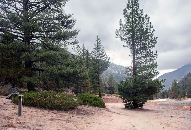
Stop(p)ed & camped Leek Springs. A beautiful little valley surrounded by a large pine and fur trees. The most romantic spot we have camped upon. Mendall Jewett, July 19, 1850. — — Map (db m227886) HM
"We decided to head for Placerville and cast out lot digging gold, and we expect to pass into this place to night....We passed...a good many cradling out gold, and we are all very enthusiastic to get started" - Albert G. Paschal, Aug 18, 1859 — — Map (db m211225) HM
"Entered Pleasant Valley in which are established several trading posts....We moved on and...descended into a valley in which is situated a few log huts & 1 tavern. This place is named Ring(g)old." James G. Shields, Aug 13, 1850 — — Map (db m211169) HM
"After descending from this ridge by a long hill...at twilight entered on as beautiful a valley as ever I laid eyes on called Pleasant Valley." - Peter Decker, Aug 7, 1849 — — Map (db m211152) HM
"We reached what in our guide book was called 'Pleasant Valley Gold Mines'; where we found two or three tents, and a few men with their gold-washing pans." - Sarah Royce. Oct 24, 1849 — — Map (db m210982) HM
"Came on the forks of the road - the left hand leading to Sutters Fort & the right hand to...Coloma...We here took the right hand fork and went...through Wevervill (and) came on...farther to Hang Town" - James A. Pritchard, Aug 11, 1849 — — Map (db m211151) HM
Carson Trail - To Pleasant Valley
"Continued down the ridge upon which we traveled day before yesterday, occasionally descending deep valleys.... We reached what the Mormons call 'Pleasant Valley Gold Diggins.'" - P. C. Tiffany, Aug 24, 1849 — — Map (db m211067) HM
"We continued on following the river. The main road leaving the river for 12 miles. Over a strip of desert without grass or water the road along the river being a pack route and impracticable for wagons" - Calvin Taylor, Sep 17, 1850 — — Map (db m159073) HM
"Ragtown...is a collection of tents and canvass shanties, where a tolerable meal can be had at one dollar a head. Whiskey is sold, cards are played, gambling pretty extensively carried on and hay sold" - Henry Sheldon Anable, Sep 1, 1852 — — Map (db m159072) HM
"We passed around a barren portion of the mountain, where there gushed from the base... almost a thousand springs of hot water in half a mile,... The springs form a hot water lake all along their course." - William R. Rothwell, Aug 18, 1850 — — Map (db m99871) HM
"At the... foot of the mountains, the Mormons... have established a trading post.... Passing on from this place, as fast as we could,... to save what money we had, we continued up Carson Valley" - Edward Patterson, Jul 11, 1850 — — Map (db m99870) HM
"We soon entered the lower end of Carson Valley. The steep mountains on our right, are thickly covered with pines... on the east side of the valley, the mountains present no green thing; all is naked and dreary." - Franklin Langworthy, Oct. 9, 1850 — — Map (db m99867) HM
"The trail, on leaving camp, entered a strip of upland, covered with wild sage and brush and through which run several mountain streams of much beauty." - Silas Newcomb, Aug 28, 1850 — — Map (db m99819) HM
"Following up the Truckee, on a sandy road, in four miles an abrupt mountain shut out the valley, compelling us to cross the stream, which we found quite dangerous, because of the swift current and deep water." John Steele, Sep 10, 1850 — — Map (db m149892) HM