113 entries match your criteria. Entries 101 through 113 are listed.⊲ Previous 100
Maryland Historical Trust Historical Markers
Launched in 1933, the roadside historical marker program has proven an effective way to draw attention to the many events, people and places that have contributed to the richness of our state and nation. The marker program is administered in cooperation with the Maryland State Highway Administration.
Near U.S. 219, 5.5 miles south of U.S. 50, on the left when traveling south.
Highest point in Maryland. Backbone Mountain, Garrett County, 3360 feet above sea level. Named for Captain Charles E. Hoye, founder of the Garrett County Historical Society. Dedicated September 1, 1952. — — Map (db m154) HM
On Aberdeen Throughway (State Highway 22) 0.3 miles east of Old Post Road, on the right when traveling east.
The first large-scale, general-purpose electronic digital computer, ENIAC (electronic numerical integrator and computer) was delivered to the U.S. Army's Ballistic Research Laboratory (BRL), Aberdeen Proving Ground, in 1947. Built by . . . — — Map (db m5434) HM
On Pulaski Highway (U.S. 40) at Bel Air Avenue, on the right when traveling south on Pulaski Highway.
Route of General Washington’s triumphant journey, December 3-23, 1783, New York to Annapolis, to resign as Commander-In-Chief of the first
American Army
Originally erected 1932 by Dorsey Chapter N.S.D.A.R. to commemorate . . . — — Map (db m145385) HM
On Pulaski Highway (U.S. 40) 1 mile south of Abingdon Road, on the right when traveling north.
The first County Seat of Baltimore County, 1659 to 1700, was located on Bush River. In 1683 it was made a Port of Entry by the Maryland Assembly. — — Map (db m1230) HM
On Kenmore Avenue (Maryland Route 924), on the right when traveling east.
One of the earliest buildings in Bel Air. Enlarged in 1814 by Thomas A. Hays (1780–1861), an attorney, landowner and entrepreneur. Moved to present location in 1960. Retains original interior features and woodwork, weatherboard and shutters. — — Map (db m159925) HM
On Pulaski Highway (U.S. 40) at Riverside Parkway, on the right when traveling south on Pulaski Highway.
Left by Captain Hall of Cranberry in 1737 to his daughter Sophia, who married Colonel Thomas White, father of Bishop William White of Philadelphia, Mrs. Robert Morris and Sophia, who married Aquilla Hall. He built this house in 1768, one of the . . . — — Map (db m1261) HM
On Calvary Road (Maryland Route 136) 0.3 miles north of James Run Road, on the right when traveling north.
Established in 1821 by Richard Webster and in continuous use, the Calvary United Methodist Church is a rare example of an early Methodist Meeting House. It is constructed of stone from a local quarry and retains its original floor plan, including a . . . — — Map (db m1490) HM
On Priestford Road (Route 136) south of Trappe Road, on the left when traveling north.
Count de Rochambeau’s heavy artillery and baggage train camped near this point September 10, 1781. After fording the Susquehanna River at Bald Friar they proceeded to Bush to join the main troops. — — Map (db m1283) HM
Built in 1827 of Port Deposit granite by local contractor John Donahoo, who built thirteen of the earliest lighthouses on the Chesapeake Bay. Originally lit with 9 whale oil lamps; a Fresnel lens was installed in 1854. The first keeper, John . . . — — Map (db m137129) HM
On Post Road (Maryland Route 7) at Old Bay Lane, on the right when traveling east on Post Road.
In operation from 1912 to 1950 and nicknamed “The Graw.” The Harford Agricultural and Breeders Association racetrack was one of four one-mile thoroughbred racecouses in Maryland and reflected Harford County’s status as a breeding center . . . — — Map (db m1269) HM
The Lock House is located at the southern terminus of the Susquehanna and Tidewater Canal, which operated from 1840-1897. The canal was pivotal in the development of the Lower Susquehanna River Valley. It connected with the Pennsylvania Canal at . . . — — Map (db m1492) HM
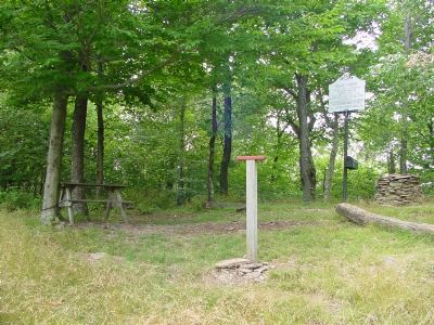
On Pylesville Road (Maryland Route 165) just north of Whiteford Road (Maryland Route 136), on the right when traveling north.
A ridge of high quality slate running from southeastern Pennsylvania into Harford County, Maryland, was quarried on a limited scale as early as 1734. Production increased in the 1840s when the opening of the Susquehanna and Tidewater Canal offered a . . . — — Map (db m169259) HM
On Baltimore Avenue (U.S. 1) at Lakeland Road, on the left when traveling south on Baltimore Avenue.
Lakeland was settled in 1890. By 1903 it was an established African American community with a public school, First Baptist Church of Lakeland and Embry African Methodist Episcopal Church. Two Rosenwald schools followed, including Lakeland High . . . — — Map (db m237129) HM
113 entries matched your criteria. Entries 101 through 113 are listed above. ⊲ Previous 100