Great Lakes Seaway Trail - French and Indian War Historical Markers
This project was funded in part by the Federal Highway Administration and administered by the New York State Scenic Byways Program of the New York State Department of Transportation and Seaway Trail, Inc.
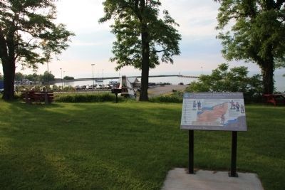
On East Lake Road (New York State Route 5) east of North Portage Road ( Route 394), on the left when traveling east.
Waterways to the Interior
Rivers and lakes served as the superhighways of the 18th century. Many rivers and lakes in the Colony of New York either bordered New France (Canada), or connected the bordering water bodies to the . . . — — Map (db m201458) HM
On Braddock Bay State Parkway 0.2 miles north of East Manitou Road (County Route 140), on the right when traveling east.
Destination Montreal In 1759, the British plan for defeating the French in North America involved major expeditions that would cut off French supply routes up and down the St. Lawrence River, block French advances south through the Champlain . . . — — Map (db m260713) HM
On Culver Road (County Route 120) 0.2 miles east of Sea Breeze drive, on the left when traveling east.
Bivouac For two days, July 2nd and 3rd, 1759, a force of 3,000 soldiers under the command of Brigidier General John Prideaux camped here. The army was advancing along the lake on a campaign from Oswego to Four Mile Creek, near Fort Niagara. . . . — — Map (db m90266) HM
Near Lewiston Road (New York State Route 104) 0.2 miles north of Hyde Park Boulevard ( Route 61).
British and French Compete for Alliances
Both the French and the British negotiated with American Indian tribes, either to gain their support or to convince them to remain neutral. In Canada, Algonquian tribes; the Ottawa, Huron, Abenaki, and . . . — — Map (db m77202) HM
Near Niagara Scenic Parkway (New York State Route 957A) 1 mile west of Interstate 190, on the left when traveling north.
Great Lakes Seaway Trail. New York State French and Indian War Commemoration 250 years. Securing Military and Commercial Goods. Fort Schlosser was built to protect the upper portage landing and was used as a storehouse for military and . . . — — Map (db m226682) HM
Near Niagara Scenic Parkway (New York State Route 957A) 1 mile north of Interstate 190.
Early European Visitors The Niagara River, with its mighty falls and rapids, was well known by Native Americans. Word of its majesty reached European explorers and soldiers who came to North America. Despite their mission, explorers and . . . — — Map (db m226683) HM
Near Lake Road (New York State Route 18) 0.2 miles north of Lake Ontario Parkway.
Land Manager Johnson arrived in the Colonies from Ireland to manage land in the Mohawk River valley near present-day Amsterdam, land granted to his uncle, Admiral Sir Peter Warren of the British Navy, in 1737. Superintendent of Indian Affairs . . . — — Map (db m90173) HM
Crossroads Timeline
1976 Blockhouse Museum Opened
1927 Fort Designated a National Historic Landmark
1900
1871 Syracuse Northern Railroad reached Brewerton
1846 Plank Road Built From Salina to Central Square
Four Steamboats built: . . . — — Map (db m253242) HM
On Lake Street at Montcalm Street, on the left when traveling east on Lake Street.
British Toehold on Lake Ontario
During the French and Indian War, the Oswego River was the only British controlled waterway into the Great Lakes. French commander-in-chief, the Marquis de Montcalm, recognizing its strategic . . . — — Map (db m75356) HM
On East 4th Street north of Show Park Road, on the left when traveling north.
Camp, Row, Camp
Campaigns in the North American wilderness required extensive planning and massive manpower to reach the objective safely and successfully. For Prideaux's army, the distance from Fort Stanwix to Fort Niagara . . . — — Map (db m75670) HM
On the Downtown Arterial (New York State Route 68) west of Commerce Street, on the right when traveling west.
Father Abbé François Picquet and the American Indians moved to Isle Picquet after la Présentation was vacated. The English thought the settlement was a French village and burned it during the siege.
Fort Lévis on Isle Royale
August 1759 . . . — — Map (db m75754) HM
On New York State Route 14, on the left when traveling east.
Lakeside Camp. Prideaux's army encamped here at Sodus Bay on the evening of July 1st, 1759. They were formed on the lake the following morning by 6:00 to continue their expedition. Each boat was numbered and each man, whether officer or . . . — — Map (db m79631) HM