11 entries match your criteria.
Historical Markers and War Memorials in Guam
Courtesy of Thomas P. Martin, February 27, 2015
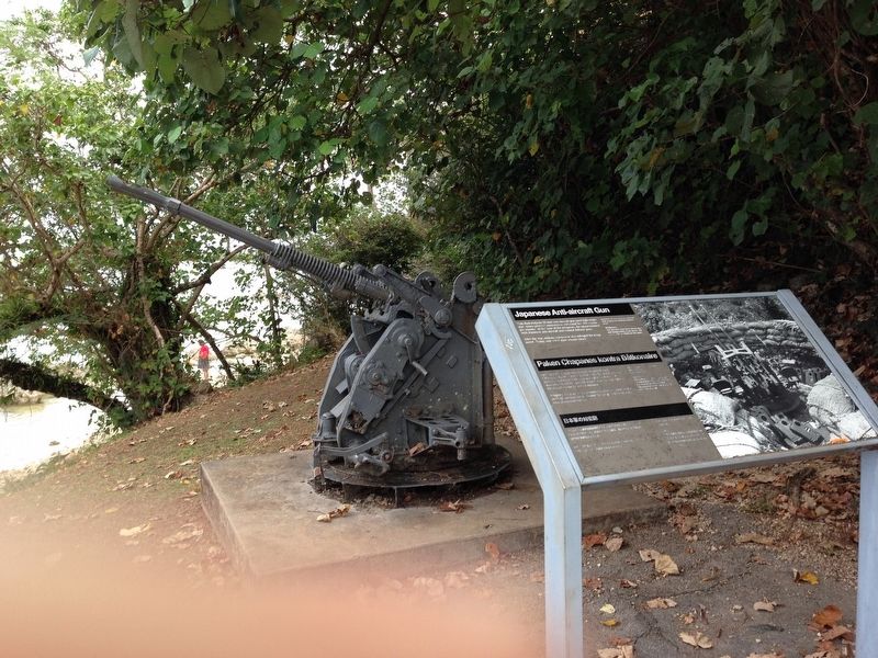
Japanese Anti-Aircraft Gun Marker
| Near Highway 2 at Follard Street, on the left when traveling north. |
| Near Highway 6, 0.2 miles south of Turner Road, on the right when traveling south. |
| Near Highway 6, 0.2 miles south of Turner Road, on the right when traveling south. |
| Near Highway 6, 0.2 miles south of Turner Road, on the right when traveling south. |
| Near Highway 6, 0.2 miles south of Turner Road, on the right when traveling south. |
| Near Marine Corps Drive (Highway 1) west of Jose Leon Guerrero Street, on the right when traveling west. |
| Near Assumption Drive, 0.4 miles north of Highway 6, on the right when traveling north. |
| Near Shoreline Drive, 0.1 miles north of Highway 2A, on the left when traveling north. |
| Near Marine Corps Drive (Highway 1) at Highway 2A, on the right when traveling south. |
| Near Soledad Drive, 0.2 miles west of Highway 2 when traveling west. |
| Near Highway 2, 0.1 miles east of Nino Perdido Street, on the right when traveling east. |
May. 25, 2024