On Wagon Box Road, on the left when traveling west.
Lodge Trail Ridge divided the drainages of both Piney Creeks with the drainage of Peno (now Prairie Dog) Creek. Up this divide, north beyond Phil Kearny, climbed the Bozeman Trail on its route to Montana. There, December 21, 1866, in violation of . . . — — Map (db m87698) HM
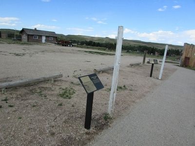
Near Wagon Box Road, on the left when traveling west.
Officers Row was a group of seven to ten non-descript log structures providing housing for officers and their families. They were probably a combination lumber, log, canvas, and dirt construction with one room, seldom larger than 24 by 30 feet. . . . — — Map (db m87619) HM
On Wagon Box Road, on the left when traveling west.
Pilot Hill – overlooking Piney and Little Piney Creek Valleys, the Bozeman Road, the Sullivant Ridge with its wood roads was a constantly manned lookout. From this post the sentry signaled to the Fort news of events as they occurred – . . . — — Map (db m87702) HM
Near Wagon Box Road, on the left when traveling west.
1867 quartermaster inspections of Fort Phil Kearny indicated the poor condition of many of the buildings on post and that they needed rebuilding. These included the barracks, officer’s quarters, post headquarters and more. The post commander’s . . . — — Map (db m87621) HM
Near Wagon Box Road, on the left when traveling west.
The mission of the Fort Phil Kearny garrison was to guard travelers on the Bozeman Trail, but it soon became apparent that the guards would also need protection. Therefore, on July 13, 1866, Captain Tenador Ten Eyck began building a fort which had . . . — — Map (db m87405) HM
On Wagon Box Road, on the left when traveling west.
As explained in No. 1 of this series, wood was the life blood of Fort Kearny. The founding soldiers had carried into this wilderness a sawmill. It was set up without the walls of the stockade as here illustrated. And here, as supplied by logs . . . — — Map (db m87701) HM
On Wagon Box Road, on the left when traveling west.
Fort Phil Kearny, built of wood and fueled by wood, required a never ending supply of wood. A supply obtained despite hostile activities by Sioux and Cheyenne. Source was the “Pinery” four miles west against the mountains. The route . . . — — Map (db m87691) HM
Near Wagon Box Road, on the left when traveling west.
The 18th Infantry’s 40-piece Regimental Band was housed at Fort Phil Kearny in a 24 by 64 green log, panel constructed, dirt roofed barrack. The band provided drummers and buglers for drill, ceremony, and combat commands during the day. In the . . . — — Map (db m87629) HM
On Wagon Box Road, on the left when traveling west.
As shown above, so ran, through treaty guaranteed Indian Land, a white man’s route of commerce. Like any road it was an environment and ecology disturbing intrusion. Which, in this case, made it a challenge bound to produce a redman’s reaction . . . — — Map (db m87704) HM
Near Wagon Box Road, on the left when traveling west.
It is a false perception that the frontier posts of the American West were garrisoned with large troops of cavalry. Actually a post’s usual population was largely infantry with a few cavalry for support, reconnaissance, escort, or mail delivery. . . . — — Map (db m87641) HM
Near Wagon Box Road, on the left when traveling west.
Because the regulations would not allow non-military dependent civilians to reside inside Fort Phil Kearny, several civilian dwellings existed outside the post stockade on the valley plain below, and in the Quartermaster corral to the south. These . . . — — Map (db m87638) HM
On Wagon Box Road, on the left when traveling west.
Before you lies the frame of a LANE & BODLEY sawmill. This was one of two steam-driven sawmills brought west for Colonel Carrington’s command. The sawmills were used to cut lumber into boards for construction of buildings, furniture and other . . . — — Map (db m87705) HM
Near Wagon Box Road, on the left when traveling west.
Even though Fort Phil Kearny, like most frontier posts, had plenty of use for a jail, this was not the main function of the Guardhouse. The 50 by 32 foot, shingled building with a brick chimney, was used primarily for guard-mount. Guard-mount was . . . — — Map (db m87637) HM
Near Wagon Box Road, on the left when traveling west.
. . . at Fort Phil Kearny was seldom successful at either of its two hospitals. The original hospital was a 24 by 84 foot structure similar to the barracks in construction. During this hospital’s short service it sadly served as the morgue for . . . — — Map (db m87624) HM
Near Wagon Box Road, on the left when traveling west.
All military posts had a magazine for storing munitions. At Fort Phil Kearny the Magazine was 16 by 16 feet, with a 11 foot dirt covered ceiling and it was buried eight feet in the southwest quadrant of the parade ground. It is referred to in . . . — — Map (db m87644) HM
Near Wagon Box Road, on the left when traveling west.
From this building the commander of the Mountain District of the U.S. Army issued orders to Forts Phil Kearny C.F. Smith, and Reno. The Mountain District was made up of the 2nd Battalion 18th Infantry until 1867 when it was reorganized into the . . . — — Map (db m87633) HM
Near Wagon Box Road, on the left when traveling west.
While not as well built and fortified as the military stockade to the north, the quartermaster’s stockade provided protection for the Quartermaster Department’s supplies, draft animals, work shops and civilian employees. Most of the supplies . . . — — Map (db m87647) HM
Near Wagon Box Road, on the left when traveling west.
Even the most remote of frontier posts could not do without its Sutler Store. Fort Phil Kearny’s was established and built by John Kinney in partnership with others, including one Fenn Burnett. The building was 24 by 64 feet and constructed in a . . . — — Map (db m87631) HM
Near Wagon Box Road, on the left when traveling west.
Fort Phil Kearny State Historic Site is administered by the Wyoming State Parks and Historic Sites Department and supported by the Fort Phil Kearny/Bozeman Trail Association. All parties are committed to the preservation and interpretation of the . . . — — Map (db m87673) HM
On State Highway 354, on the right when traveling west.
In May of 1832, Captain Benjamin Bonneville left Fort Osage, Missouri with an expedition consisting of one hundred and ten men and twenty wagons, headed for the Rocky Mountain West. Upon his arrival in the Green River Valley, he ordered immediate . . . — — Map (db m80521) HM
Near Business U.S. 80 near Main Street, on the left when traveling west.
From 1858 to 1890 the area in the foreground was occupied by the log and frame structure shown in the photograph. The building was the fourth Officers' Quarters in a row of six constructed shortly after For Bridger was declared a military post in . . . — — Map (db m90642) HM
Near Business U.S. 80 near Main Street, on the left when traveling west.
These log buildings and corrals are a reconstruction of the trading post operated by mountain men Jim Bridger and Louis Vasquez in 1846. The post was originally built in 1843 when the fur trade was rapidly dying due to a change in Eastern fashions . . . — — Map (db m90616) HM
Near U.S. 80 near Main Street, on the left when traveling west.
This set of buildings completed the holdings of the Post Trader. The first board and batten building with the large double doors served as the carriage house. Judge Carter owned several animal-drawn vehicles which lent an air of wealth to the . . . — — Map (db m90748) HM
Near Business U.S. 80 near Main Street, on the left when traveling west.
This structure was of frame construction and completed in 1884 during a period of extensive improvement at the Post. It supplanted the old log Commanding Officers Quarters which had been in use since 1850.
After the abandonment of Fort Bridger in . . . — — Map (db m90685) HM
Near Business U.S. 80 near Main Street, on the left when traveling west.
This two story victorian house served as the Commanding Officer's quarters from 1884 until the post was abandoned in 1890. The luxury of the quarters and the list of V.I.P.'s who were entertained here suggest that the intended use of this building . . . — — Map (db m90686) HM
Near Business Interstate 80 near Main Street, on the left when traveling west.
Beginning as a Wyoming Centennial project in 1990, archaeologists from Western Wyoming College have been working to uncover the physical remains of 19th century life at Fort Bridger. As the fort evolved over time, from an emigrant supply station, to . . . — — Map (db m90580) HM
Near Business U.S. 80 near Main Street, on the left when traveling west.
Above is a copy of a watercolor of Fort Bridger done by Merritt D. Houghton (1845-1918), known for his historic illustrations of Wyoming towns, ranches and mines. The view is toward the south and the Uinta Mountains.
In 1889, the date of this . . . — — Map (db m90750) HM
Near Business U.S. 80 near Main Street, on the left when traveling west.
At the close of the fur trade era, western America history began to take on a more permanent shape. The motivation of people coming west shifted away from exploration and hunting. Families were seeking land to clear and farm; men were hoping to find . . . — — Map (db m90618) HM
Near Business U.S. 80 near Main Street, on the left.
At the northeast corner of Judge Carter's complex rose the log chinked ice house. Three doors at the southern side appeared one over the other, allowing this tall building of 18 feet 7 inches by 14 1/4 feet to be entered at all levels as the ice . . . — — Map (db m90731) HM
Near Business Interstate 80 at Main Street, on the left when traveling west.
Completed in 1887, this building served as an infantry barracks, or housing for infantry troops stationed here. With an interior of wooden floors and plastered walls, it was a vast improvement over the rude log barracks in use since 1858. Shaped . . . — — Map (db m90579) HM
Near Business U.S. 80 near Main Street, on the left when traveling west.
The neat row of mortared cobblestones (#1) is a remnant of the west wall of the Mormon fort, which was completed in late summer of 1857. It is the largest and most impressive feature uncovered in recent excavations at Fort Bridger. The lighter . . . — — Map (db m90621) HM
Near Business U.S. 80 near Main Street, on the left when traveling west.
This log and frame officer's quarters was among the first buildings constructed at Fort Bridger in 1858. The log section of this cabin measures 41' x 33' with the rear addition of frame construction measuring 22.5' x 22'. It stood first in a row of . . . — — Map (db m90640) HM
Near Business U.S. 80 near Main Street, on the left when traveling west.
This sketch of Fort Bridger appeared in the June 16, 1873 issue of New York's Daily Graphic, Shown are six log officer's quarters on the left; the hospital in the background; and the enlisted men's barracks on the right. — — Map (db m90749) HM
On Business Interstate 80 near Main Street, on the right when traveling east.
The fort was established about 1842 by Jim Bridger discoverer of Great Salt Lake; notable pioneer, trapper, fur trader, scout and guide. Bridger was born at Richmond, Virginia, March 17, 1804 and died at Westport, Missouri, July 17, 1881. His . . . — — Map (db m36596) HM
Near Business Interstate 80 near Main Street, on the left when traveling west.
Built in 1868 of quarried limestone slabs, this guardhouse was a replacement for the not-so-secure log guardhouse that stood fifty yards north of here. With walls 2' thick, the exterior dimensions were 24' x 58'. The height of the roof went from 10' . . . — — Map (db m90582) HM
Near Business U.S. 80 near Main Street, on the left when traveling west.
The post commissary, erected in 1867, measured 28' x 100' and was built of cut stone quarried about two miles west of the fort. A portion of the old cobblerock Mormon Wall was utilized to form a section of the building's north wall.
The . . . — — Map (db m90581) HM
Near Business U.S. 80 near Main Street, on the left when traveling west.
Judge Carter began building his home in 1858 and continually added onto it as his family grew and his status improved. The house was a frame structure with board and batten siding. Two bay windows flanked the front porch. The Carter’s boasted one of . . . — — Map (db m90746) HM
Near Business U.S. 80 near Main Street, on the left when traveling west.
As an indication of his wealth and influence William Carter provided three buildings not commonly available to the average person on the American frontier. The first frame building served the family as a private school. It measured a mere 11 feet 3 . . . — — Map (db m90732) HM
Near Business U.S. 80 near Main Street, on the left when traveling west.
This building was constructed in 1887 and served as the post guardhouse until 1890. It was used to confine prisoners and to house men during their 24-hour shifts on guard duty. In addition to supervising the work activities of the prisoners, a . . . — — Map (db m90635) HM
Near Business U.S. 80 near Main Street, on the left when traveling west.
The decedents re-interred here in 1933 represent a very significant cross section of those individuals whose name and contributions will ever be associated with Fort Bridger's early day history. Of particular interest are......
"Uncle Jack" . . . — — Map (db m90688) HM
On August 3, 1855 the Church of Jesus Christ of Latter-day Saints concluded arrangements for the purchase of Fort Bridge from Louis Vasquez, partner of James Bridger, for $3,000. Final payment was made October 18, 1858. A cobblestone wall was . . . — — Map (db m90617) HM
Near Business U.S. 80 near Main Street, on the left when traveling west.
The buildings in this area are virtually all that remain of the once thriving commercial empire of Judge William Alexander Carter and his wife Mary, Fort Bridger's only two Post Traders. Carter arrived at Fort Bridger with Colonel Albert S. . . . — — Map (db m90724) HM
Near Business U.S. 80 near Main Street when traveling west.
Although Judge Carter dabbled in many areas, his main responsibility revolved around his activities as the post trader at Fort Bridger. In this store he sold various items not supplied by the Army to the garrison, including limited amounts of . . . — — Map (db m90727) HM
On County Road 274 just west of County Road 281, on the left when traveling west.
Established in November, 1853, by Captain John Nebeker and Captain Isaac Bullock who located here with a number of Latter Day Saints. This was the first place in Wyoming where land was irrigated. The site was given to Wyoming by Anton Hansen . . . — — Map (db m174178) HM
147 entries matched your criteria. Entries 101 through 147 are listed above. ⊲ Previous 100