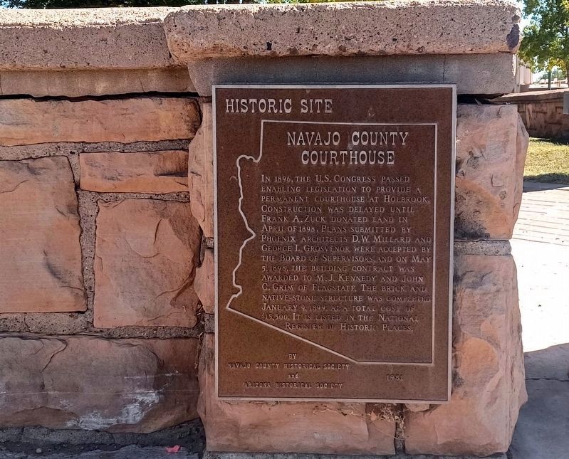
In 1896, the U.S. Congress passed enabling legislation
to provide a permanent courthouse at Holbrook.
Construction was delayed until Frank A. Zuck donated
land in April of 1898. Plans submitted by Phoenix
architects D.W. Millard and George . . . — — Map (db m30158) HM
This monument marks a segment of an early road across northern Arizona following the 35th parallel-transcontinental survey. The route evolved from several pathfinding expeditions: Lt. Amiel W. Whipple's 1853-54 railroad survey; Lt. Edward F. Beale's . . . — — Map (db m236476) HM
One of the remaining one-room brick schoolhouses in Northern Arizona was built in 1900 of fired brick.
The school was named for Charles Shumway who settled in Spring Valley (now Silver Creek Valley) in 1878 and built a grist mill for wheat and . . . — — Map (db m36738) HM
Brigham City, first called Ballenger's Camp, was established here in April, 1876, as one of four fortified settlements erected along the Little Colorado River by Mormon pioneers of the United Order. They farmed the land, dammed the river and built a . . . — — Map (db m36331) HM
This monument marks a segment of an early road across northern Arizona following the 35th parallel-transcontinental survey. The route evolved from several pathfinding expeditions: Lt. Amiel W. Whipple's 1853-54 railroad survey; Lt. Edward F. Beale's . . . — — Map (db m236470) HM
This monument marks the cemetery and vicinity of the site of Sunset, a Mormon pioneer settlement founded by Lot Smith in March, 1876. The settlers, part of a colonization group called from Utah to Arizona by Brigham Young, came by way of Lee's . . . — — Map (db m185080) HM
This crossing, first noted early in the 1850s in journals and maps of explorers along the 35th parallel, is the only convergence of major travel routes on the Little Colorado River. It lies on the trail used by Mormon immigrants journeying from Utah . . . — — Map (db m32722) HM
In 1863, the United States government created the Arizona Territory from land it acquired during the Mexican-American War and the 1848 Treaty of Guadalupe-Hidalgo. Its northern region remained isolated and undeveloped until the railroad arrived. . . . — — Map (db m209689) HM
A group of colonists called by Brigham Young, under the leadership of William C. Allen settled here March 24, 1876. They erected a fort of cottonwood logs and mud on this site. It was first known as Allen's Camp. In 1878 the name was changed to St. . . . — — Map (db m36386) HM
Owner
Navajo County, AZ
Design Engineer
American Bridge Company
Rehabilitation Engineer
Jerry A. Cannon
The Little Colorado River formed one of the most formidable obstacles to transcontinental travel across Arizona on Route 66. The . . . — — Map (db m195839) HM
Thin black lines indicate changes in relevance. Between each pair of lines entries are ordered geographically but all have the same relevance.
* Inflectional forms of words are their plurals, singulars, and possessives as well as gramatical tenses and similar variations.