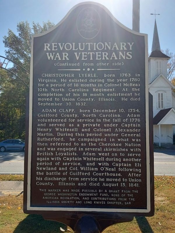
On Saint Johns Road 0.3 miles east of Jonesboro Quarry Road, on the right when traveling west.
St. John's Cemetery contains the graves of four Revolutionary War Soldiers.
Jacob Hileman, born July 20, 1762 in Northampton Co., Pennsylvania. As a private he served in the 4th company, 3rd battalion. Northampton County Militia in 1778 . . . — — Map (db m207797) HM WM
On Illinois Route 127 0.3 miles south of Landreth Road, on the right when traveling north.
This property was placed on the National Register of Historic Places by the United Sates Department of the Interior in 2025. Established in 1873, Rendleman Orchards represents a rare and enduring example of a multi-generational family farm in . . . — — Map (db m299649) HM
On Old Main Street (State Road 2018) 0.1 miles north of Drug Store Street, on the left when traveling north.
In 1902 Raleigh Rutherford Haynes, one of the South’s leading textile pioneers, and the founder of Cliffside, built his home on this site. After Haynes’ death on February 6, 1917, his son Charles lived here for the next 40 years. The house was . . . — — Map (db m227395) HM
On Gainsville Highway (U.S. 129/19) 0.6 miles north of Blood Mountain Cove Road, on the right when traveling north.
(panel 1) The Appalachian Trail in North Georgia
The 2,190 mile Appalachian Trail (A.T.) is the product of the vision, hard work, and dedication of thousands of people who have conceived, built, maintained and protected this . . . — — Map (db m230145) HM
On Brattonsville Road 0.1 miles north of Percival Road, on the right when traveling south. Reported missing.
The Homestead was built between 1823 and 1826 for Dr. John Simpson Bratton and his wife Harriet Rainey Bratton, the second generation of the Bratton family to live at Brattonsville. Bricks for the chimneys were made on the plantation. The two . . . — — Map (db m272030) HM
Near West 6th Street 0.2 miles west of North Graham Street, on the right when traveling west.
Mecklenburg County remembers with honor her gallant sons who served in the 43rd Regiment N.C. Troops. In January and February 1862 an infantry company known as the Union Farmers was recruited and enlisted in Charlotte and Monroe with Captain Robert . . . — — Map (db m256689) HM WM
On Lower Clear Creek Road east of U.S. 441, on the right when traveling east.
Originally constructed along Lost Creek, Union County, this mill was built by James Rice. After migrating from North Carolina to Sharp’s Station in 1790, “Uncle Jim” and his sons completed construction of the grist mill in the autumn of 1798. . . . — — Map (db m259108) HM
On Glencoe Street, on the left when traveling west.
In the decades following the Civil War, the textile industry thrust the South into a period of rapid industrialization. In North Carolina, construction of railroads began through Piedmont “backcountry,” and cities sprung up in their paths. Piedmont . . . — — Map (db m222805) HM
Near Courthouse Square (North Main Street) (U.S. 129) at East Jarrard Street, on the left when traveling south.
Minutes of the Inferior Court of White County, GA, August Term 1861.
Wednesday, August 7th 1861: "Ordered by the Court that White (County) Marksmen the use of any part of the courthouse that they may choose for the establishment of a military . . . — — Map (db m131679) HM
On South Main Street (State Highway 124) at East Broad Street, on the left on South Main Street. Reported permanently removed.
As a tribute to his skills exploiting enemy weaknesses, Pickens became known as the "Wizard Owl" or "Skyagunsta" - a bird known for seeing clearly, acting wisely and striking quickly.
Pickens was a tall, religious Presbyterian from . . . — — Map (db m259654) HM
Thin black lines indicate changes in relevance. Between each pair of lines entries are ordered geographically but all have the same relevance.
* Inflectional forms of words are their plurals, singulars, and possessives as well as gramatical tenses and similar variations.